


North and Central Texas
Today and Tonight
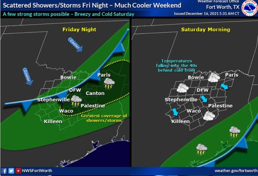
There is a chance for thunderstorms mainly along and east of I-35 this afternoon into tonight. A few storms could be strong with gusty
winds and small hail.
Friday through Wednesday
There is a chance of thunderstorms mainly north of I-20 Friday afternoon ahead of a strong cold front. Thunderstorms will increase
coverage across most North and Central Texas Friday night as the front moves through. Gusty winds and frequent lightning would be
the main threats with these storms.
SPOTTER INFORMATION STATEMENT
The NWS does not expect the activation of spotters at this time.
South Central and Southwest Arkansas, North Central and Northwest Louisiana, Southeast Oklahoma, East and Northeast Texas
Today and Tonight
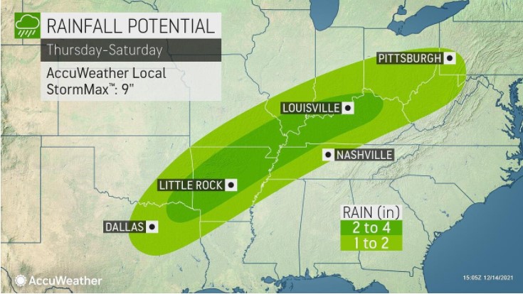
Expect scattered showers and a few thunderstorms today, mainly over East Texas, Northwest Louisiana, Southwest Arkansas, and Southeast Oklahoma, along with and ahead of a weak cold front that will enter the region late this morning and become stationary this afternoon over portions of Northeast Texas and Southwest Arkansas. While you can not rule out an isolated strong storm capable of producing locally gusty winds and brief heavy rainfall, the threat for organized severe thunderstorms remains very low.
These showers and thunderstorms will remain focused over extreme Northeast Texas, Southwest Arkansas, and Southeast Oklahoma
tonight, as the front begins to lift back north as a warm front.
Friday through Wednesday
Isolated to scattered showers and a few thunderstorms will remain, possibly over extreme Northeast Texas, Southwest Arkansas, and Southeast Oklahoma. Still, they will begin to increase during the evening as a cold front begins to shift southeast into the region late Friday night. Showers and a few embedded thunderstorms will become widespread over the area Saturday morning along and behind the cold front, gradually diminishing from northwest to southeast during the day. Much cooler temperatures will follow in the wake of the front Saturday,
with dry conditions returning late Saturday night and Sunday. However, another upper-level disturbance will move through the
region Monday and Monday night, with areas of light rain increasing. As a result, mild and dry conditions will return Tuesday through the end of the holiday week.
SPOTTER INFORMATION STATEMENT
There should be no need for activation of emergency management personnel, amateur radio operators, and storm spotters through
tonight.