


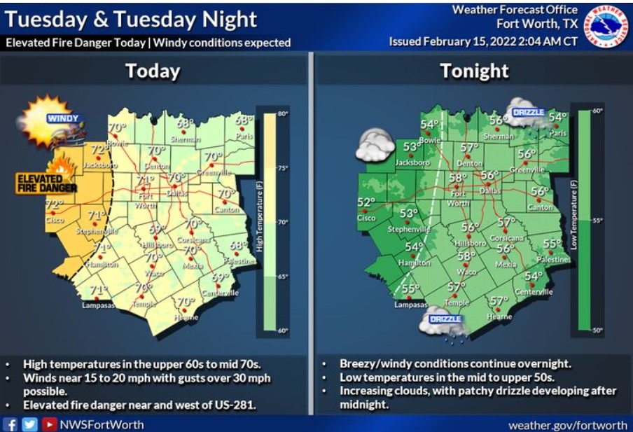
North and Central Texas
Today and Tonight
An elevated threat for grass fires is expected today across western portions of North and Central Texas, where windy conditions may lead to rapid fire spread.
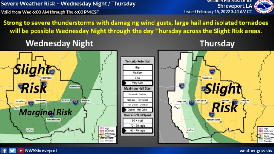
Wednesday through Monday
Storm chances will increase Wednesday afternoon and evening across much of North and Central Texas. Strong to severe thunderstorms will be possible Wednesday night into Thursday morning along a cold front. The main threat will be hail and damaging winds, but a brief tornado could be possible.
SPOTTER INFORMATION STATEMENT
The NWS does not expect the activation of spotters for Tuesday night.
South Central and Southwest Arkansas, North Central and Northwest Louisiana, Southeast Oklahoma, and East and Northeast Texas
Today and Tonight
You should not expect any hazardous weather.
Wednesday through Monday
Showers and thunderstorms will increase Wednesday afternoon again through Thursday, ahead of a strong upper-level storm. The system will eject northeast across West Texas into Oklahoma.
The potential will exist for strong to severe thunderstorms across the region Wednesday night and through the day on Thursday, before cooler and drier conditions return in the wake of a cold frontal passage on Thursday night.
SPOTTER INFORMATION STATEMENT
The NWS will not need the activation of emergency management personnel, amateur radio operators, and storm spotters through Tuesday night.