


This Hazardous Weather Outlook is for North and Central Texas.
Today and Tonight
Isolated thunderstorms will be possible across parts of East and
Central Texas. Severe weather is unlikely, and the main threat will be
heavy rainfall.
Tuesday through Sunday
Isolated to scattered storms are forecast throughout the
week, especially across Central and East Texas. No severe weather is
expected but scattered, and brief heavy rain will be possible.
SPOTTER INFORMATION STATEMENT
The NWS does not expect spotter activation at this time.
This Hazardous Weather Outlook is for South-Central and Southwest Arkansas, North-Central and Northwest Louisiana, Southeast Oklahoma, East, and Northeast Texas.
This Afternoon and Tonight
The NWS does not expect hazardous weather through tonight.
Monday through Saturday
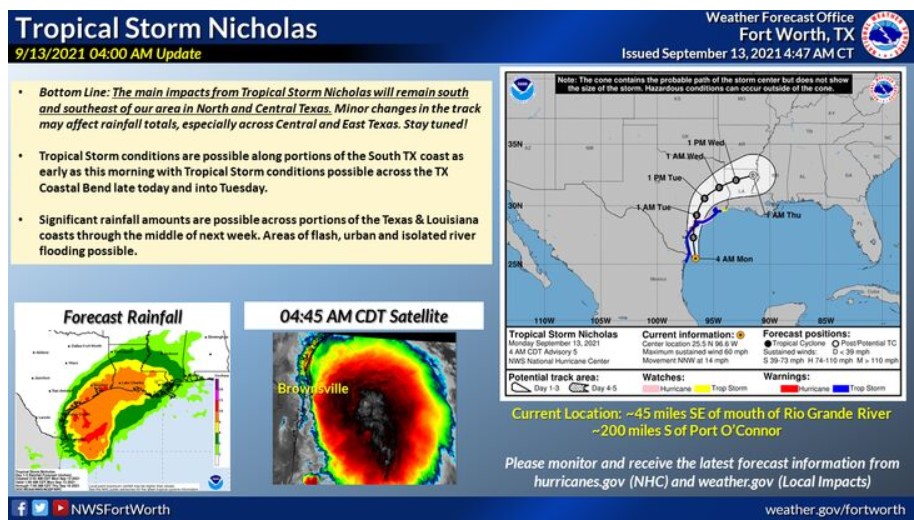
Tropical Storm Nicholas has developed in the Bay of Campeche, with
additional strengthening expected as it tracks northward over the
western Gulf of Mexico early this week. Given the current track of
Nicholas, the threat of heavy rainfall and possible flash flooding
may become more of a concern across parts of lower East Texas and
North Central Louisiana by mid to late week. Depending on the storm
track and intensity, this threat could expand farther north
to include more of our region up to the Interstate 20 corridor. Some weak and short-lived tornadoes may also be possible, as with any inland tropical system. Continue to monitor the latest forecast updates on Tropical Storm Nicholas as this system evolves.
SPOTTER INFORMATION STATEMENT
The NWS will not need to activate emergency management personnel, amateur radio operators, and storm spotters tonight.