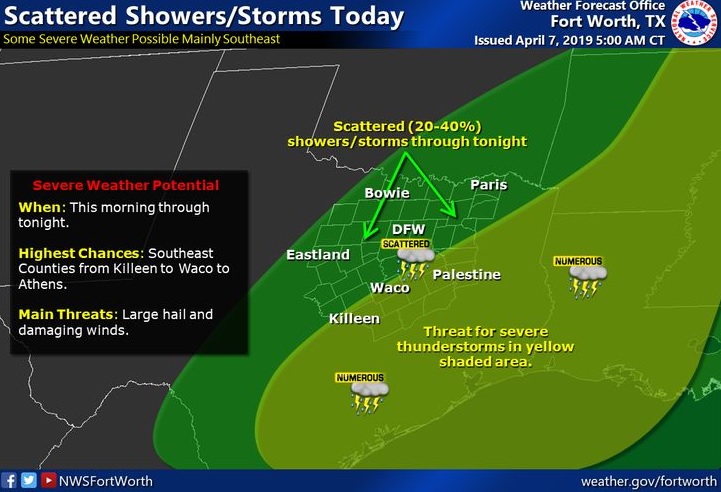
This Hazardous Weather Outlook is for portions of southwest
Arkansas, southeast Oklahoma, and northeast Texas.
While isolated to widely scattered showers and thunderstorms will be possible this morning, showers and thunderstorms will increase this afternoon from the southwest, as the parent upper-level storm system begins to lift east northeast into Eastcentral Texas. There will be a threat for isolated strong to severe thunderstorms this afternoon and evening across Southeast Oklahoma and portions of extreme Northeast Texas and Southwest Arkansas, with damaging winds, large hail, and locally heavy rainfall possible. Where the heavier rains repeatedly move over the same areas, localized flash flooding will be possible. The severe weather threat will diminish later this evening, but the risk for locally heavy rainfall will persist through tonight.
Monday through Saturday
Showers and isolated thunderstorms will begin to diminish from
west to east Monday, as the parent storm system continues to shift east out of the area. While much warmer and drier conditions are expected for much of this week, showers and a few embedded
thunderstorms will increase across the region Saturday.
.SPOTTER INFORMATION STATEMENT
Activation of emergency managers, spotter networks, and amateur
radio operators may be needed this afternoon and tonight.


 EastTexasRadio.com Powered by Ten Stations


