


North and Central Texas
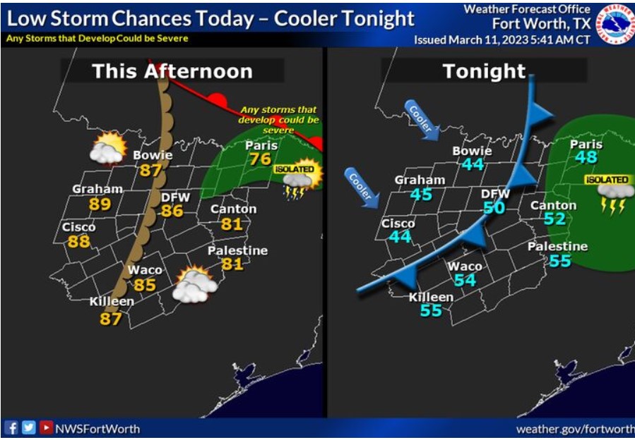
After a cloudy morning, breezy south winds and an approaching dryline will allow temperatures to soar into the mid and upper-80s this afternoon. There is a low chance of thunderstorms developing along and east of the dryline this afternoon. If any storms can grow, they are likely severe, with large hail being the main threat. Storm’s chances are around 10%. A cold front will move through tonight and usher in cooler air. Temperatures will fall into the 40s tonight.
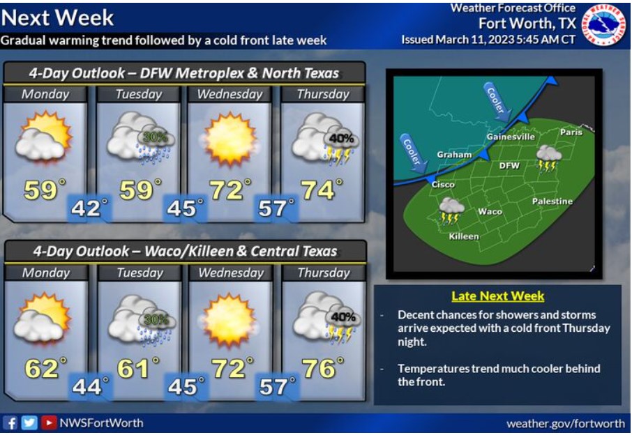
Expect cool weather through early next week behind the weekend cold front. Low rain chances will return on Tuesday, with a quick warm-up expected toward mid to late week. Unfortunately, the warmer weather won’t last long. Another cold front will likely bring much cooler temperatures back to the region Thursday night, along with decent chances for showers and storms.
Today and Tonight
Low thunderstorm chances return late Saturday afternoon into Saturday
evening across North Texas. Severe weather will be possible with any
storms that develop. Hail will be the main threat.
Sunday through Friday
Low storm chances will return Thursday through Friday morning.
SPOTTER INFORMATION STATEMENT
The NWS does not expect spotter activation at this time.
South Central and Southwest Arkansas, North Central and Northwest Louisiana, Southeast Oklahoma, and East and Northeast Texas
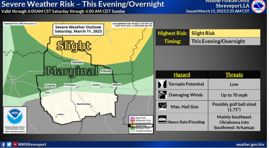
There remains a Slight Risk for severe weather across mainly Southeast Oklahoma and Southwest Arkansas from late this evening into the overnight hours.
Today and tonight
Patchy dense fog should lift later this morning across the region.
Otherwise, there will be a marginal threat for strong to severe
thunderstorms late this evening through the overnight hours, mainly
across the northern half of Northeast Texas and far Northern and
Northeastern Louisiana. If this severe weather threat materializes, large hail, damaging wind gusts, and an isolated tornado will be possible.
Sunday through Friday
Thunderstorms will end on Sunday across portions of Northern
and Northeastern Louisiana. Otherwise, do not anticipate any hazardous weather at this time.
SPOTTER INFORMATION STATEMENT
Spotter activation should not be necessary this evening or tonight.