


North and Central Texas
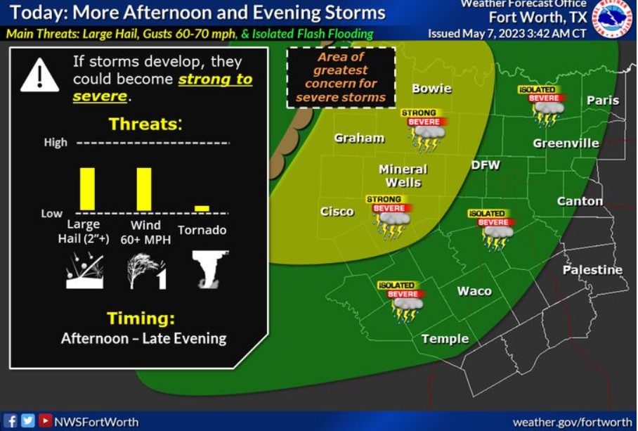
Another round of strong to severe storms will be possible across especially western portions of North and Central Texas later today and this evening. Primary threats will remain similar as in the past several days, with large hail and damaging winds the immediate threats. While the tornado threat is low, you can’t rule out a brief tornado. Areas with heavier rainfall in the past three days may see an isolated instance of flooding if more precipitation occurs over saturated soils.
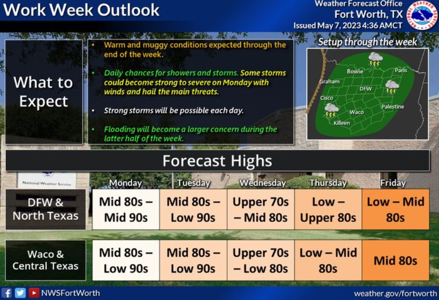
For your workweek outlook: Warm and muggy conditions will persist with daily chances for showers and storms. Strong to severe storms will be possible on Monday, with a threat of damaging winds and large hail. Some storms could become strong, with winds throughout the week and hail the primary concerns. Check back frequently for more information on severity as we go through the week.
Today and Tonight
Thunderstorms will be possible again later this afternoon and into the evening hours. Strong to severe storms are possible across the west and northwest, with large hail and damaging winds the primary concern. Isolated instances of flash flooding are possible where soils are saturated or where storms with heavy rainfall train.
Monday through Saturday
Thunderstorm chances will continue through the end of the week, with additional stronger storms each day, mainly in the afternoon and evening. The flash flooding threat will increase over the latter half of this week.
SPOTTER INFORMATION STATEMENT
Expect limited spotter activation this afternoon, mainly
along and west of I-35.
South Central and Southwest Arkansas, North Central and Northwest Louisiana, Southeast Oklahoma, and East and Northeast Texas
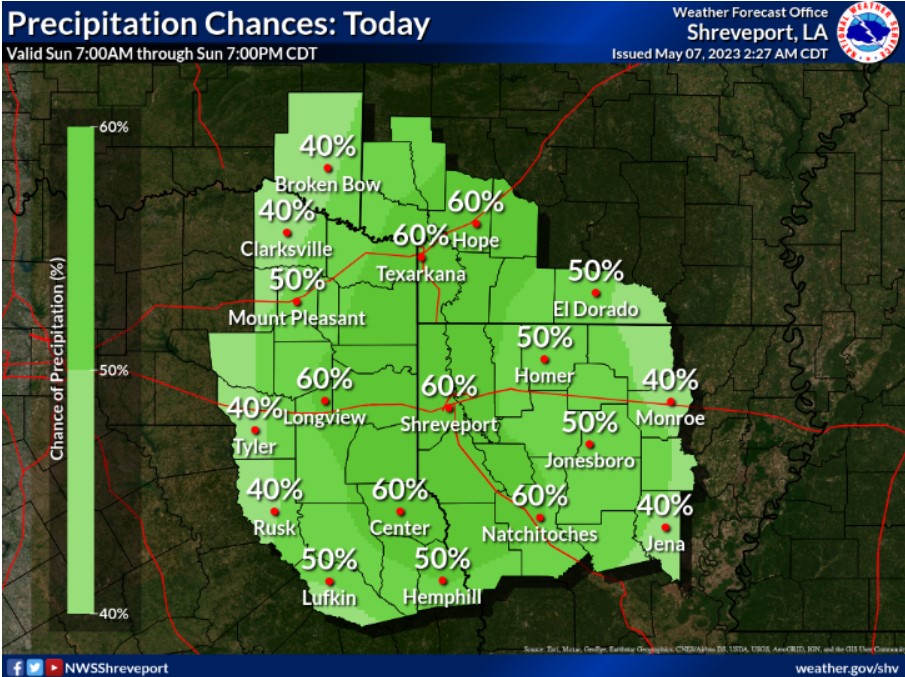
Scattered to numerous showers and thunderstorms are expected later today, increasing during afternoon peak heating as an upper-level disturbance lifts northward from central Texas.
Today and tonight
Scattered thunderstorms will be possible across the area this afternoon and evening. You can’t rule out some isolated strong to severe storms, with damaging winds and large hail being the primary threats.
Monday through Saturday
Periods of scattered thunderstorms will continue throughout the upcoming work week and next weekend; however, the overall threat of severe weather is uncertain. Still, you can’t rule out the potential for some isolated to scattered severe thunderstorms and locally heavy rainfall during this period. Damaging winds and large hail will be the primary threats to severe storms.
SPOTTER INFORMATION STATEMENT
Spotter activation may be needed.