


North and Central Texas
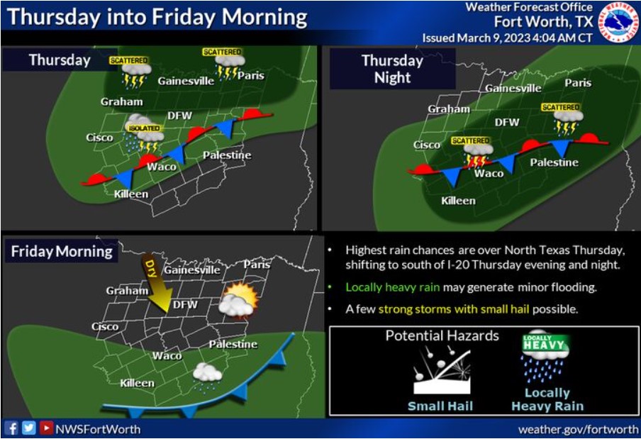
Thursday’s weather will feature a wavering stationary front across the area with cool temperatures in the 60s to the north and warm temps in the 70s and 80s to the south. The best rain chances will be across northern parts of North Texas Thursday, but this will shift southward as the front begins to push back to the south Thursday night. Some storms could be intense and produce locally heavy rainfall and small hail. By Friday morning, drier air will work into the region with a low chance of lingering showers across Central Texas.
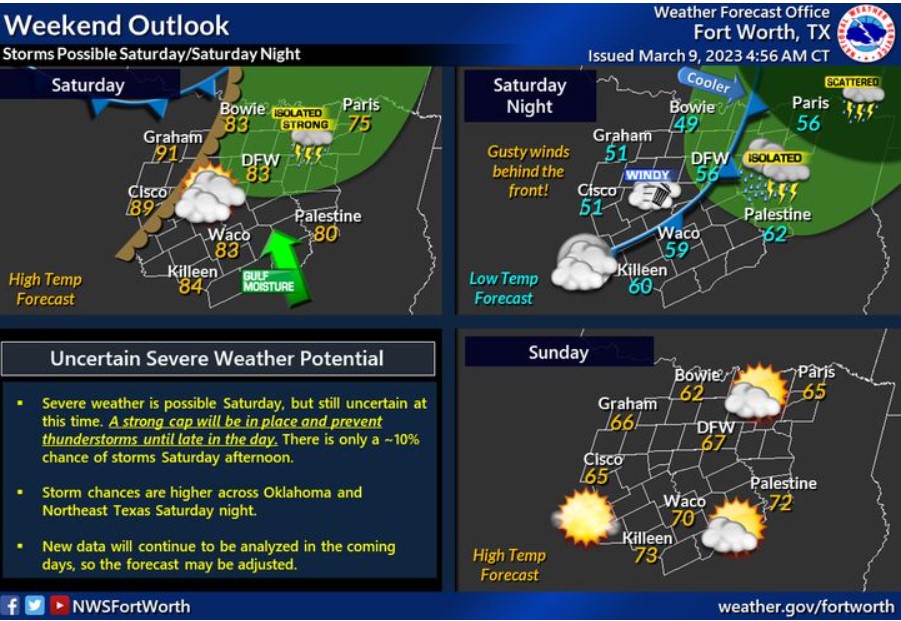
Saturday will be warm and breezy, with highs in the 80s for most. A dryline will advance into North Texas late in the day that may support the development of thunderstorms in the afternoon. There is only about a 10% chance of thunderstorms Saturday afternoon. If storms can develop, they are likely to become intense or severe. Thunderstorm chances are higher over Oklahoma and Northeast Texas Saturday night. A cold front will move through and bring gusty winds and cooler temperatures to the region.
Today and Tonight
Isolated thunderstorms are possible today across North Texas, with
more widespread thunderstorms expected tonight across much of the
area. The severe threat is low, but a few storms may be able to
produce small to marginally severe hail and heavy rain.
Friday through Wednesday
Thunderstorm chances return late Saturday afternoon into Saturday
evening. A conditional severe weather threat could materialize during
this time.
SPOTTER INFORMATION STATEMENT
The NWS does not expect spotter activation at this time.
South Central and Southwest Arkansas, North Central and Northwest Louisiana, Southeast Oklahoma, and East and Northeast Texas
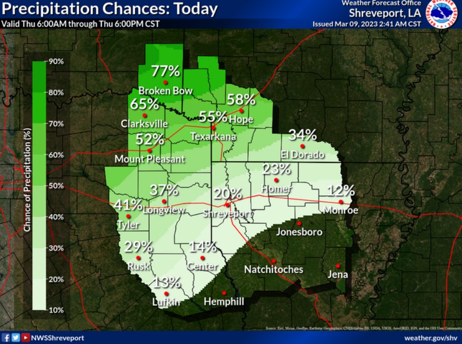
Showers and storms will continue along and north of the I-20 corridor today, spreading south of the I-20 corridor by this afternoon.
Today and tonight
Showers and thunderstorms will continue this morning across Southeast Oklahoma and the northern sections of Southwest Arkansas before diminishing by midday. However, additional rain and thunderstorm development is expected over this area into Northeast Texas late this afternoon, along and behind a cold front which will begin to slide Southeast through the remainder of the region overnight. Brief heavy rainfall will be possible in the stronger storms, with minor flooding of low-lying, poor drainage areas potential, especially this morning over Southeast Oklahoma and portions of Southwest Arkansas.
Friday through Wednesday
Showers and a few thunderstorms will diminish from north to south across East Texas and North Louisiana by midday Friday as more relaxed and drier air spills south behind the passage of a cold front. This front will return north as a warm front across East Texas and Western Louisiana Saturday, and shift north of the region into Eastern Oklahoma and Western Arkansas Saturday night. This front will focus on the development of isolated to scattered showers and thunderstorms over Southeast Oklahoma and portions of Southwest Arkansas Saturday night before an upper-level disturbance. Strong instability also contributes to some of these storms possibly becoming severe. Large hail is the main threat before the severe weather diminishes early Sunday.
Scattered showers and thunderstorms will diminish with the cold frontal passage over Southern Arkansas and North Louisiana Sunday afternoon. Much more relaxed and drier air will return to the region through midweek.
SPOTTER INFORMATION STATEMENT
The NWS does not expect spotter activation through tonight.