


North and Central Texas
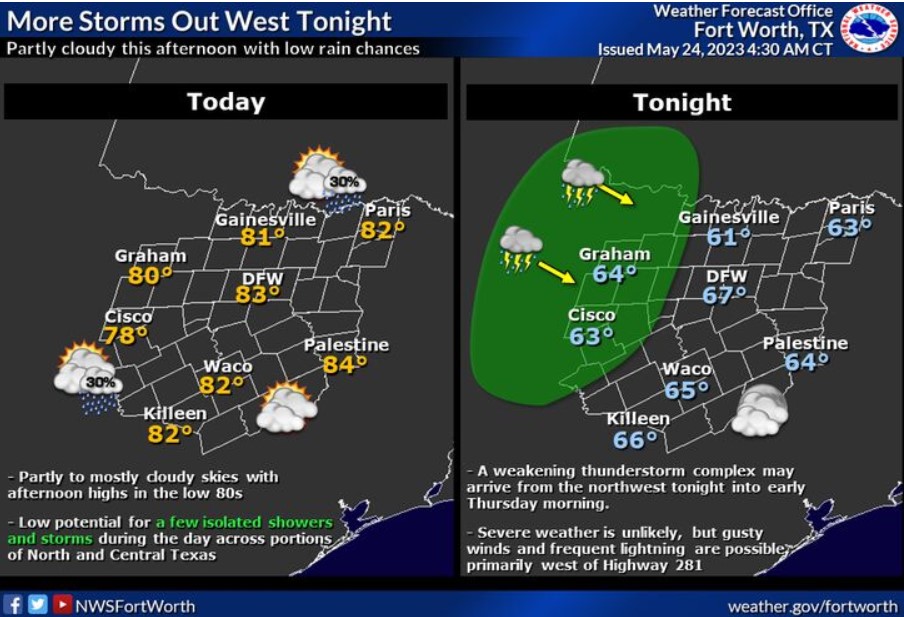
Today will feature partly to mostly cloudy skies, with afternoon highs rising into the low 80s across much of the region. There is a low chance for a few isolated showers and storms across portions of North and Central Texas during the day. Expect additional thunderstorms to move into our western zones later tonight into Thursday morning. The severe potential looks low, but gusty winds and frequent lightning will be possible primarily west of Highway 281.
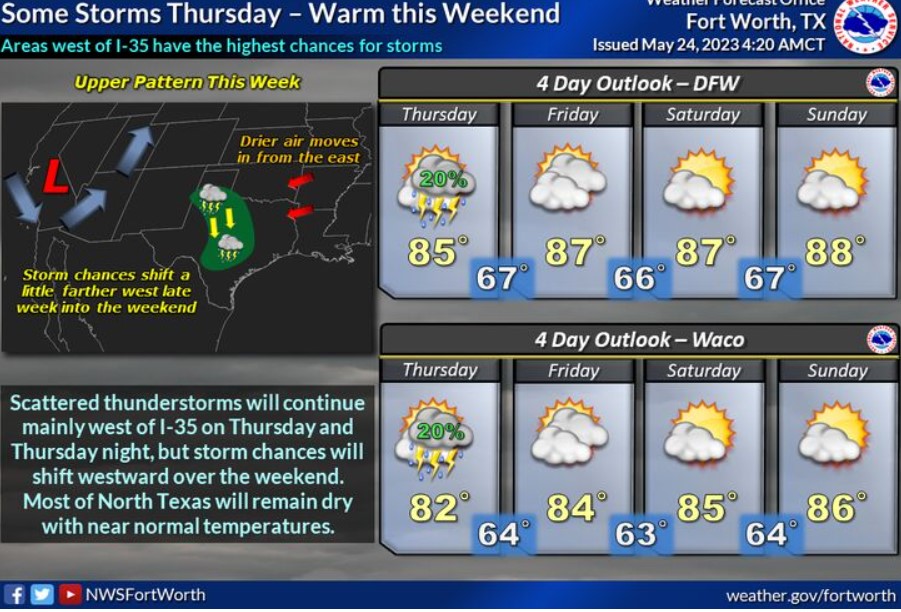
Thunderstorms will again be possible Thursday and Thursday night, mainly west of I-35, but then we should see a lull in storm chances through the weekend. Temperatures will be near average for this time of year. Therefore, you do not need to expect severe weather.
Today and Tonight
Showers and thunderstorms will continue to push through North and Central Texas this morning with gusty winds, lightning, and heavy rainfall. This activity should diminish through the morning. Additional thunderstorms are possible again late tonight, mainly west of I-35.
Thursday through Tuesday
Expect isolated thunderstorms Thursday and Friday, mainly west of I-35. Slightly better chances for storms will arrive on Monday and Tuesday across all of North Texas. Do not expect widespread severe weather at this time.
SPOTTER INFORMATION STATEMENT
Do not expect spotter activation at this time.
South Central and Southwest Arkansas, North Central and Northwest Louisiana, Southeast Oklahoma, and East and Northeast Texas
Today and Tonight
Scattered showers and thunderstorms will be possible mainly this afternoon. Some may result in a brief heavy downpour and strong wind gusts.
Thursday through Tuesday
Do not expect any hazardous weather at this time.
SPOTTER INFORMATION STATEMENT
Do not expect spotter activation at this time.