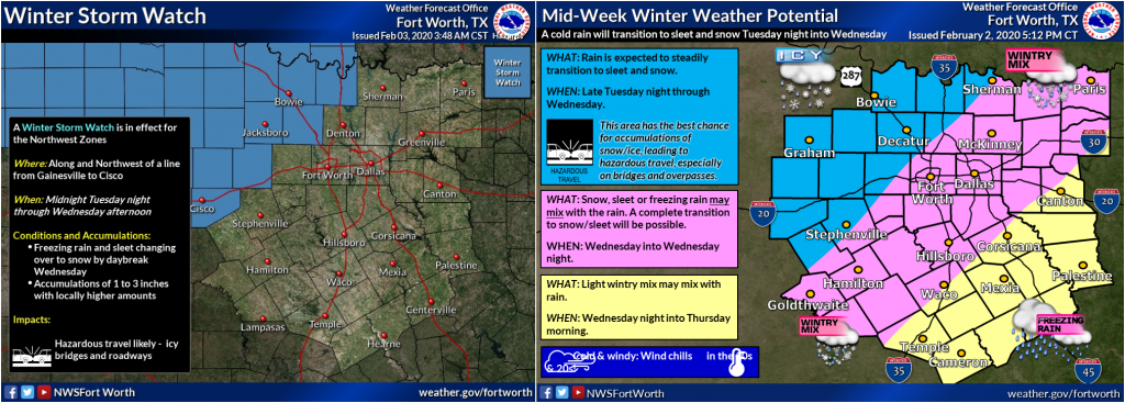


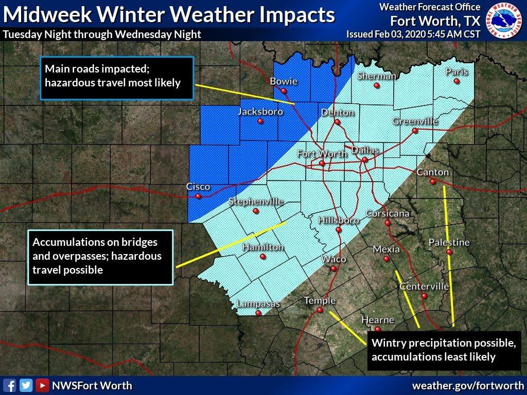
Travel may become hazardous this week due to the arrival of a much colder airmass followed by a round of wintry precipitation. Areas most impacted will be along and northwest of a line from Gainesville to Cisco where accumulations of sleet and snow will likely impact main roads. Farther east and south, cold rain late Tuesday night will likely transition to freezing rain and sleet. Temperatures will hover closer to the freezing mark, which may help limit any accumulations to bridges and overpasses. This could still create hazardous driving conditions in some areas. There is still quite a bit of uncertainty with regard to all of the specifics, so it is important to check back for the latest updates for your area.