


North and Central Texas
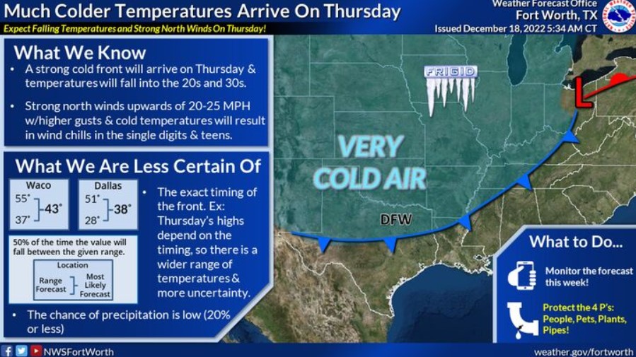
Much colder temperatures arrive on Thursday as a cold front surges south across much of the US. The exact timing on the front is still somewhat uncertain, which is why there is a broader range of the high temperature on Thursday. Regardless, the day’s high temperature will likely occur during the morning, with temperatures falling into the 20s and 30s throughout the day. The combination of strong north winds will result in wind chill values in the single digits and teens.
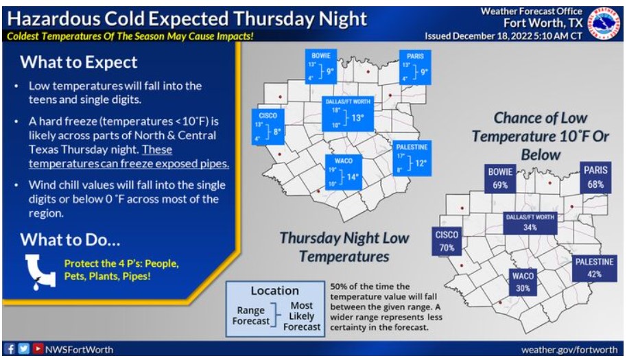
Low temperatures will fall into the teens and single digits Thursday night. A hard freeze, with temperatures less than or equal to 10F, is likely across North and Central Texas. These temperatures can freeze exposed pipes! Wind chill values will fall into the single digits or below 0F across most of the area. Take the necessary actions to protect the 4 P’s: people, pets, plants, and pipes!
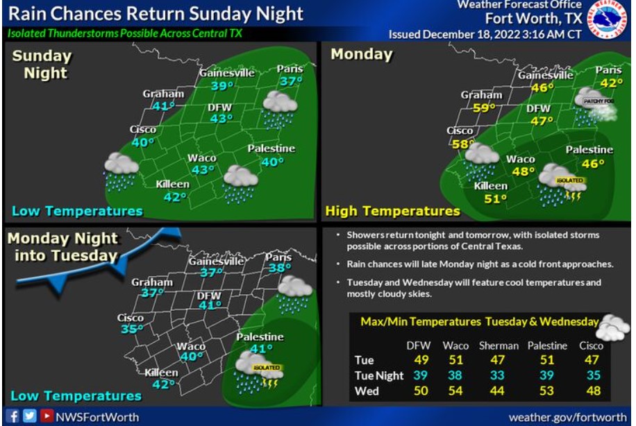
Rain chances return Sunday night and Monday across most of the region, with the best bets across our southeastern counties. An isolated storm or two may occur in the southeasternmost counties, but the NWS does not expect severe weather. Rain chances should end from west to east Monday evening ahead of an incoming cold front. Expect overcast skies and highs in the upper 40s to low 50s on Tuesday and Wednesday.
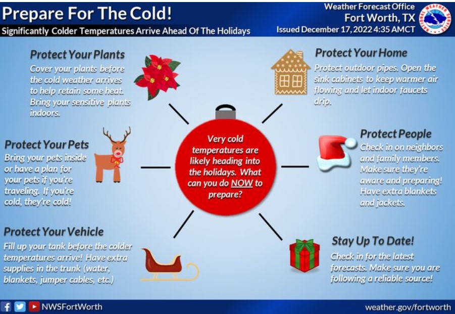
Take advantage of the lovely weekend to prepare for the significantly colder temperatures late next week through the holiday weekend. You can take action now, including protecting your home, vehicle, and plants. You can also check in on neighbors and friends and offer help. Always bring your pets indoors! A hard freeze will likely impact North and Central Texas on Thursday night.
South Central and Southwest Arkansas, North Central and Northwest Louisiana, Southeast Oklahoma, and East and Northeast Texas
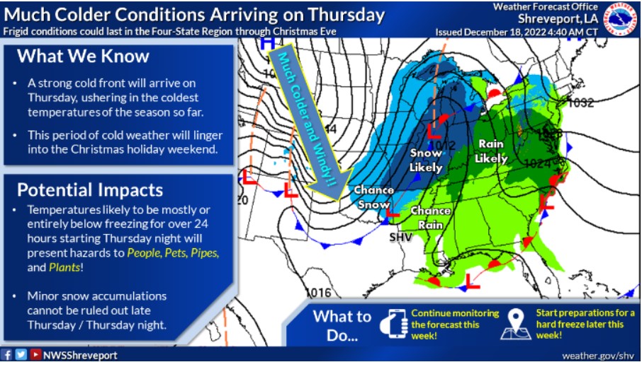
By far, the coldest air of the season will be moving into the Four State Region late Thursday and remain anchored across our region through the upcoming Holiday Weekend. Therefore, you should take action this week in preparation for this bitterly cold arctic air.
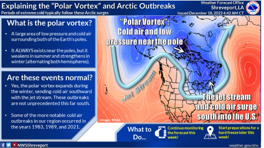
The term “polar vortex” will probably become widely used over the next several days as Arctic air surges southward later this week. Although these more significant cold air outbreaks aren’t necessarily an annual event this far south, these episodes are certainly not unprecedented.
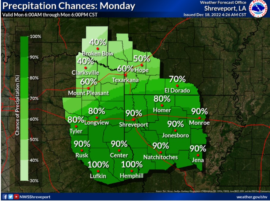
Precipitation returns in earnest on your Monday. The heaviest rainfall will likely be across portions of Deep East Texas into West Central and East Central Louisiana.