


North and Central Texas
Another complex of thunderstorms will approach from the west-northwest tonight, bringing another round of rain/storm chances to North and Central Texas through Wednesday morning. A few storms west of the I-35 corridor may be vital to severe, with primarily a damaging wind threat. Small hail and localized flooding due to heavy rainfall are also possible.
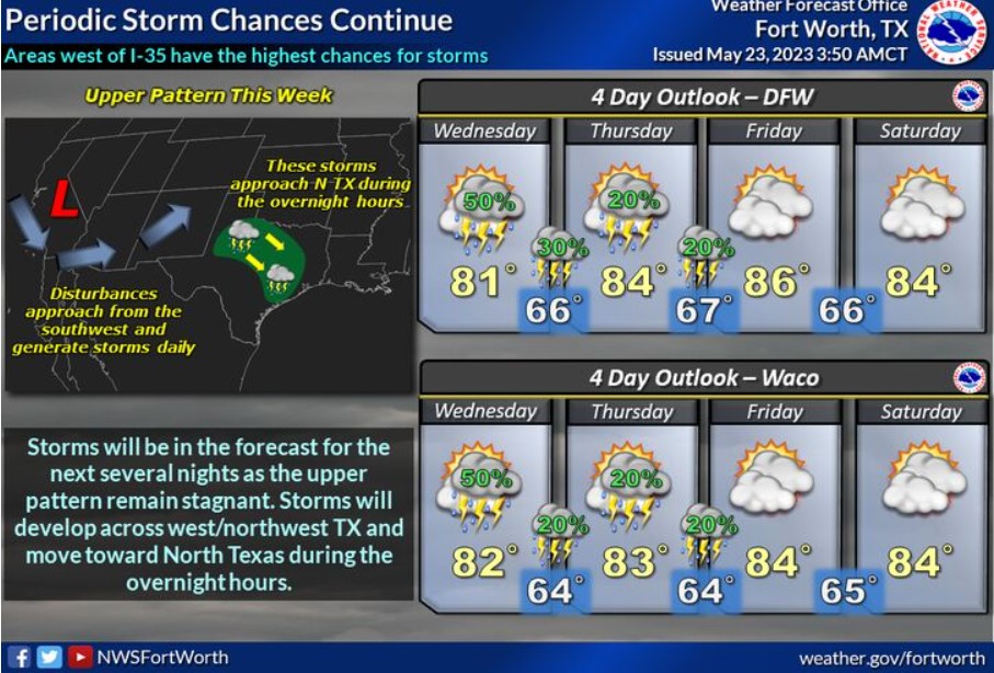
Periodic thunderstorms will invade North and Central Texas each night through the end of the week. Areas west of I-35 will have the best chances to see rainfall and storms through Friday.
Today and Tonight
A complex of storms approaching the I-35 corridor this morning will continue decreasing in intensity. Occasional lightning will be the primary hazard south of I-20.
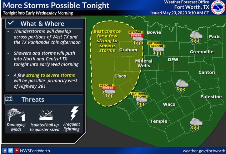
Expect additional thunderstorms to move into our area from the west tonight into early Wednesday morning. A few storms may become vital to severe, primarily west of Highway 281, and contain damaging wind gusts, frequent lightning, heavy rain, and small hail.
Wednesday through Monday
Expect additional storm chances Wednesday and Thursday nights with areas west of I-35 having the highest chances for storms.
SPOTTER INFORMATION STATEMENT
Do not expect spotter activation at this time.
South Central and Southwest Arkansas, North Central and Northwest Louisiana, Southeast Oklahoma, and East and Northeast Texas
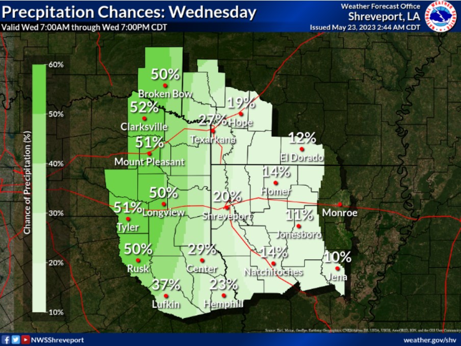
Rain chances are back in the forecast on Wednesday, but mainly across portions of Northeast Texas, Southeast Oklahoma, and extreme Southwest Arkansas.