


North and Central Texas
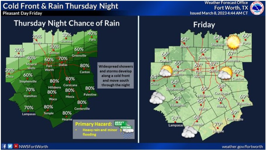 Widespread showers and thunderstorms develop along a cold front and move south through the night. Heavy rain and minor flooding will be the primary hazards. Drier air moves in Friday and should make for a pleasant end to the workweek.
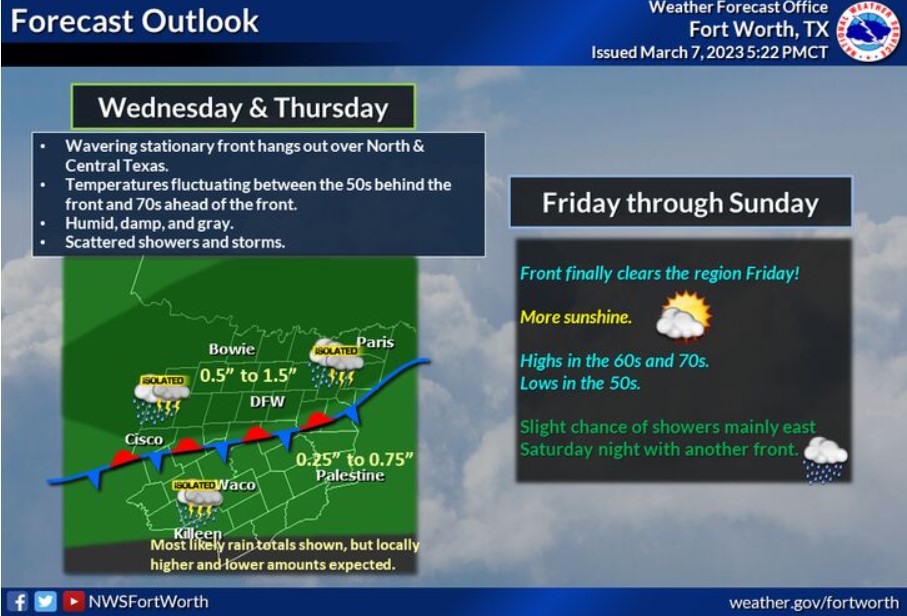 Wednesday and Thursday’s weather will feature a wavering stationary front that causes temperatures to fluctuate between the 50s behind the cool air to the 70s ahead. This front will produce gray, damp, and humid conditions across the region. Scattered showers and thunderstorms will develop and impact the area Wednesday and Thursday. The most likely rainfall amounts through Thursday will range from a half inch to an inch and a half over North Texas to a quarter to three-quarters inch over Central Texas. On Friday, the front will finally clear the region with more sunshine and highs in the 60s and 70s with lows in the 50s. There will be a slight chance of showers Saturday night with another fast-moving front.
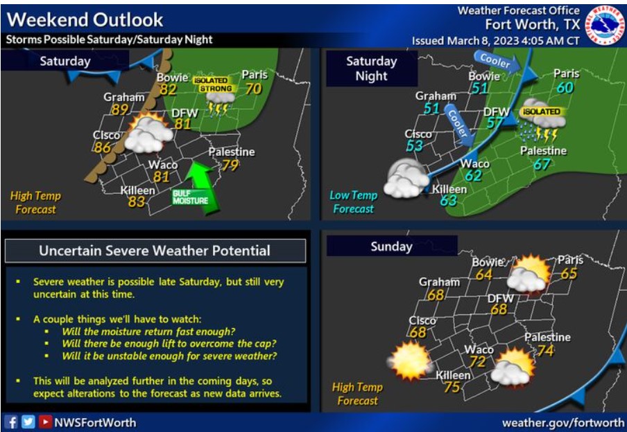 Saturday will be warm and breezy, with highs in the 80s for most. A dryline will advance into North Texas late in the day and may support the development of thunderstorms in the afternoon. The severe threat is uncertain at this time. Details that are yet to come into focus are:
- The number of moisture returns ahead of the dryline.
- The strength of the lift and cap.
- The amount of general instability.
A cold front will move through overnight and lower temperatures Sunday.
Today and Tonight
Isolated thunderstorms are possible across North Texas today and
tonight. The severe threat is low, but a few storms may be able to
produce small hail and brief heavy rain.
Thursday through Tuesday
Isolated thunderstorms are possible Thursday, with widespread showers
and thunderstorms expected Thursday night. Some storms may produce
heavy rain and localized minor flooding Thursday night. The severe
threat will remain low, with small hail being the main hazard.
Thunderstorm chances return Saturday. The severe threat is uncertain
at this time.
SPOTTER INFORMATION STATEMENT
The NWS does not expect spotter activation at this time.
South Central and Southwest Arkansas, North Central and Northwest Louisiana, Southeast Oklahoma, and East and Northeast Texas
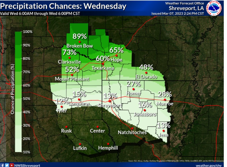 Rain chances will be highest on Wednesday across areas mainly north of the Interstate 20 Corridor.
Wednesday through Monday
Scattered to numerous showers and a few thunderstorms will continue
at times Wednesday through Friday across portions of extreme
Northeast Texas, Southeast Oklahoma, and Southwest Arkansas are near and north of a weak frontal system that will remain stationary over the
area. Heavy rainfall will be possible, with widespread rainfall
amounts of one to two inches, with isolated higher amounts of up to
three inches possible. It may result in minor flooding of low-lying, poor drainage areas before the rain diminishes Friday morning.
Additional isolated to scattered showers and a few thunderstorms
will return to the area Saturday night and Sunday near another weak
surface front before cooler and drier conditions, return to the area
Monday.
SPOTTER INFORMATION STATEMENT
The NWS does not expect spotter activation at this time.