


North and Central Texas
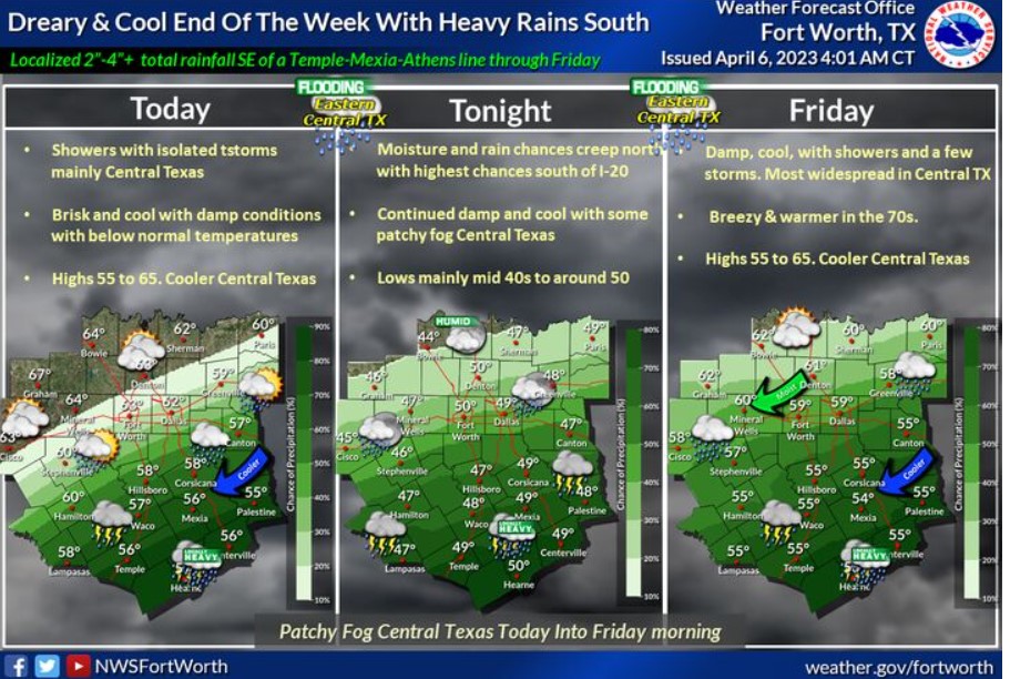
Expect a brisk, cool temp and rainy end to the week, primarily for Central Texas, where the more widespread rain and cooler temperatures will exist. Locally heavy 2″-5″ rainfall may result in minor principal flooding and rises on area mainstem rivers and their tributaries. A few embedded thunderstorms will be possible along and south of I-20 and I-30 by tonight, but they will not be severe. Highs each afternoon generally range between 55 and 65 degrees, with lows tonight primarily in the 40s. A brisk northeast or east wind of 10 to 15 mph is expected, with occasional higher gusts.
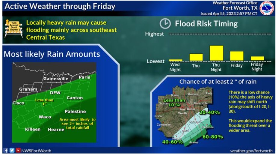
Multiple rounds of showers and storms will be possible through Friday night. However, it will be confined mainly across our southern counties. Across Central Texas, you can expect to see 1-3″ of total rainfall, especially around the Brazos Valley, with isolated higher amounts of up to 5″ possible. Locally heavy rain may cause isolated flooding. Remember to check back for new forecast updates, and never drive through flooded roads!
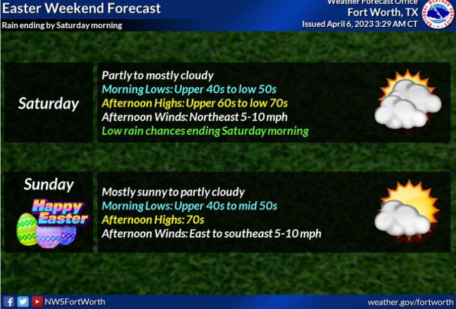
Any lingering rain will end by Saturday morning, leaving the rest of Easter Weekend dry. Expect morning lows in the 40s and 50s and afternoon highs in the 60s and 70s.
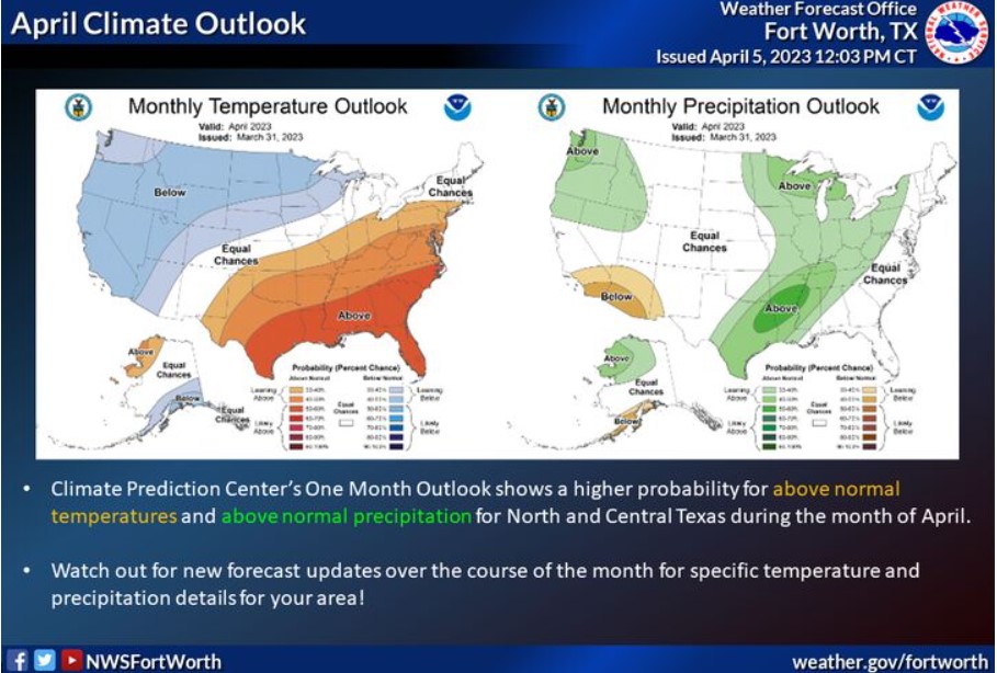
The Climate Prediction Center’s Month Outlook shows North and Central Texas in a higher probability for above-average temperatures and above-average precipitation. Check back frequently over the rest of the month to get more specific details about temps and rain chances for your area!
Today and Tonight
Scattered thunderstorms are possible along and south of I-20 today
and tonight. A few storms may produce small hail and frequent lightning. As a result, there is a potential for heavy rain and localized flooding across the Brazos Valley.
Friday through Wednesday
Scattered thunderstorms are possible through early Saturday morning, mainly along and south of I-20. As a result, portions of Central Texas, including the Brazos Valley, will potentially see heavy rainfall and localized flooding.
SPOTTER INFORMATION STATEMENT
Do not expect spotter activation at this time.
South Central and Southwest Arkansas, North Central and Northwest Louisiana, Southeast Oklahoma, and East and Northeast Texas
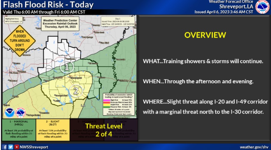
Locally heavy rains and thunderstorms will continue to train across portions of Northeast and Deep East Texas into parts of Northern Louisiana and South Central Arkansas. As a result, flash flooding will be possible across this region through today, where training showers and thunderstorms are.
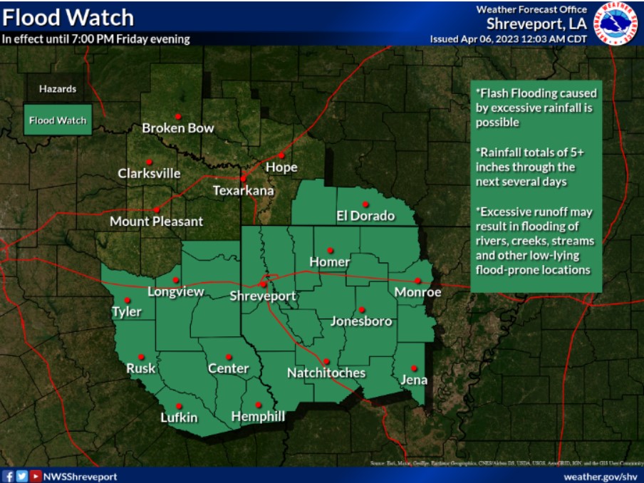
The NWS expanded the Flood Watch to include all our Louisiana Parishes, East Texas, and a few counties in Southwest Arkansas. Expect rainfall totals of 5+ inches across this area over the next several days. Remember, Turn Around, Don’t Drown.
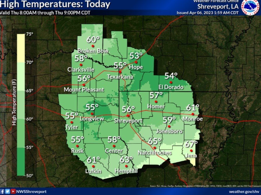
Look for cooler temperatures today across portions of the Four State Region. Persistent rain coverage will help keep temperatures cool behind the passing front.
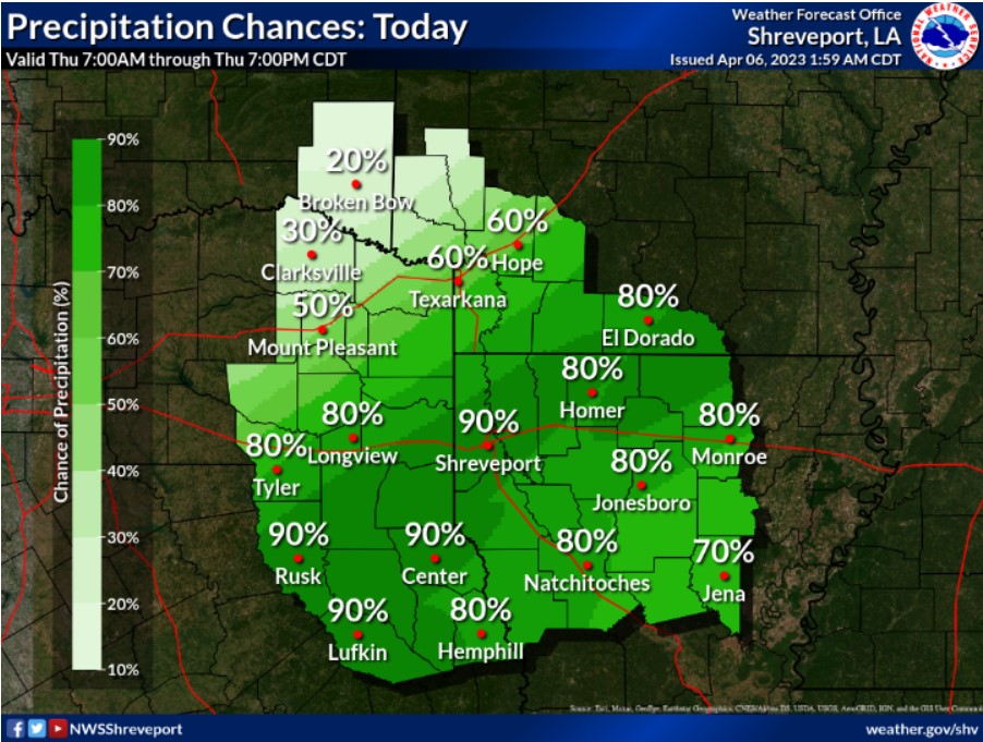
The most significant rain chances tonight will be across the southwest two-thirds of the Four State Region, including the southern half of Northeast Texas, Northern Louisiana, and South Central Arkansas.
Thursday through Tuesday.
The pattern looks to remain unsettled through the end of the week as rounds of heavy rainfall will become more likely as the front stalls south of the region. It could reintroduce flooding concerns across the region through the end of the week as several inches of rainfall will be possible, mainly from Deep East Texas into North and Central Louisiana. However, the rain will gradually end by this Easter weekend as the stalled boundary finally exits to the southeast.
SPOTTER INFORMATION STATEMENT
Do not expect spotter activation at this time.