


North and Central Texas
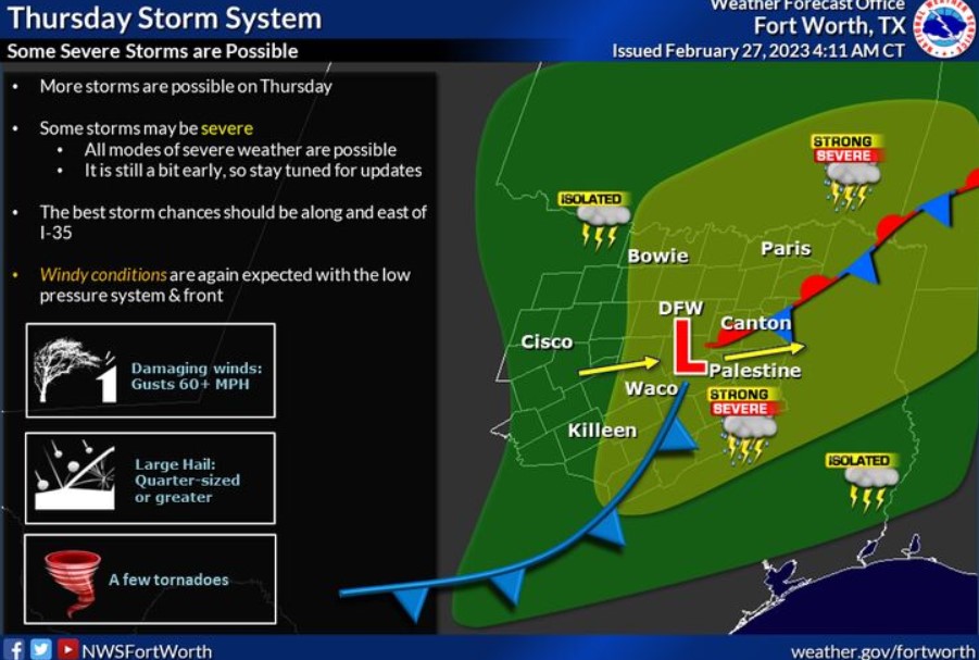
Severe storms will be possible across North and Central Texas on Thursday associated with the next low-pressure system and cold front. The best chances for severe storms now are areas along and east of the Interstate 35 corridor. We will be able to gather more detailed information in the coming days, so stay tuned and check back for updates.
South Central and Southwest Arkansas, North Central and Northwest Louisiana, Southeast Oklahoma, and East and Northeast Texas
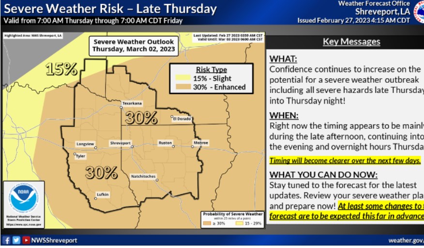
We continue to monitor the chance of severe weather on Thursday. Severe storms will likely be across the region from Thursday afternoon through Thursday night. So stay tuned for the latest information and remember, now is the time to prepare.
Today and tonight
Expect breezy conditions as a frontal boundary moves through the area. In addition, a thin line of showers will push through the area along the front. Expect no severe weather today or tonight.
Tuesday through Sunday
Scattered numerous thunderstorms will begin moving across the
region on Wednesday with some storms capable of producing hail and
strong wind gusts. On Thursday, another round of strong to severe
thunderstorms will be possible from late afternoon into the overnight
hours where large hail, damaging winds, and tornadoes will all be
possible.
SPOTTER INFORMATION STATEMENT
Do not expect spotter activation at this time.