


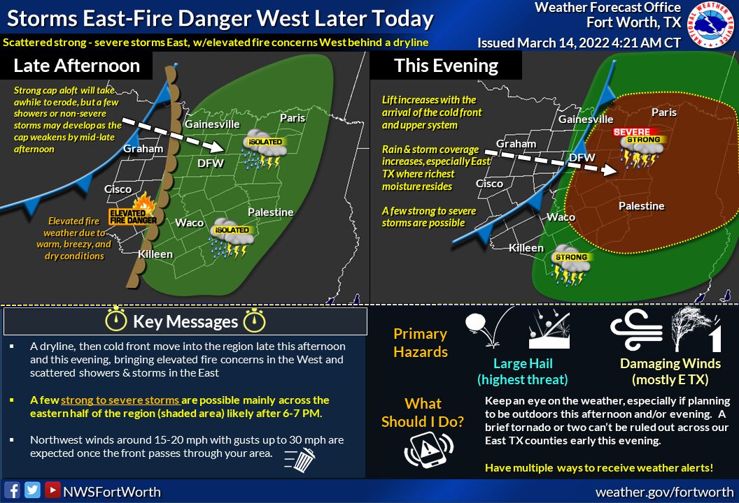
A storm system and associated dryline, then cold front impact your Monday late today through tonight. Most of the day will likely be rain-free or maybe a few sprinkles or brief showers due to a substantial cap aloft over the area. However, scattered to numerous showers and thunderstorms, some vital to severe are expected to develop east of the dryline by 5:00 to 7:00 pm east of the dryline or generally along and east of I-35/35W, as the approaching upper disturbance and increasing lift arrives across the forecast area.
Large hail and a few instances of damaging winds will be primary threats, though a brief tornado, or two, can’t be ruled out with initial discrete storms across our East Texas counties where better moisture quality will exist. So stay alert and monitor forecasts later today closely and be prepared to take action if the National Storm Center issues a warning for your area.