


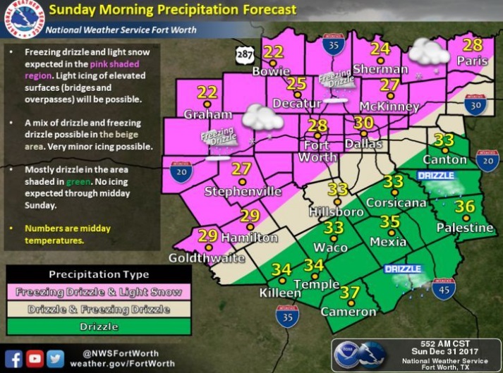
The National Weather Service in Fort Worth and Denton Police Department are reporting a mix of freezing drizzle and light snow this morning in the pink shaded area. Some icy sports are occurring, especially on bridges and overpasses which may lead to hazardous travel. A mix of freezing drizzle is possible in the beige shaded area with little or no ice accumulation expected. Temperatures will remain above freezing southeast of a Lampasas, Waco, to Canton line through early afternoon. That means just drizzle with on impacts in that area.
The National Weather Service in Shreveport issued a Hard Freeze Warning from midnight tonight until 10:00 am Monday. The Hard Freeze Watch is no longer in effect.
An Arctic air mass is bringing cold temperatures into the region today across all of the Four-State Region. As the clouds clear from north to south this evening, temperatures will fall into the mid and upper teens across extreme Northeast Texas, Southeast Oklahoma, Southwest Arkansas, and the eastern sections of Northcentral Louisiana, to the lower 20s across lower East Texas and Northwest Louisiana.
Temperatures will fall below freezing across the region this evening and will remain well below freezing through much of the morning Monday.
Precautions should be taken to protect pipes and provide warm shelter for plants and pets tonight and Monday. Prolonged exposure could lead to hypothermia and may harm pets and livestock.