


North and Central Texas
Today and Tonight.
A line of showers and thunderstorms will move through North Texas this morning and afternoon. These storms will be capable of producing isolated severe wind gusts, hail, and perhaps a tornado or two within the line.
Wednesday through Monday
The NWS does not expect any hazardous weather at this time.
SPOTTER INFORMATION STATEMENT
Expect no spotter activation at this time.
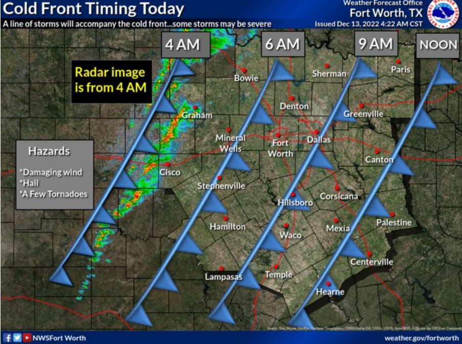
Expect a line of storms to move through, impacting the morning drive and school drop-off in the Metroplex. The thunderstorms will move to a Bonham, Rockwall, and Corsicana line around 10:00 am. This morning at 4:00, the National Weather Service issued a Tornado Watch for counties north and west of Dallas-Fort Worth until 11:00 am.
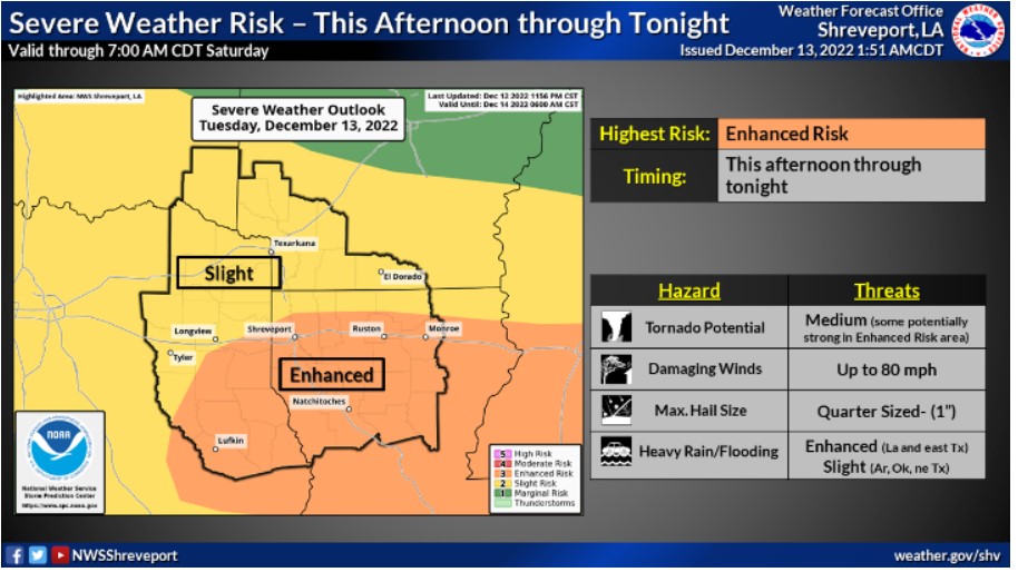
The cold front will move into Northeast Texas after 10:00 Tuesday morning and become more assertive in Arkansas and Louisiana this afternoon and evening. All severe weather threats will be possible. Damaging wind and a few tornadoes will be the primary threats, with scattered large hail likely over the southern half of East Texas and Northwest Louisiana. The Storm Prediction Center indicates that these areas have an enhanced severe weather risk. That’s a three on the 1-to-5 risk scale, while the northern half will have a marginal to slight risk.