


North and Central Texas
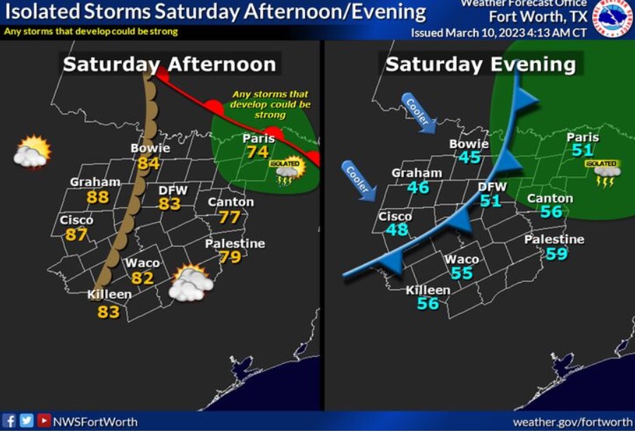
Much warmer weather is expected ahead of a storm system in the Plains on Saturday. A warm front will race northward by afternoon, with temperatures climbing into the low to mid-80s. A few storms may develop by Saturday afternoon across our northeast counties. Any storms that can develop have the potential to become strong. A cold front will slide through the area Saturday night, with cooler air filtering into the region into Sunday morning.
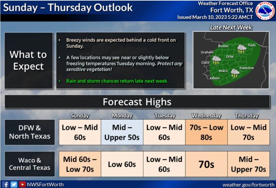
Mild and quiet weather is expected behind a cold front late this weekend through early next week. Expect the coolest temperatures on Tuesday morning, where a few locations might dip near or below freezing. Make sure you protect any sensitive vegetation ahead of time! We’ll warm back up toward the middle of the week, with rain chances returning Thursday.
South Central and Southwest Arkansas, North Central and Northwest Louisiana, Southeast Oklahoma, and East and Northeast Texas
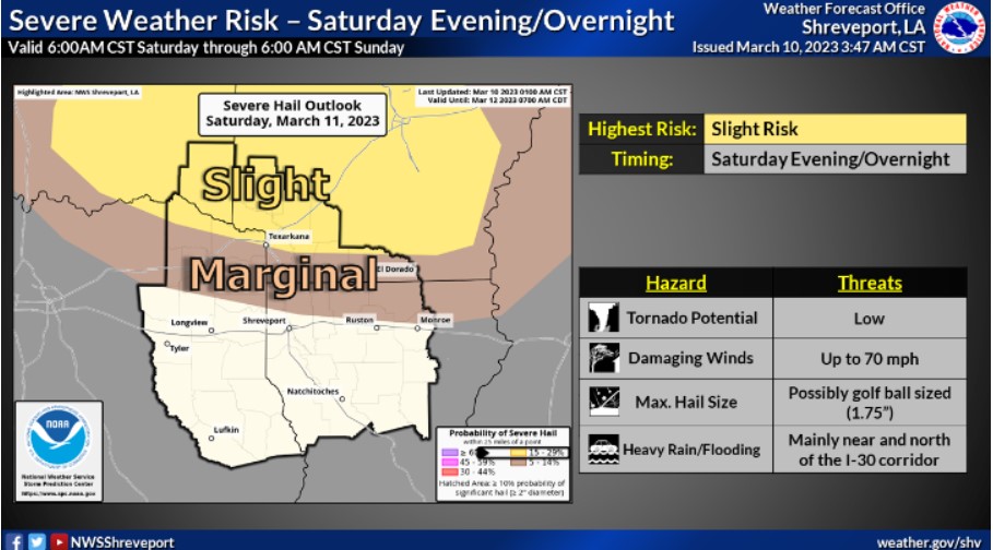
Here is the Day Two Outlook from the Storm Prediction Center with a Slight to Marginal Risk for Severe Thunderstorms for our areas north of I-20 during Saturday evening and overnight. It comes ahead of our next hearty cold front.
Today and tonight
Rain and thunderstorms will be ending later today across the region.
Saturday through Thursday
While strong to severe thunderstorms will be possible north of the region Saturday Evening through Saturday Night, there will be a a threat for thunderstorms late Saturday Night through the first half of Sunday across portions of the region. The severe weather threat should stay north and east of the area through this weekend.
SPOTTER INFORMATION STATEMENT
Do not expect spotter activation at this time.