


North and Central Texas
Good rain chances will continue for the rest of the weekend, with most locations seeing measurable rainfall by Sunday night. The exact timing of where rain will occur is somewhat uncertain due to weak winds aloft and the fact that smaller-scale features will drive showers and storms because of outflow boundaries and weak upper-level disturbances. The severe weather potential is low, but intense storms with gusty winds and heavy rain are possible. Check back for updates whenever you can!
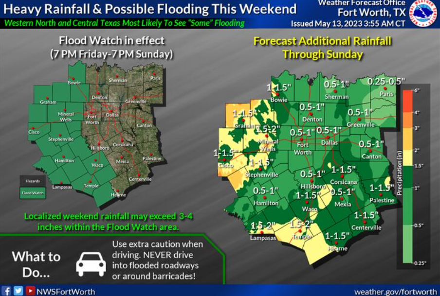
A Flood Watch remains in effect until 7:00 pm Sunday for western sections of North-Central Texas. Additional localized heavy rainfall between 0.5″ and 2″ may occur, even potentially outside the watch area. Make sure to have multiple ways to receive warnings, especially at night.
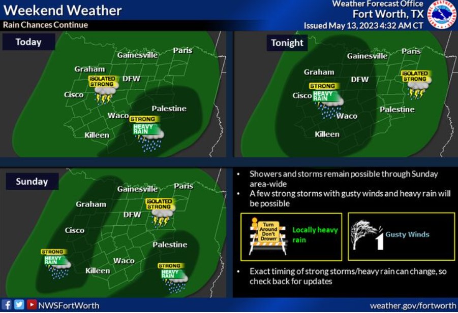
Today and Tonight
There is a chance of thunderstorms across much of the area today. A few storms may be vital to severe, mainly across Central Texas.
In addition, rounds of heavy rainfall may produce a few instances of flooding or flash flooding across western Central and North Texas, where a Flood Watch is in effect through Sunday evening
Sunday through Friday
Expect occasional chances for storms through much of next week. The severe weather threat is low, but intense storms with small hail, gusty winds, and heavy rain are possible.
SPOTTER INFORMATION STATEMENT
Do not expect spotter activation at this time.
South Central and Southwest Arkansas, North Central and Northwest Louisiana, Southeast Oklahoma, and East and Northeast Texas
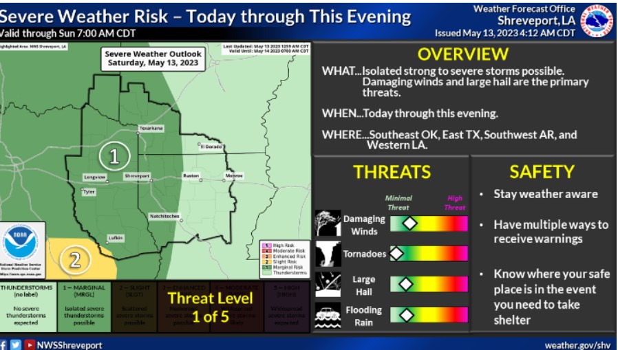
Strong to severe storms will be possible this evening over East Texas, Southeast Oklahoma, Southwest Arkansas, and Western Louisiana. Damaging winds and large hail are the primary threats.
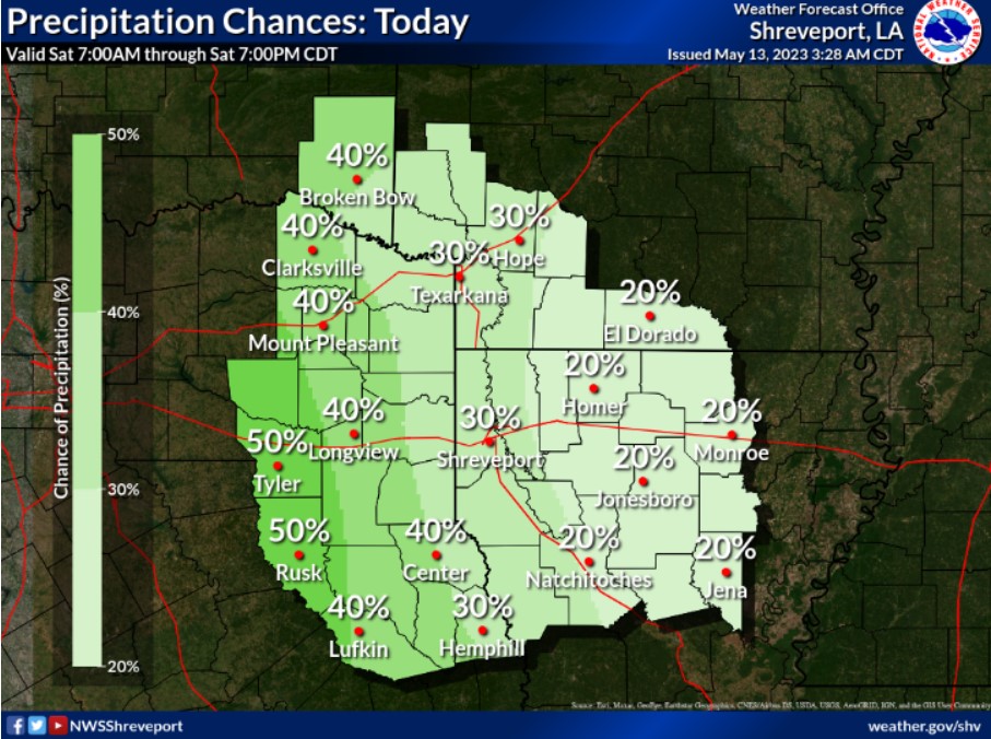
Isolated to scattered showers and thunderstorms will be possible today, especially over East Texas, Southeast Oklahoma, and portions of Southwest Arkansas and Western Louisiana.
Today and tonight
Isolated strong to severe thunderstorms will be possible across Southeast Oklahoma, Northeast Texas, Southwest Arkansas, and much of Northern Louisiana today through this evening. The strongest storms could produce damaging winds and large hail. Additionally, areas of heavy rain may lead to flash flooding.
Sunday through Friday
The overall threat of severe weather is uncertain. Still, you can’t rule out the potential for an isolated severe thunderstorm during this period. However, the somewhat more substantial threat will be in the western
zones of the Four State region on Saturday. Periods of scattered thunderstorms will continue through the end of the weekend and at least the first half of next week. Damaging winds and possibly large hail will be the primary threats to severe storms. Also, with a prolonged thunderstorm potential expected to continue, a flooding threat will remain across the region and extend into next week.
SPOTTER INFORMATION STATEMENT
Do not expect spotter activation at this time.