


North and Central Texas
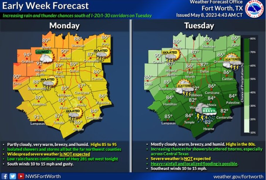
Warm, humid, breezy, and sometimes wet weather is expected early this week, especially on Tuesday. Temperatures will remain above average with highs well into the 80s, with even lower-mid 90s northwest zones this afternoon. Expect deficient rain and storm chances later tonight. Still, most will not see any rainfall, with the possibility of an isolated risk for a strong to severe storm across far western North & Central Texas by this evening. On Tuesday, an upper cut-off system over South-Central and Southeast Texas will increase rain and storm chances. Do not expect severe weather, but Central Texas may see localized, hefty rainfall and instances of flooding late in the day and into Tuesday evening.
Today and Tonight
Expect low chances for thunderstorms today. Some storms could become strong with gusty winds and small hail.
Tuesday through Sunday
The flash flooding threat will increase over the latter half of this week. The overall severe threat is low, but some storms could become strong. Thunderstorm chances will continue and grow for the weekend, especially in Central Texas.
SPOTTER INFORMATION STATEMENT
Do not expect spotter activation at this time.
South Central and Southwest Arkansas, North Central and Northwest Louisiana, Southeast Oklahoma, and East and Northeast Texas
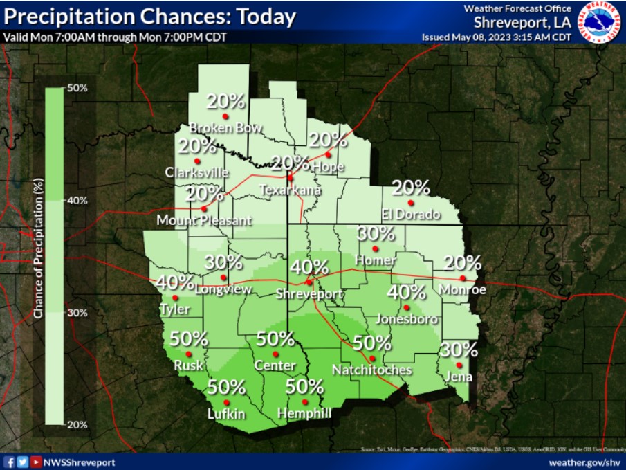
Isolated to scattered showers and thunderstorms will increase across much of the region this afternoon and possibly linger into the early evening before diminishing as heating wanes.
Today and tonight
Scattered thunderstorms will be possible across the area this afternoon and evening. You can’t rule out some isolated strong to severe storms, with damaging winds and large hail being the primary threats.
Monday through Saturday
The overall threat of severe weather is uncertain. Periods of scattered thunderstorms will continue through much of the upcoming work week and into next weekend. Still, you must consider the potential for some isolated to scattered severe thunderstorms and locally heavy rainfall during this period. Damaging winds and large hail will be the primary threats to severe storms.
SPOTTER INFORMATION STATEMENT
Spotter activation may be needed.