


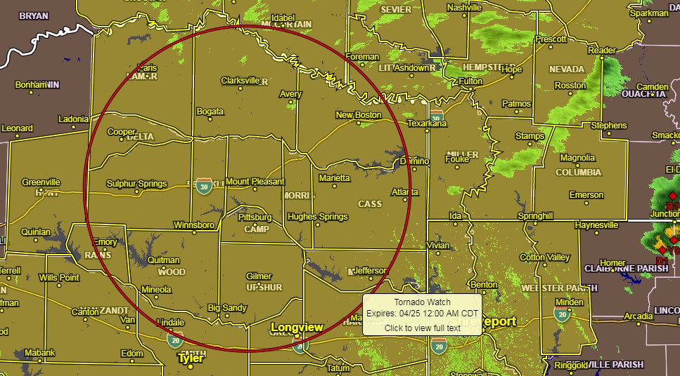
This afternoon, the upper-level trough is approaching the area from the west while the dryline is taking shape over North Texas. Meanwhile, the low-level moisture continues to filter into the four-state region. Dewpoints are increasing into the lower 60s over and near the western sections. Instability will not be an issue as and convection should begin to fire along the dryline over North Texas. It will provide the force needed to get things going. They will produce massive hail, especially early this evening, as more thunderstorm clusters develop into the evening hours. They will push across Southern Arkansas and Northern Louisiana with damaging wind threat emerging.
Isolated tornadoes are not out of the question between now and midnight.
The pressure gradient will tighten across the area with some healthy and gusty winds left in its wake for the first half of Saturday. Skies will clear during the day Saturday and be pleasant with highs in the low to mid-70s.
Saturday night surface high pressure will build into the region, relaxing the winds and bring cooler temperatures to all areas. Low Saturday night will range from the upper 40s north of I-30 to the mid-50s elsewhere.