


North and Central Texas
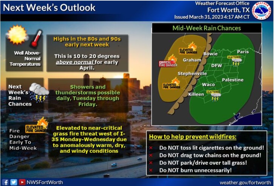
The first week of April will feature well above-normal temperatures, with rain and storm chances and a grass fire threat. Afternoon temperatures will climb into the 80s and 90s early next week, making it feel more like summer than spring. Showers and thunderstorms will be possible beginning Tuesday and continuing through the end of the week. Additional anomalously warm, dry, and windy conditions behind a dryline will result in an elevated to near critical fire threat generally west of I-35 early to mid-week.
Today and Tonight
Thunderstorm chances return today and will continue ahead of an advancing dryline this afternoon and a cold front this evening. Expect the storm coverage to be the highest east of Interstate 35. A few storms may become vital to severe, with hail and damaging winds, the primary hazards this afternoon into the early evening hours.
Saturday through Thursday
Thunderstorm chances return Sunday, mainly Sunday afternoon and
evening. The severe potential looks low. However, a strong storm or two with hail and gusty winds is possible.
SPOTTER INFORMATION STATEMENT
The NWS could request limited spotter activation east of an advancing
dryline this afternoon and a cold front this evening.
South Central and Southwest Arkansas, North Central and Northwest Louisiana, Southeast Oklahoma, and East and Northeast Texas
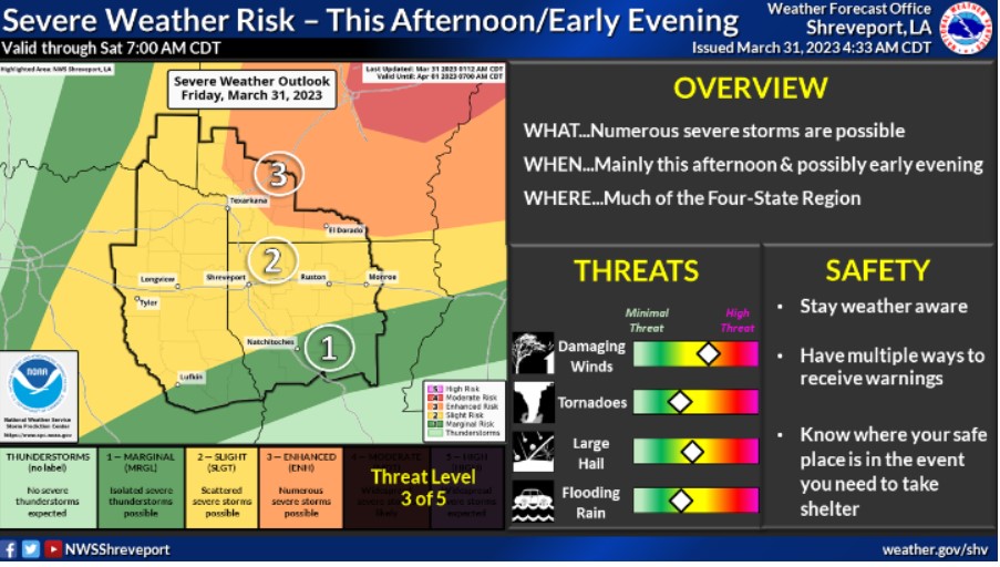
The threat of severe weather will return to the Four-State Region today as thunderstorms could increase this afternoon into the early evening hours. Some of these storms could be severe, with the primary threat of damaging winds, but large hail and a few tornadoes also cannot be ruled out. The higher threat area will reside across much of Southwest Arkansas, where an Enhanced Risk of Level 3 of 5 is in place.
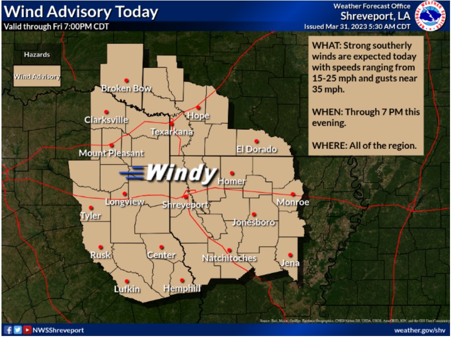
Strong southerly winds are expected today, with speeds ranging from 15-25 mph and higher gusts near 35 mph. Therefore, a Wind Advisory is in effect areawide through 7:00 pm today.
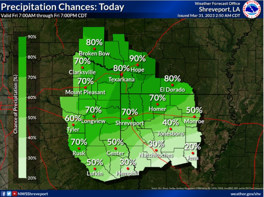
Scattered to numerous showers and thunderstorms are expected today because of a cold front shifting eastward from the Plains. Some storms could be severe this afternoon into the evening hours.
Today and Tonight
Thunderstorm chances will increase this afternoon and through the evening hours. Scattered severe storms will be possible along and north of the I-20 corridor, with numerous severe storms possible across southern Arkansas. Tornadoes, damaging winds, and large hail will be possible.
In addition, a Wind Advisory is in effect until 7:00 pm today. Southerly solid winds 15-25 mph, gusting to 35-40 mph, will be possible.
Saturday through Thursday
More thunderstorms will impact much of the ArkLaTex during the day Sunday, overnight into early Monday, and again Tuesday. Storms which develop on Tuesday will have the potential to become severe across areas along and north of I-20, especially southeast Oklahoma and Southwest Arkansas.
SPOTTER INFORMATION STATEMENT
Spotter activation will likely be needed this afternoon.