


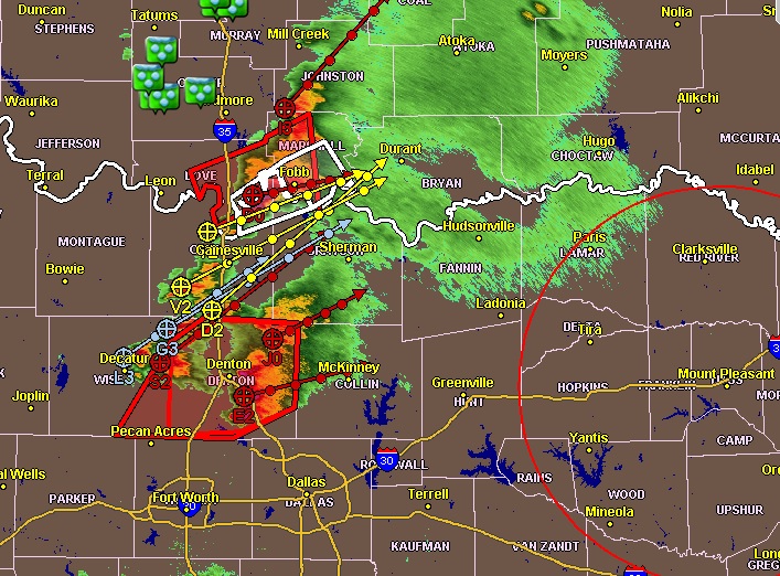
The NWS continues monitoring two main areas of severe thunderstorms. One is over Cooke, Grayson, and Wise Counties, and is tracking toward the northeast at about 35 mph. They are capable of producing hail larger than golf balls; damaging wind gusts more than 60 mph, and perhaps a few tornadoes. A Tornado Watch remains in effect until 11:00 pm. To the south, another area of severe thunderstorms is across Johnson, Hill, Somervell, Bosque, Hamilton, and Mills Counties. These are capable of producing hail larger than quarters, and damaging wind gust more than 60 mph and flash flooding. A Severe Thunderstorm Watch continues for these areas through 11:00 pm.