


North and Central Texas
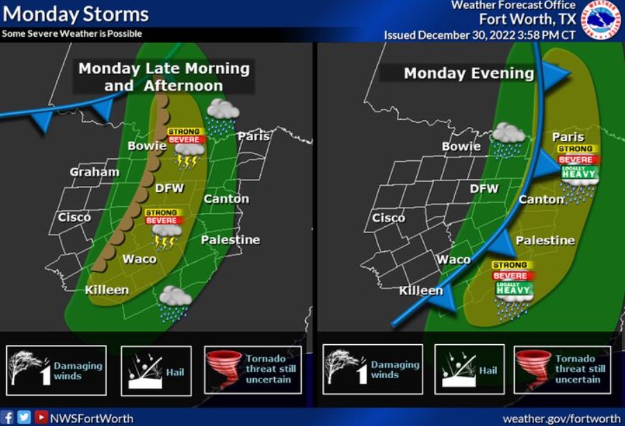
The next storm system will bring a chance of rain and some potential for severe weather as it sweeps through the region on Monday. The best rain chances will be across the eastern third of the area, and the highest extreme weather potential is along and east of the Interstate 35 corridor. There are still a lot of uncertainties regarding the specific timing and location of storm development and severe weather potential, but we should know more in the coming days. So stay tuned and be safe this holiday weekend!
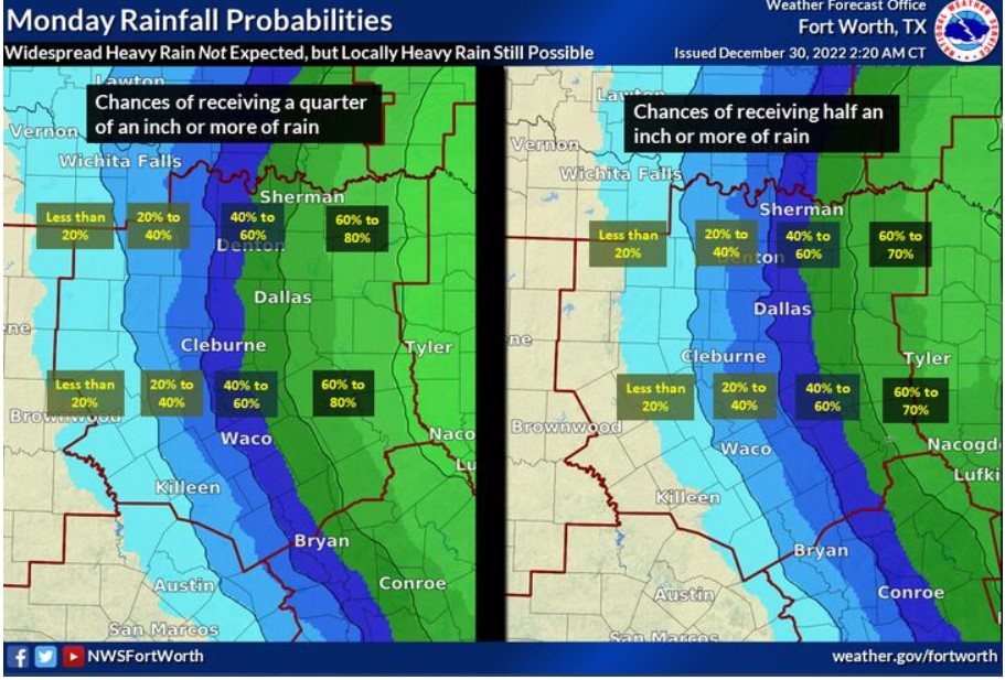
The next storm system will produce some rain across much of the region, but at this time, it will be moving fast enough to prevent widespread heavy rain from happening. The maps indicate the chances of receiving a quarter of an inch or more and a half inch or more rain on Monday. The chances of receiving half an inch or more don’t appear too high until you get into East Texas. That said, any thunderstorm could dump locally higher amounts, so isolated instances of flooding may still occur. Stay tuned for forecast updates as we approach 2023!
South Central and Southwest Arkansas, North Central and Northwest Louisiana, Southeast Oklahoma, and East and Northeast Texas
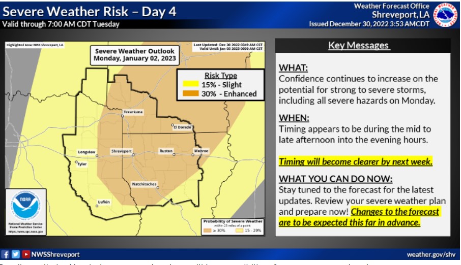
Details are limited, but there may be a possibility of vital to severe thunderstorms across portions of the Four State Region sometime on Monday, January 2. Keep watching the forecast for early next week, as the threat of strong to severe thunderstorms could increase.
Today and tonight
Expect no hazardous weather.
Saturday through Thursday
Expect showers and thunderstorms to increase across the region Monday. It is ahead of a strong upper-level disturbance and associated dryline that will advance east across Oklahoma and Texas. Much warmer and more humid conditions will yield increasing instability over the area Monday, with ample wind shear expected to be in place for the potential for severe thunderstorms Monday afternoon and night.
Damaging winds, large hail, isolated tornadoes, and locally heavy rainfall which may result in minor flooding of low-lying, poor drainage areas are the main threats before these storms diminish from west to east late Monday night through Tuesday morning.
SPOTTER INFORMATION STATEMENT
Expect no spotter activation at this time.