


North and Central Texas
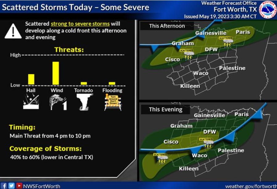
A cold front will move through North and Central Texas this afternoon, with scattered showers and thunderstorms expected to develop. A few of these storms will be severe, with damaging winds being the main threat. Some instances of severe hail will also be possible. Storm chances will diminish late evening as the front moves into Central Texas.
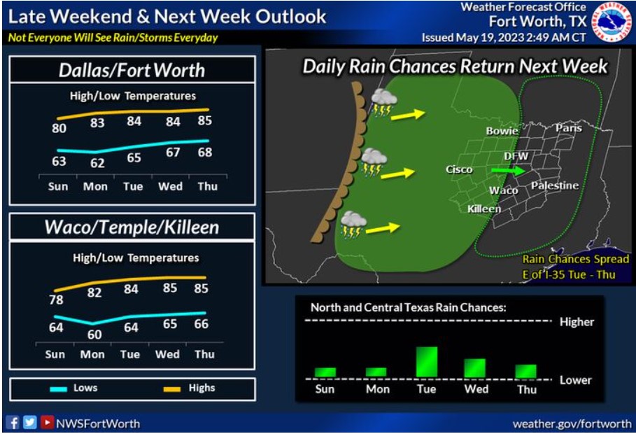
After the cold front on Friday, expect cooler-than-normal temperatures over the weekend, with temperatures then slowly rising back to near-normal values over the first half of the week. Low chances for showers and storms are possible again beginning Sunday.
Today and Tonight
Expect thunderstorms to accompany a strong cold front moving through the region this afternoon and evening. A few storms may be vital to severe, with primarily a damaging wind threat. Also, you must consider a few isolated severe storms capable of producing large hail.
Saturday through Thursday
Thunderstorm chances return to portions of Central Texas and western North Texas Sunday and Monday, with more rain chances spreading eastward Tuesday, Wednesday, and Thursday. Frequent lightning is the primary concern at this time.
SPOTTER INFORMATION STATEMENT
Do not expect spotter activation at this time.
South Central and Southwest Arkansas, North Central and Northwest Louisiana, Southeast Oklahoma, and East and Northeast Texas
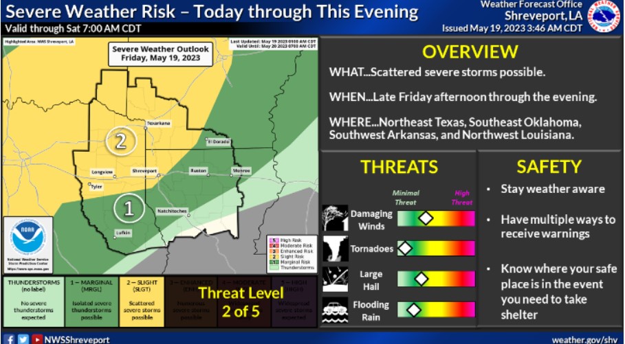
There is a Slight Risk for severe thunderstorms late Friday afternoon over Southeast Oklahoma and then during the evening over Northeast Texas and Southwest Arkansas. Damaging winds and large hail are the primary threats before the storms weaken for the overnight hours.
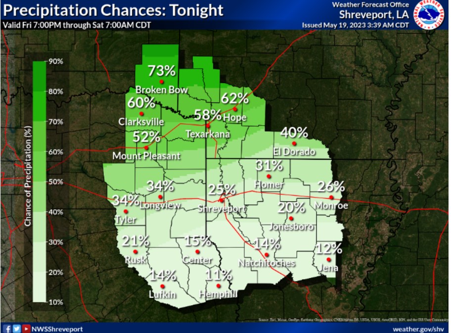
There is a non-zero chance for some isolated showers and thunderstorms across our far northwest zones tonight, mainly towards morning.
Today and Tonight
Scattered showers and a few thunderstorms will be possible this morning across Southeast Oklahoma and portions of extreme Northeast Texas and Southwest Arkansas with a passing upper-level disturbance. While these storms will weaken by midday today, additional showers and thunderstorms will develop by late afternoon over this area, just ahead of an approaching cold front and associated upper-level disturbance.
With moderate instability developing over the region ahead of the front, some of these storms may be severe, with damaging winds and large hail the main threats. In addition, locally heavy rainfall could result in minor flooding issues across mainly the northern half of Northeast Texas, Southeast Oklahoma, and Southwest Arkansas. Expect these storms to weaken late Friday Night as they spread into portions of North Louisiana once the air mass stabilizes when the front moves through the region.
Saturday through Thursday
Do not expect hazardous weather at this time. Friday night spotter activation will likely be needed.