


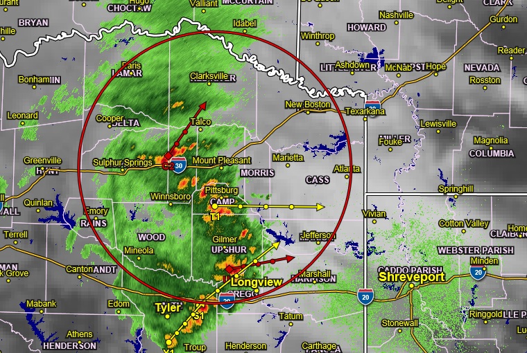
Radar 9:00 pm Saturday
A cold front became stationary around the Interstate 30 corridor this afternoon, but with a firm cap in place, precipitation development will be limited. However, a strong upper trough continues to dig southeast towards the Southern Rockies, and a weak upper disturbance is currently passing over Texas strengthening southwest flow aloft. It has provided enough lift for convective development across North and Central Texas this afternoon. Watches and warnings have gone up in the same vicinity as some of these storms have been severe. This convection should move east-northeast into portions of East Texas, southwest Arkansas, and Northwest Louisiana tonight, generally south of the Interstate 30 corridor. A few of these storms could be severe with large hail and damaging winds as the primary threats. Also, can’t rule out an isolated tornado.
As the previously mentioned trough moves into the Rockies, the stalled surface boundary will move back north as a warm front, and significant scale ascent will spread over the area. Convection will increase in coverage across the entire region by Sunday afternoon.
As the upper trough and an associated surface low move eastward into the southern plains, elevated instability will increase as temperatures cool aloft. It, along with significant deep layer shear, will result in the potential for damaging winds and large hail. The overall tornado threat appears low, but cannot be completely
ruled out.
A cold front will move across the area by late Monday morning ending rain chances from west to east. Most of the region should remain dry for most of next week, with our next chance of precipitation on Friday and next weekend as another cold front approaches the area. Temperatures should be cooled back to near climatological norms behind the front Tuesday, and Wednesday followed by a quick warming trend Thursday and Friday.