


Wind Advisory In Effect From Noon Tuesday to 7:00 am Wednesday
Wind will be 15-25 mph from the North with gusts up to 40 mph for portions of South Central and Southwest Arkansas, North Central and Northwest Louisiana, and East and Northeast Texas. It will be from noon Tuesday until 6:00 am Wednesday. Gusty winds could blow around unsecured objects with tree limbs blown down and a few power outages. In addition, expect strong winds and rough waves on area lakes that would create hazardous conditions for small craft.
Precautionary/Preparedness Actions
Use extra caution when driving, mainly if operating a high-profile vehicle, and secure outdoor objects. Also, boaters in area lakes should use extra caution since strong winds and rough waves can overturn small craft.
North and Central Texas

Rain will likely transition to a rain-snow mix Tuesday afternoon and continue into Tuesday night for parts of North Texas. With surface temperatures generally remaining above freezing, the snow will be wet and slushy, with no accumulation expected on surface roads. Snow is more likely to accumulate on grassy and elevated surfaces across Northwestern North Texas and along the Red River. Please continue to monitor the forecast for updates!
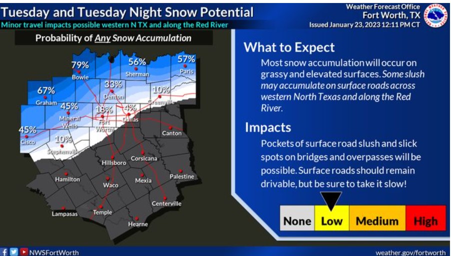
Above-freezing, surface temperatures will limit snow accumulation. Therefore, any snow that falls will likely be wet and slushy. The collection is likely on grassy and elevated surfaces, especially across western North Texas and along the Red River, where temperatures will be slightly colder, and a snow mixture will begin sooner. Please continue to monitor the forecast for updates!
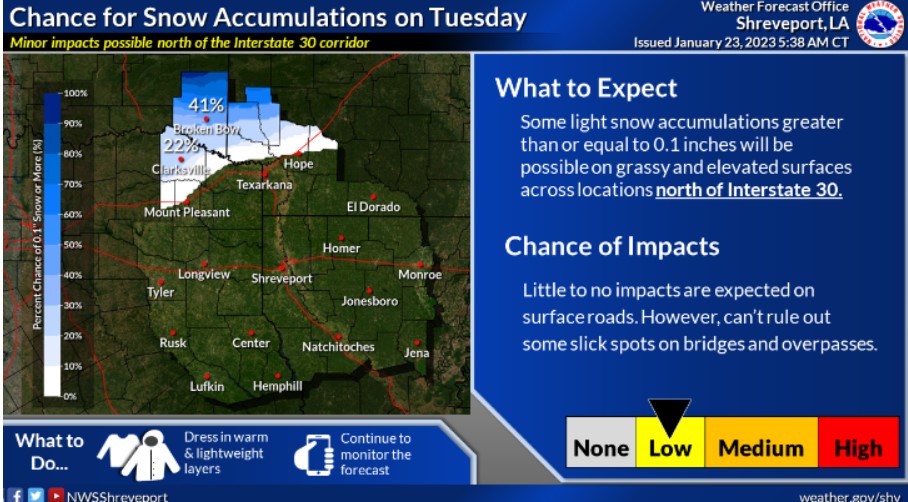
There is the potential for light snowfall accumulations Tuesday afternoon and night across portions of extreme Northeast Texas, Southeast Oklahoma, and the adjacent sections of Southwest Arkansas with the passage of a robust upper-level storm system. Any impacts will be minimal but stay tuned as the forecast may change over the next few days!