


North and Central Texas
Today and Tonight
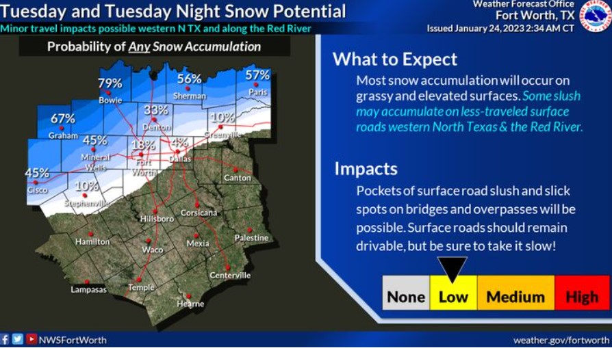
Expect snow to begin later today and continue into tonight, primarily from the Big Country into Texoma, where some snow may accumulate on grass and elevated surfaces. Ground temperatures will be too warm for widespread travel impacts. Although some slick spots will be possible on bridges and overpasses, surface streets should remain wet and drivable.
A few storms will be possible today, mainly across Central and East Texas. The National Weather Severe does not expect severe weather, but the strongest storms may contain small hail and heavy rain.
Wednesday through Monday
Thunderstorms may accompany a cold front Saturday night.
SPOTTER INFORMATION STATEMENT
Do not expect spotter activation at this time.
Winter Weather Advisory
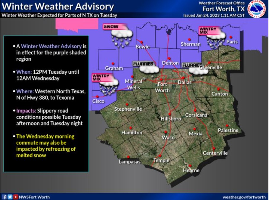
A Winter Weather Advisory is in effect for the purple-shaded region on the map from noon Tuesday through midnight Wednesday. The affected area is western North Texas and the Texoma region, where you can expect minor travel impacts.
Above-freezing, surface temperatures will limit snow accumulation. Therefore, any snow that falls will likely be wet and slushy. The collection is likely on grassy and elevated surfaces, especially across western North Texas and along the Red River Valley, where temperatures will be a little colder and where a snow mixture or transition to all snow will begin sooner. Please continue to monitor the forecast for updates!
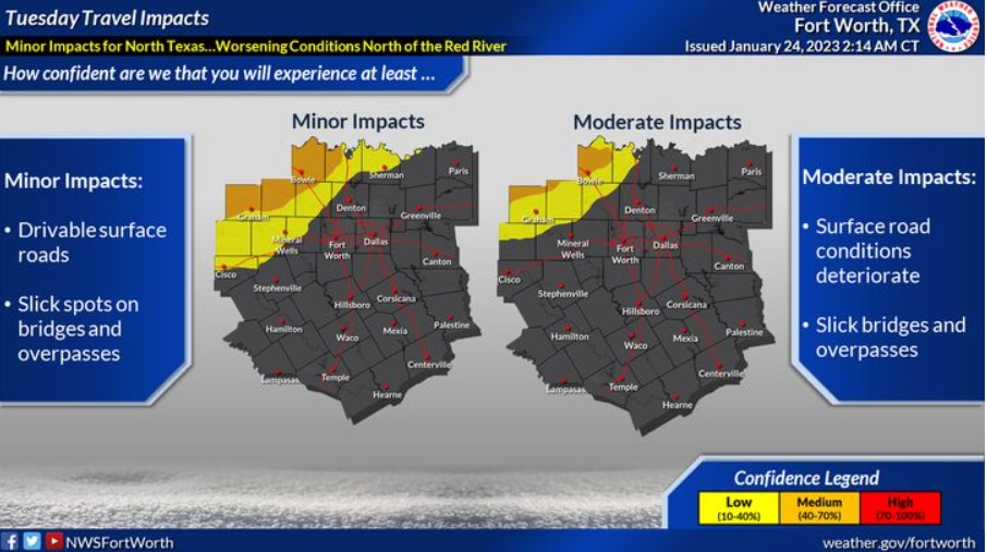
Expect minor travel impacts today and tonight. Light slushy snow accumulation on surface streets will be minimal and mostly confined to bridges or overpasses. However, moderate to heavy snow periods are possible across Northwestern North Texas and along the Red River, which would create brief travel impacts. Be sure to drive slowly and plan to add extra time to your commute if you have travel plans today and tonight.
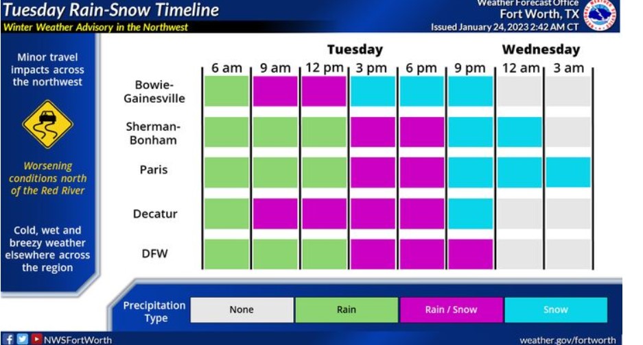
Expect widespread precipitation today as a robust storm system moves overhead. Some of this precipitation will be snow, particularly along the Red River and the northwest portions of North Texas. The graphic indicates a timeline of expected rain at different regional points.
Wind Advisory
North wind 15 to 25 with gusts up to 40 mph will affect South Central and Southwest Arkansas, North Central and Northwest Louisiana, and East and Northeast Texas from noon Tuesday until 6:00 am Wednesday.
Gusty winds could blow around unsecured objects, blow down tree limbs and cause power outages. In addition, strong winds and rough waves on area lakes will create hazardous conditions for small craft.
Precautionary Preparedness Actions
Use extra caution when driving, mainly if operating a high-profile vehicle. In addition, secure outdoor objects. Also, boaters on the area lakes should use extra caution since strong winds and rough waves can overturn small craft.
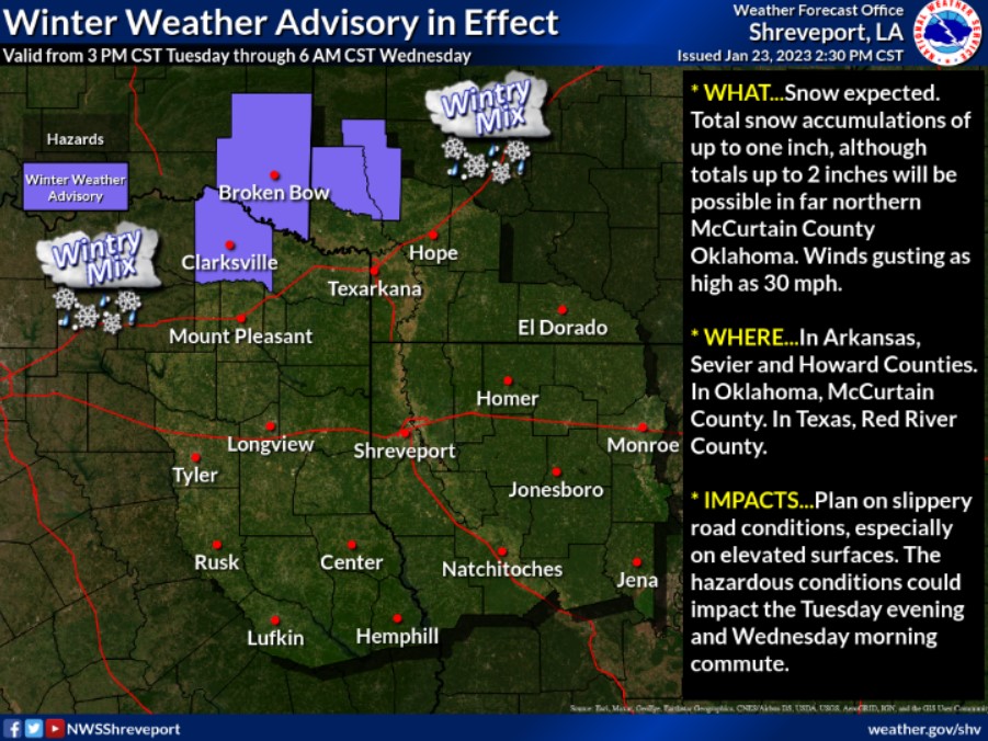
A Winter Weather Advisory is in effect across Red River County in Northeast Texas, McCurtain County in Southeast Oklahoma, and Sevier and Howard Counties in Southwest Arkansas beginning late Tuesday Afternoon through Tuesday Night. Light snow accumulations will be possible across these counties before the precipitation ends early Wednesday Morning.
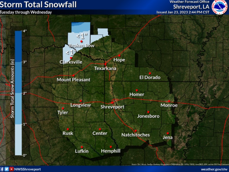
There is the potential for light snowfall accumulations Tuesday afternoon and night across portions of extreme Northeast Texas, Southeast Oklahoma, and the adjacent sections of Southwest Arkansas with the passage of a robust upper-level storm system. At this time, expect only minimal impacts, except across far Northern McCurtain County, Oklahoma, where higher snow amounts will be possible.
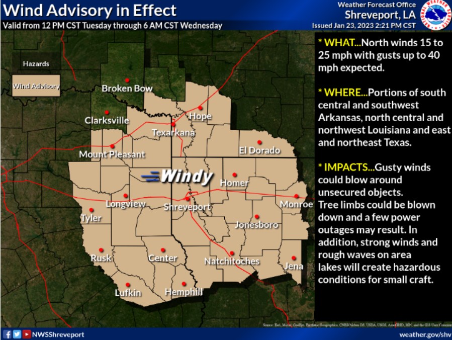
It will become windy across the Four State Region Tuesday through Tuesday Night as a robust upper-level storm system moves into our region from the west and northwest. Look for north winds of 15 to 25 mph, with gusts as high as 40 mph.
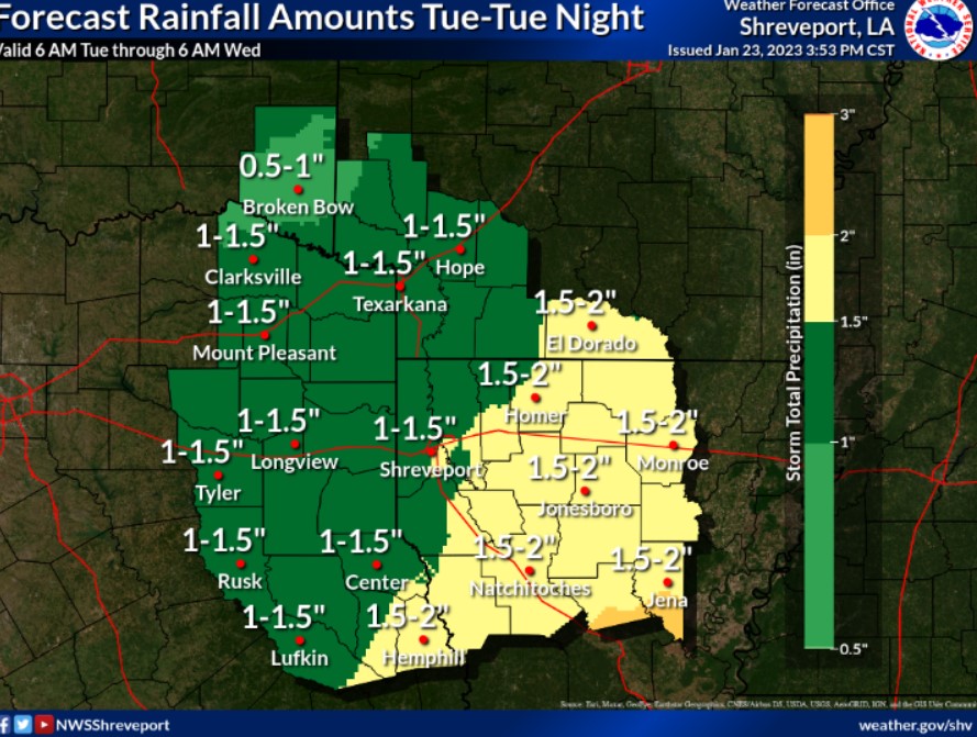
The threat of heavy rainfall and localized flooding will increase through the day on Tuesday into Tuesday night as firm upper-level disturbance shifts into the region. Total rainfall amounts will generally range between 1-2 inches with isolated higher amounts. The highest totals will be across Deep East Texas into much of North Louisiana.
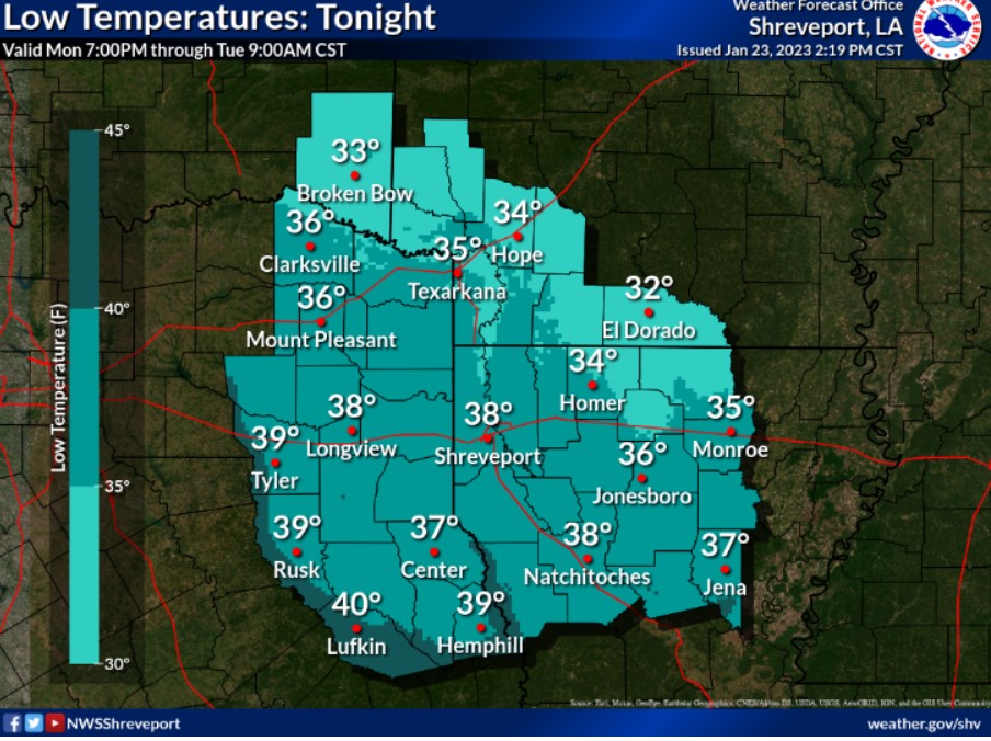
Not as cold tonight across the Four State Region with increasing cloud cover from the west. Overnight lows will range from the lower 30s north and northeast to near 40 west and southwest.