


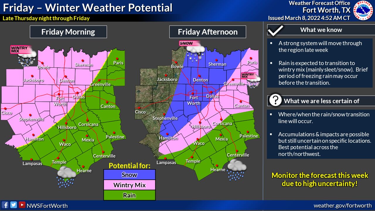
Precipitation chances will increase late Thursday night, following the passage of an unseasonably strong cold front. As a result, a wintry mix is possible across parts of North Texas on Friday. Accumulations of snow and sleet may occur northwest of a Goldthwaite, Dallas-Fort Worth, and Paris line, expecting cold rain elsewhere.
Precipitation will end from west to east by Friday afternoon, but some sleet may mix with the rain in areas east of the I-35 corridor during the afternoon hours before the precipitation comes to an end. The details regarding this event will become more evident as the event approaches. Continue to monitor the forecast this week!