


North and Central Texas
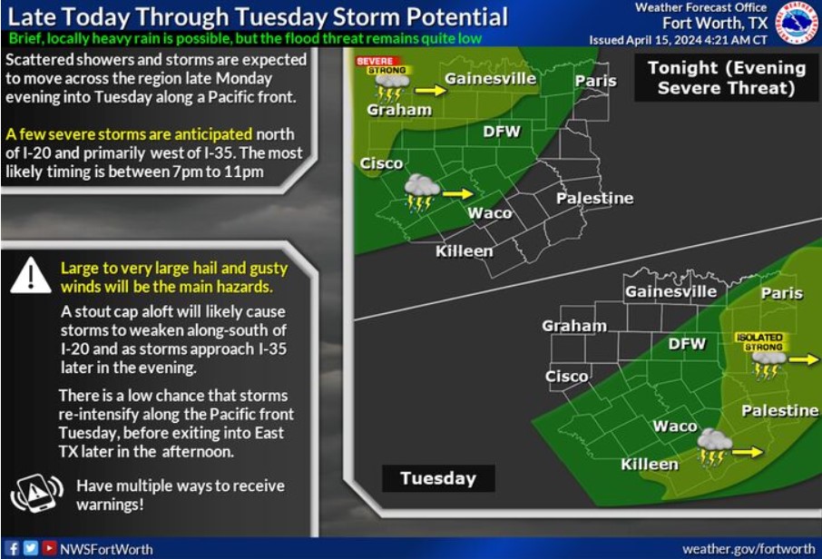
Expect thunderstorms to develop near a dryline across West Texas late this afternoon, then move east-northeast into western North Texas this evening when the main window for severe storms occurs north of I-20 and west of I-35. A cap aloft should help storms weaken during the overnight hours and early Tuesday, though a few intense storms may occur. Scattered storms redevelop along an advancing Pacific cold front later Tuesday morning, with solid storms mainly across East Texas. Large to colossal hail and damaging winds are the primary severe hazards this coming evening, followed by small hail and gusty winds with any stronger storms after that. Flooding should be minimal with this event.
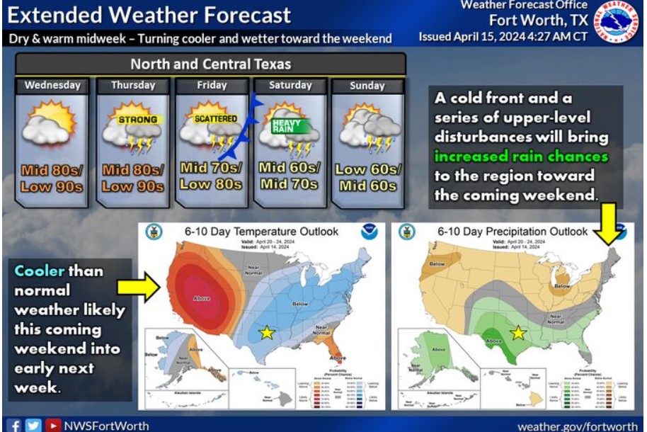
After a dry, warm midweek period, a cold front and a series of upper-level disturbances will bring cooler, wetter conditions to the region late in the week into the coming weekend. There will be threats for strong or severe thunderstorms, mainly on Thursday, and heavy rainfall is possible over the weekend.
Today and Tonight
Thunderstorms are possible late this afternoon, mainly across western North Texas. Strong to severe storms are
possible, especially west of I-35 and north of I-20. Hail and gusty winds will be the primary hazards.
Tuesday through Sunday
Redevelopment of thunderstorms could occur across portions of the East Texas area on Tuesday, and a few storms could become strong with hail and gusty winds. After a dry midweek period, additional thunderstorm
chances are forecast toward the end of the workweek and into next weekend with the arrival of a cold front.
SPOTTER INFORMATION STATEMENT
Do not expect spotter activation at this time.
South Central and Southwest Arkansas, North Central and Northwest Louisiana, Southeast Oklahoma, and East and Northeast Texas
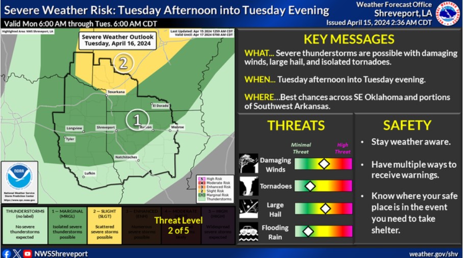
A slight risk for severe thunderstorms remains on Tuesday across Southeast Oklahoma and Southwest Arkansas. All modes of severe weather may be possible. Please stay tuned for updates on this next system.
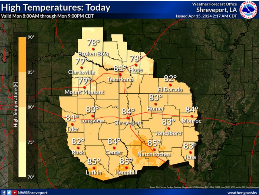
Mostly cloudy skies and southerly winds will continue through today, with temperature maximums ranging in the upper 70s to low-to-mid 80s.
Today and tonight
Expect no hazardous weather.
.Tuesday through Sunday
Scattered strong to severe thunderstorms will be possible across much of the region Tuesday ahead of a weak front that will become stationary over Eastern Oklahoma into North Texas. Damaging winds, hail, and isolated tornadoes are the severe weather threats and will be concentrated mainly across Southeast Oklahoma and Southwest Arkansas. Storms should diminish during the evening. Another round of thunderstorms will be possible Thursday afternoon into Friday along and north of the Interstate 30 corridor of Northeast Texas and Southwest Arkansas ahead of a cold front, shifting south across the remainder of the region Friday night and Saturday with the front. Some storms may be severe Thursday afternoon across Southeast Oklahoma and Northeast Texas.
SPOTTER INFORMATION STATEMENT
Do not expect spotter activation at this tiime