


North and Central Texas
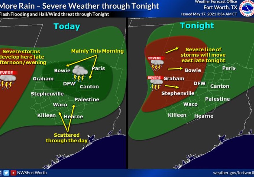
Today and Tonight.
Expect thunderstorms across much of North and Central Texas on Monday. Locally heavy rainfall and lightning will be the main threats, but the stronger storms could produce large hail and gusty winds.
Tuesday through Sunday.
Expect widespread thunderstorms on Tuesday, some of which could be severe. In addition, heavy rainfall will likely result in flash flooding.
Thunderstorm chances will continue through the weekend. Additional rounds of heavy rainfall may cause further flooding issues and significant rises on area rivers. Additionally, a few strong or severe thunderstorms will be possible.
SPOTTER INFORMATION STATEMENT
The NWS does not expect the activation of spotters at this time.
South Central and Southwest Arkansas, North and Northwest Louisiana, Southeast Oklahoma, East, and Northeast Texas.
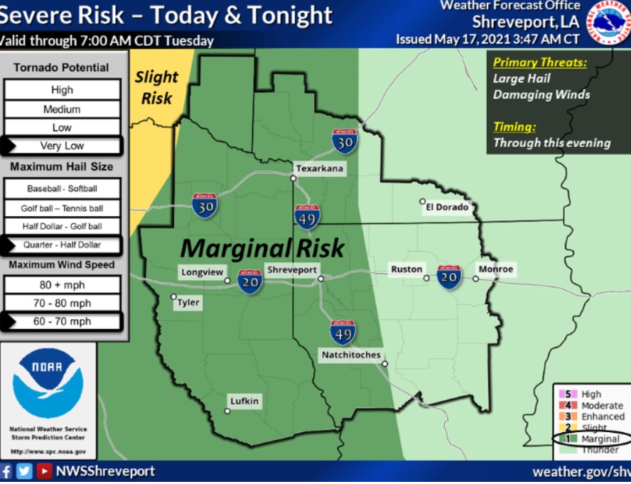
This Afternoon and Tonight
Isolated thunderstorms will increase over East Texas, Southeast Oklahoma, and possibly portions of Southwest Arkansas and Western Louisiana this afternoon and spread across the region tonight. Brief heavy rainfall will be possible, with additional shower and isolated thunderstorm redevelopment potential across Southeast Oklahoma and adjacent Southwest Arkansas late tonight. A couple of isolated severe thunderstorms are likely across Southeast Oklahoma and East Texas through this evening. If any severe storms develop, damaging winds and large hail will be the primary risks.
Monday through Saturday
Showers and thunderstorms will increase across the region Monday
with the passage of an upper-level disturbance. It is possible for isolated strong to severe thunderstorms over East Texas, Southeast Oklahoma, adjacent sections of Southwest Arkansas, and Western Louisiana, with locally gusty winds and brief heavy rainfall. Showers and thunderstorms will increase once again Tuesday afternoon and continue through much of this week, with the threat for locally heavy rain and flash flooding possible through Thursday over East Texas, Southeast Oklahoma, Southwest Arkansas, and possibly Western Louisiana. Cumulative rainfall
amounts of three to five inches are possible over these areas, with isolated higher amounts over eight inches possible, especially over portions of East Texas. This rainfall will result in new rises and possible flooding on area creeks and bayous, rivers, and lakes. Isolated severe thunderstorms will be possible each day as well, with damaging winds the main threat. Expect these showers and thunderstorms to diminish across the region by Saturday gradually.
SPOTTER INFORMATION STATEMENT
The NWS does not expect the activation of emergency management personnel, .amateur radio operators, and storm spotters through
tonight.