


North and Central Texas
Tonight
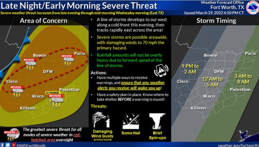
Expect thunderstorms to move through most of North and Central Texas overnight. Some of these will be severe with damaging winds
and perhaps a few tornadoes. Winds will occasionally gust to 40 mph across the region today. There will still be a threat of grass fires mainly along and west of a line from Lampasas to Bowie where the combination of warmest temperatures and the lowest humidity will exist.
Wednesday through Monday
There is a low chance of storms late Friday night, mainly north of I-20 and across all of North and Central Texas late Monday.
SPOTTER INFORMATION STATEMENT
The NWS could request limited spotter activation overnight.
Southeast Oklahoma, and East and Northeast Texas
Tonight
A Wind Advisory is in effect until 7:00 am Wednesday. Look for southerly winds to increase today to near 20 to 30 mph with gusts as high as 40 mph, especially later this afternoon through the overnight hours. Showers and thunderstorms will become widespread after midnight towards the predawn hours on Wednesday. The primary threats associated with these storms will be damaging wind gusts and isolated tornadoes. Some of these storms could also produce large hail and brief heavy downpours.
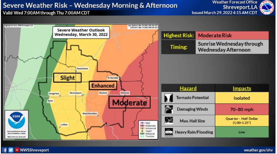
Wednesday through Monday
There will be a continued threat of strong to severe thunderstorms through the mid-morning hours on Wednesday before the storms push east of the region. Again, the primary hazards associated with these storms will be damaging wind gusts and isolated tornadoes, and some could also produce large hail and brief heavy downpours.
SPOTTER INFORMATION STATEMENT
Activation of emergency management personnel, amateur radio operators will likely become necessary after midnight tonight and through the mid-morning hours on Wednesday. Please relay any information about observed severe weather to the NWS while following all local, state, and CDC guidelines.