


North and Central Texas.
Today and Tonight
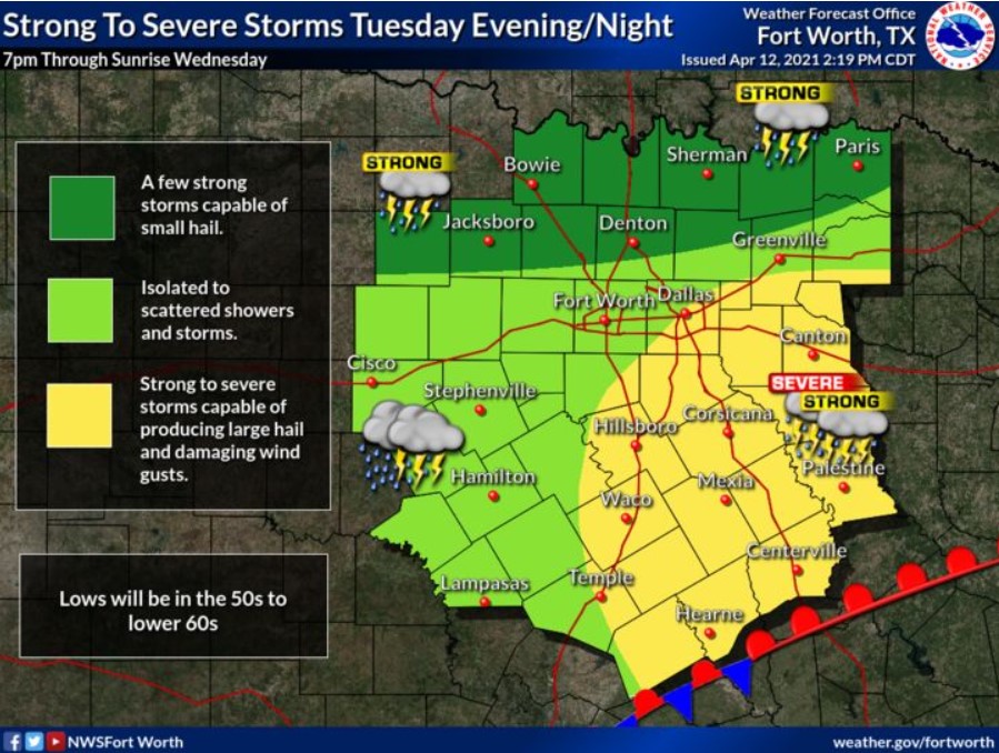
Scattered thunderstorms will continue this morning, mainly along and north of I-20. Hail will be the main threat.
Additional thunderstorms are expected across southeast Texas late this afternoon and evening along a warm front. Some of these may clip
our southeastern areas from Hearne to Canton into the late evening. Severe weather will be possible during this time.
Wednesday through Monday
On and off storms will continue through early Saturday across all of North and Central Texas. The severe weather threat will
be low during this time, but a few intense storms will be possible on Friday.
SPOTTER INFORMATION STATEMENT
NWS does not expect spotter activation at this time.
South-Central and Southwest Arkansas, North-Central and Northwest Louisiana, Southeast Oklahoma, East, and Northeast Texas
This Afternoon and Tonight
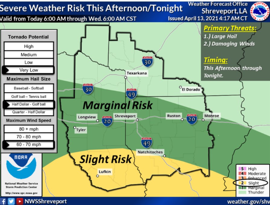
Isolated to widely scattered showers and thunderstorms will be possible this evening through the overnight hours over portions
of extreme Northeast Texas, Southeast Oklahoma, and adjacent sections of Southwest Arkansas. Isolated strong thunderstorms cannot
be ruled out, with hail and locally gusty winds possible.
Tuesday through Sunday
Isolated to scattered showers and thunderstorms will be possible Tuesday, especially over portions of Deep East Texas and
North-Central Louisiana. Isolated strong thunderstorms cannot be ruled out over these areas Tuesday afternoon and evening, with
locally gusty winds and hail possible. Scattered showers and possibly a few isolated thunderstorms will be possible across the
region Tuesday night through at least Saturday. NWS expects no other hazardous weather.
SPOTTER INFORMATION STATEMENT
Activation of emergency management personnel, amateur radio operators and storm spotters may be needed this evening and
overnight across portions of extreme Northeast Texas, Southeast Oklahoma, and adjacent sections of Southwest Arkansas.