


North and Central Texas
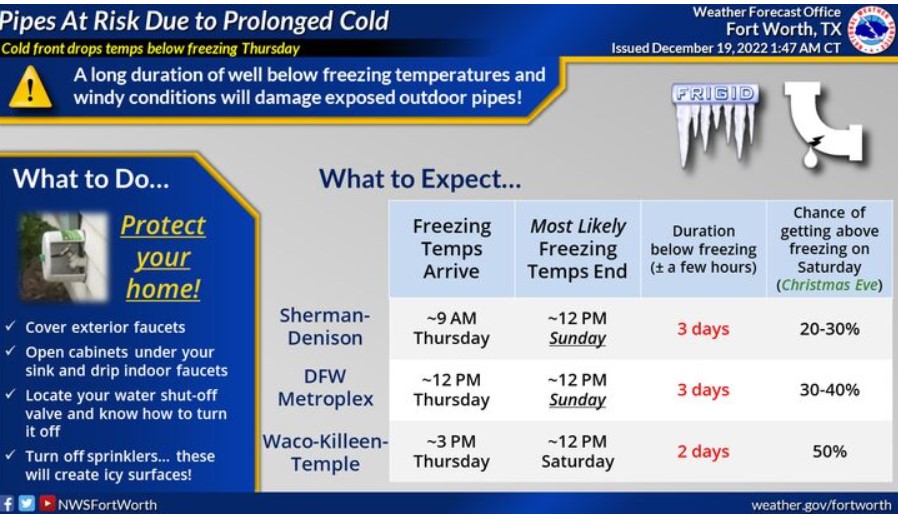
A long duration of well below-freezing temperatures and windy conditions will damage exposed outdoor pipes and cause them to burst. Temperatures fall below freezing Thursday and will remain below freezing until Saturday, Christmas Eve, for most, except those along the Red River. There is a slight chance that temperatures will stay below freezing everywhere through Sunday, Christmas Day. Cover outdoor pipes, and let indoor faucets drip. Locate your water shut-off valve, know how to turn it off, and remember to turn off sprinklers!
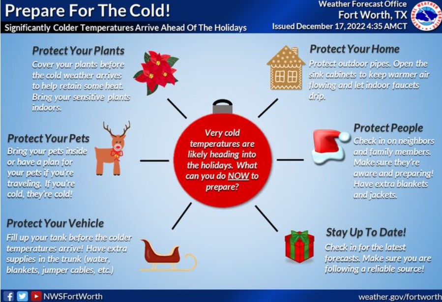
Take advantage of the weather to prepare for the significantly colder temperatures late next week through the holiday weekend. You can take action now, including protecting your home, vehicle, and plants. You can also help your neighbors and friends prepare. Always bring your pets indoors! A hard freeze will likely impact North and Central Texas on Thursday night.
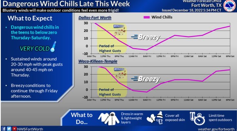
Dangerous wind chills in the teens to below zero are expected Thursday through Saturday in the wake of the strong Arctic cold front. Blustery winds around 20-30 mph, gusts around 40-45 mph, and sharply falling post-frontal ambient temperatures will make Thursday feel even more frigid. The highest gusts will occur in the morning and afternoon hours on Thursday. Breezy conditions will continue on Friday. Make sure to dress warmly, cover exposed skin, and limit your time outdoors!
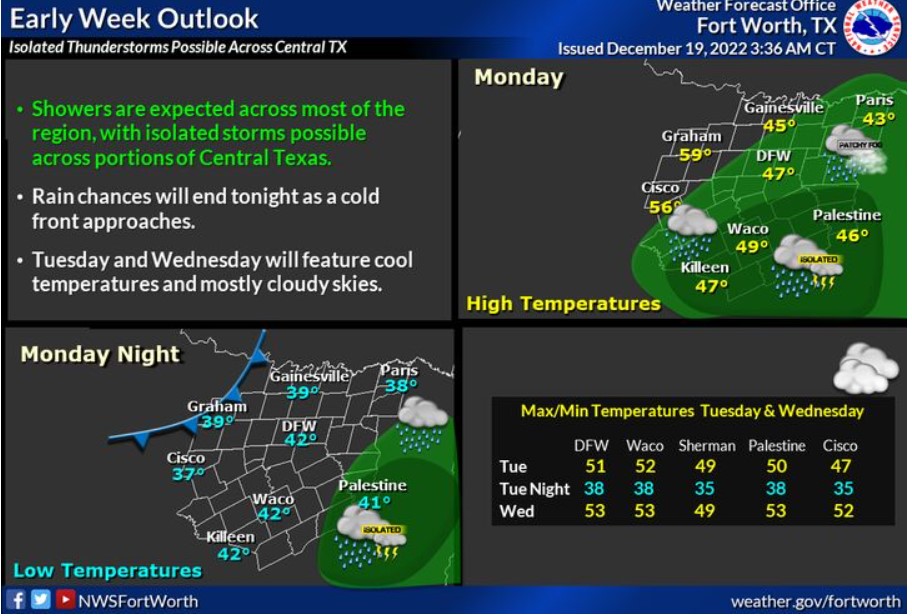
Rain chances return Monday across most of the region, with the best bets across our southeastern counties. Expect light rain with little to no accumulation across North Texas. An isolated storm or two may occur in the southeasternmost counties, but the NWS does not expect severe weather. Rain chances should end from west to east Monday evening ahead of a weak cold front.
Today and Tonight
Isolated thunderstorms may affect portions of Central and East Texas today, but don’t expect severe weather.
Tuesday through Sunday
An arctic front will arrive on Thursday, ushering in bitter-cold temperatures. Some light snow will be possible behind the front on Thursday, but don’t expect any significant snow-related impacts.
A hard freeze is expected Thursday night into Friday morning for nearly the entire region, which could result in damage to unprotected pipes and exterior faucets.
Subfreezing temperatures will persist through at least Christmas Eve. Subzero wind chills will also be possible at times, especially across North Texas.
SPOTTER INFORMATION STATEMENT
The NWS does not expect spotter activation at this time.
South Central and Southwest Arkansas, North Central and Northwest Louisiana, Southeast Oklahoma, and East and Northeast Texas
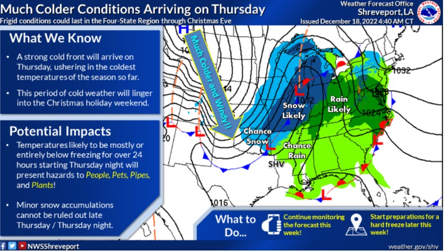
By far, the coldest air of the season will be moving into the Four State Region late Thursday and remain anchored across our region through the upcoming Holiday Weekend. Therefore, you should act this week to prepare for this bitterly cold arctic air.
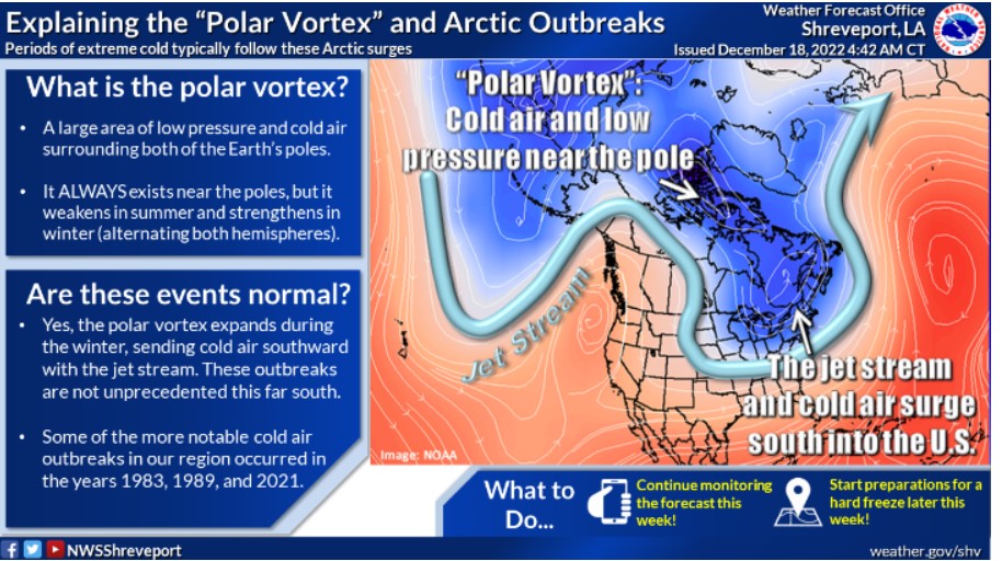
The term “polar vortex” will probably become widely used over the next several days as Arctic air surges southward later this week. Although these more significant cold air outbreaks aren’t necessarily an annual event this far south, these episodes are certainly not unprecedented.