


North and Central Texas
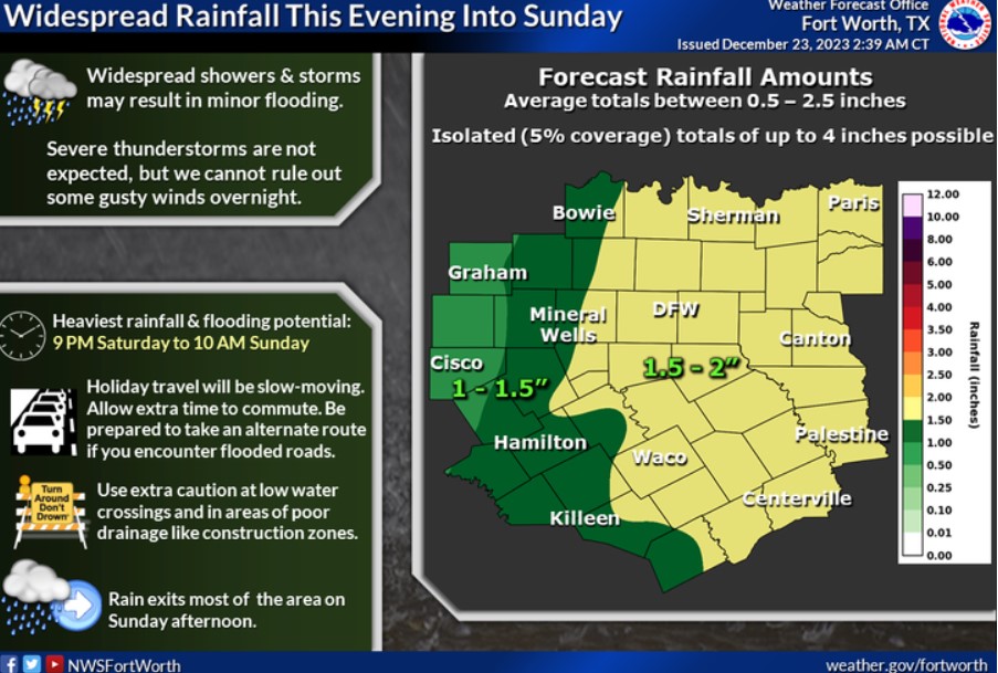
Showers and thunderstorms will increase across North and Central Texas this evening and continue into Sunday morning. If traveling on the roads this holiday weekend, allow plenty of time to reach your destination. Additional rainfall amounts will average between 0.5-2.5 inches across the region, with isolated totals as high as 4 inches. Periods of heavy rainfall could lead to minor flooding, especially in low-lying and flood-prone areas. Rain will exit most of the area on Sunday afternoon, leading to dry conditions heading into Christmas Day.
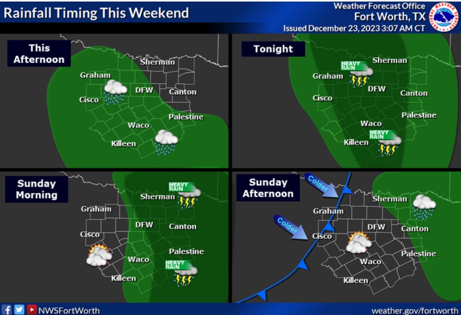
Widespread showers and thunderstorms are expected this weekend, with peak coverage occurring tonight into Sunday morning. Rain will exit the area to the east on Sunday morning, with most of the area becoming dry by Sunday afternoon.
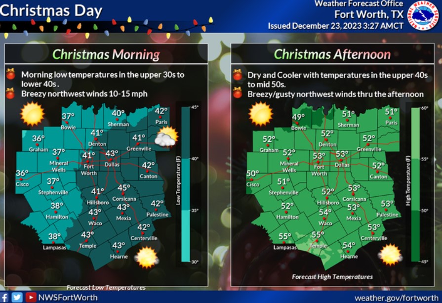
A cold front will move through late Sunday night into Christmas morning, pushing most precipitation to the east. Expect Christmas Day to be chilly and dry with breezy northwest winds and clearing skies.
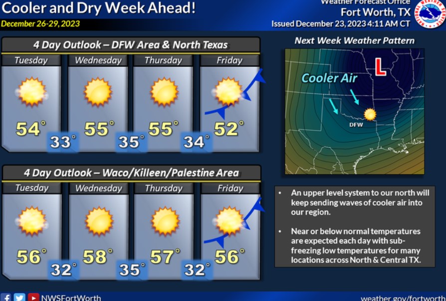
Expect cooler temperatures and drier conditions to prevail next week. The highs next week will remain in the low to mid-50s across much of the area, with overnight lows in the mid-30s.
Today and Tonight
Isolated thunderstorms are possible this afternoon, with better storm chances expected tonight into Sunday morning. Periods of heavy rain and lightning will be the primary concerns.
Sunday through Friday
Thunderstorm chances continue on Sunday as a cold front moves across the region. The severe weather potential is low, but additional periods of heavy rain are possible. Lightning is also a hazard with this activity.
SPOTTER INFORMATION STATEMENT
Do not expect spotter activation at this time.
South Central and Southwest Arkansas, North Central and Northwest Louisiana, Southeast Oklahoma, and East and Northeast Texas
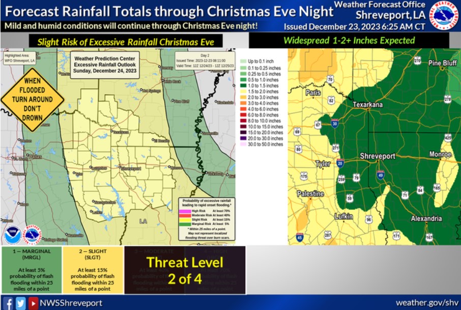
Moderate to heavy rainfall will be possible across the Four-State Region late tonight through much of Christmas Eve. A Slight Risk for excessive rain is in place for the region, with widespread rainfall of 1-2+ inches expected through Christmas Eve night.
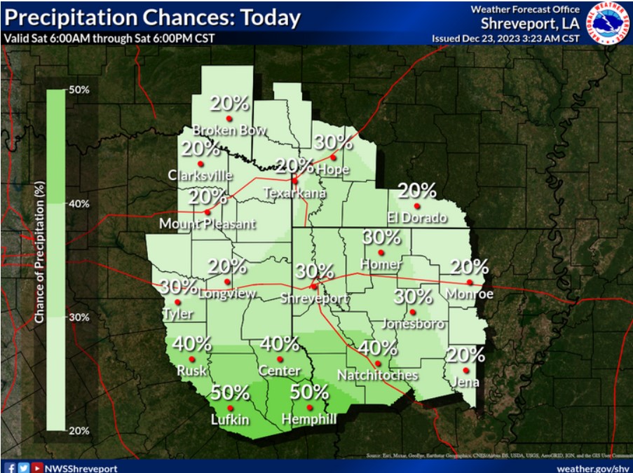
This afternoon, look for isolated to scattered showers to increase, especially over East Texas and much of North Louisiana.
SPOTTER INFORMATION STATEMENT
Do not expect spotter activation at this time.