


North and Central Texas
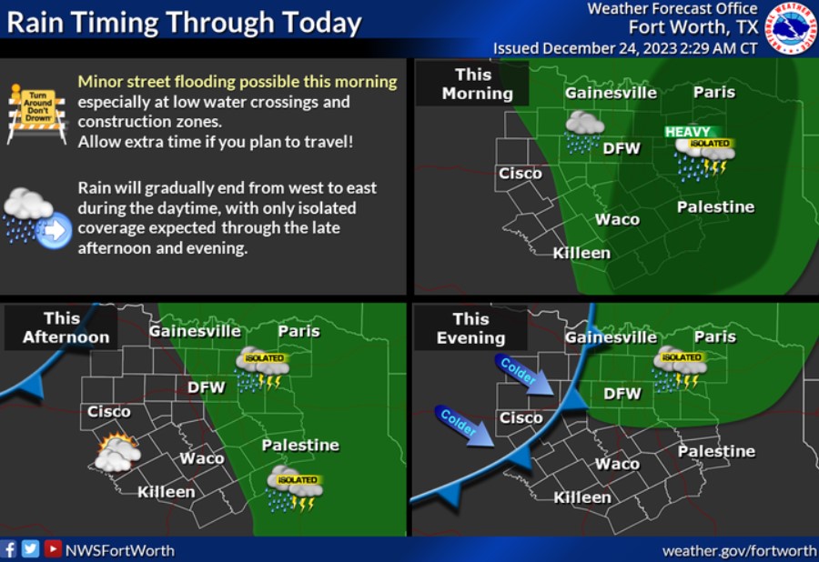
Showers and isolated storms will continue today before gradually ending from west to east this afternoon. Minor street flooding is possible, especially in the morning, so be cautious if you are on the roads this holiday weekend.
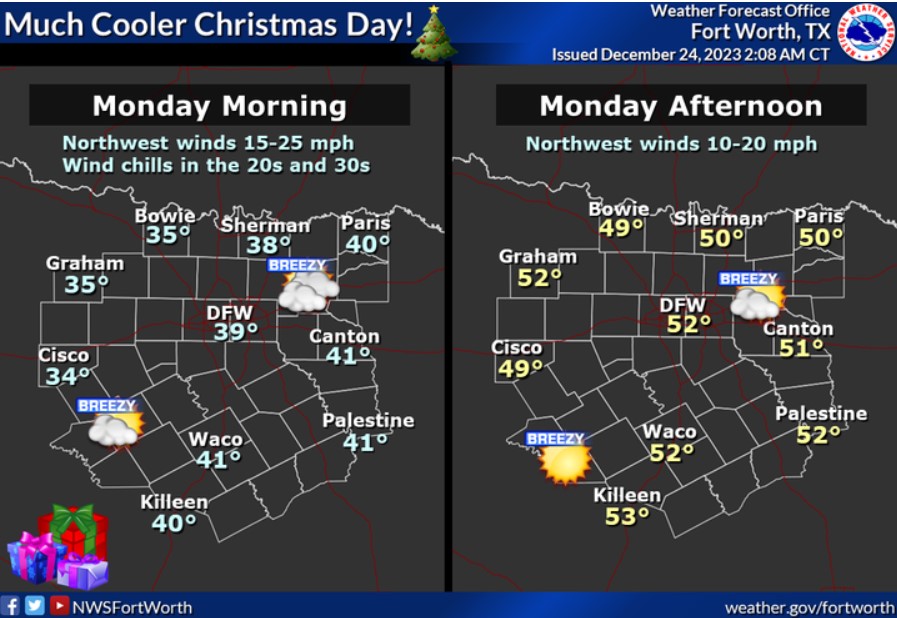
Expect Christmas Day to be chilly and dry with breezy northwest winds and clearing skies. Expect morning temperatures in the 30s and lower 40s with wind chills in the 20s and 30s. Highs will be in the 40s and lower 50s.
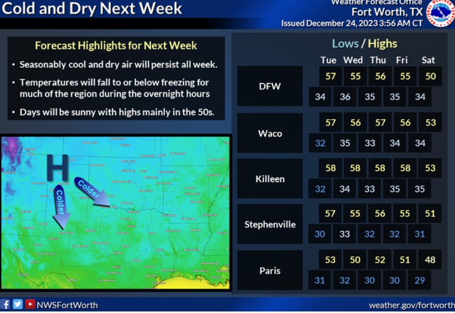
Much cooler and drier conditions are in store next week, with overnight temperatures falling to or below freezing for much of the region and highs in the 50s.
Tonight
Widespread showers and thunderstorms will affect much of the area overnight into early Sunday morning. Periods of heavy rain and lightning will be the primary concerns. A few thunderstorms may produce gusty winds late tonight into Sunday.
Sunday through Friday
Thunderstorm chances continue on Sunday as a cold front moves across the region. The severe weather potential is low, but additional periods of heavy rain are possible. Lightning is also a hazard with this activity. A few thunderstorms may produce gusty winds on Sunday morning.
SPOTTER INFORMATION STATEMENT
Do not expect spotter activation at this time.
South Central and Southwest Arkansas, North Central and Northwest Louisiana, Southeast Oklahoma, and East and Northeast Texas
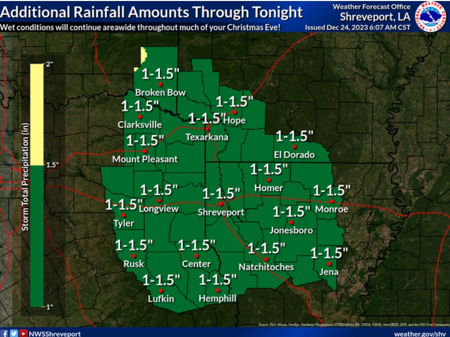
Areas of rain with a few embedded thunderstorms will continue across the region throughout your Christmas Eve but will gradually diminish from west to east by this evening. Additional rainfall amounts of 1.00-1.50 inches are expected areawide.
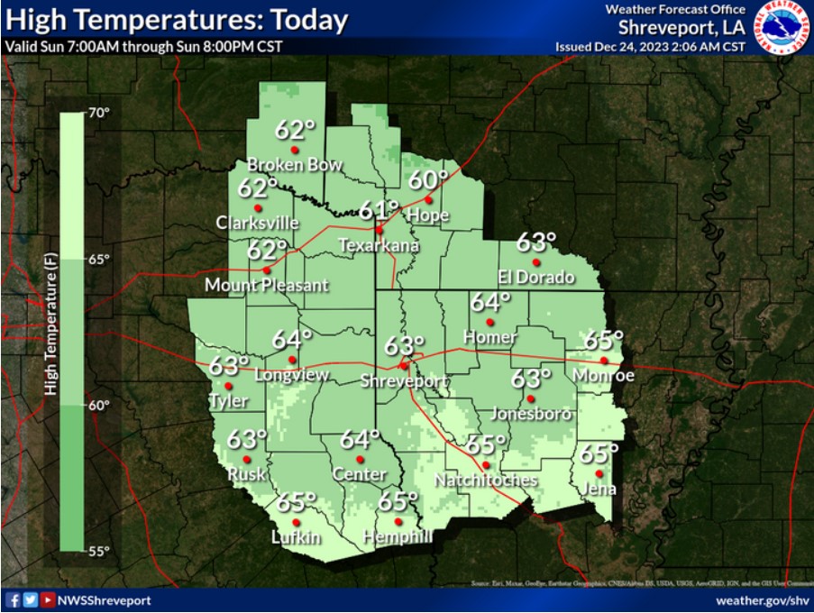
Temperatures will remain stable today, maxing out in the low to mid-60s as overcast skies and light to moderate rainfall abound.
Today and tonight
Showers and a few embedded thunderstorms will spread east across the region today as a solid upper-level disturbance and associated cold front move into the area. Expect widespread rainfall amounts of one to excess of two inches before the rain diminishes from west to east late this afternoon through this evening. In addition to the welcome rains, isolated intense storms can not be ruled out, with locally gusty winds possible. Look for cooler temperatures and drier air to begin to spread east into the region late tonight with the passage of the cold front.
Monday through Saturday
SPOTTER INFORMATION STATEMENT
Do not expect spotter activation at this time.