


North and Central Texas
Today and Tonight
Scattered storms are ongoing this early morning north of Interstate 20, with more expected through the rest of today across much of the region.
There will be a threat for strong to low-end severe storms generally south of HWY-84, with usually a hail and gusty to damaging wind
potential. Heavy downpours may lead to temporary ponding, but do not expect flash flooding.
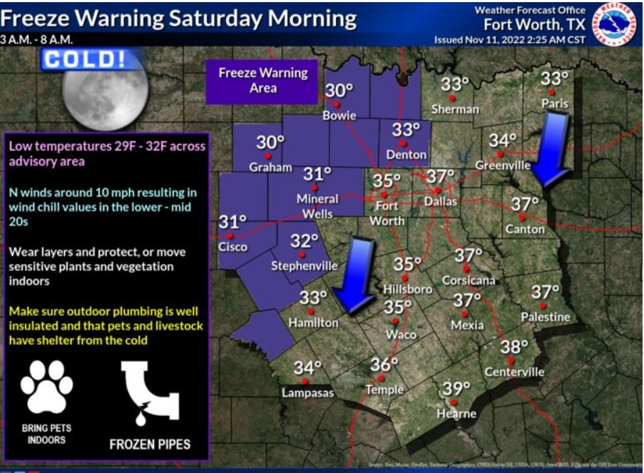
Saturday through Thursday
Isolated thunderstorms will be possible Monday in portions of North and Central Texas. However, the NWS does not expect severe weather.
South Central and Southwest Arkansas, North Central and Northwest Louisiana, Southeast Oklahoma, and East and Northeast Texas
Today and tonight.
Expect showers and thunderstorms to move into the area from the northwest through today as a robust frontal boundary advances
through the region. However, the NWS does not anticipate any severe weather.
Saturday through Thursday
Behind the front, minimum temperatures will fall into the thirties this weekend through the first half of next week, with temperatures
in some locations reaching the freezing mark during this period. Additional rain chances will return on Monday and again on Wednesday. But, again, do not expect severe weather at this time.