


North and Central Texas
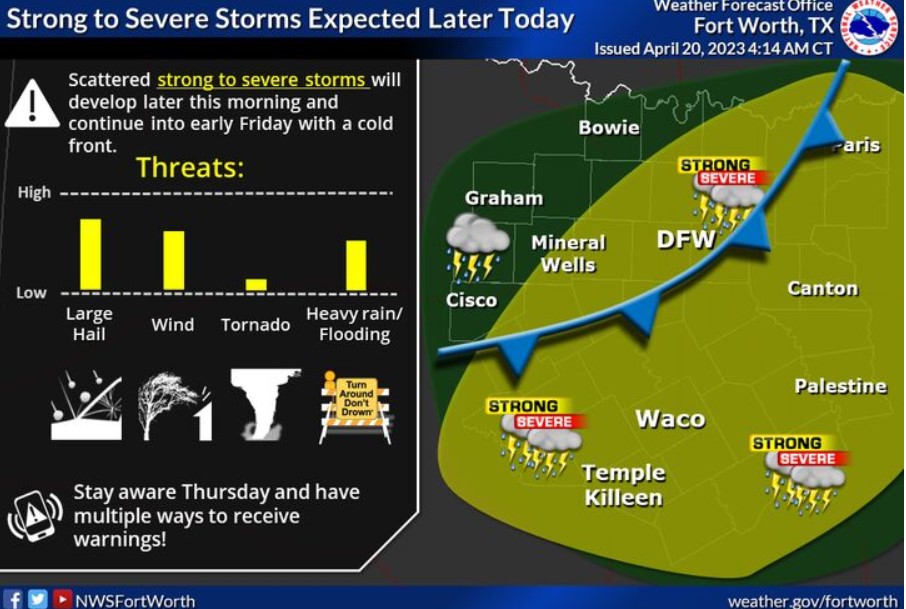
Scattered strong to severe storms will develop later this morning, then increase in coverage this afternoon and evening as a slow-moving cold front and upper disturbance impact North and Central Texas. The greatest threats are large hail (some very large with discrete storms) and damaging winds to 65 mph. However, a tornado or two can not be ruled out, especially across eastern Central Texas into East Texas. Lastly, heavy rainfall amounts between 1 to 3 inches, with isolated higher amounts across Central and East Texas, may lead to a localized flooding threat. Storm chances come to an end from west to east on Friday.
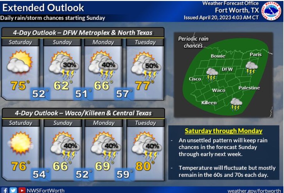
A robust cool down is expected this weekend, with highs in the 60s and 70s. Low rain chances return Sunday and continue through early next week.
Today and Tonight
This afternoon and tonight, scattered to numerous thunderstorms will pose a threat for large hail, damaging winds, and heavy rain across much of North and Central Texas. The tornado threat is low but not zero.
Friday through Wednesday
Low thunderstorm chances return Sunday and continue for much of next week.
SPOTTER INFORMATION STATEMENT
It is possible for spotter activation for parts of North and
Central Texas.
South Central and Southwest Arkansas, North Central and Northwest Louisiana, Southeast Oklahoma, and East and Northeast Texas
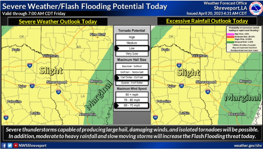
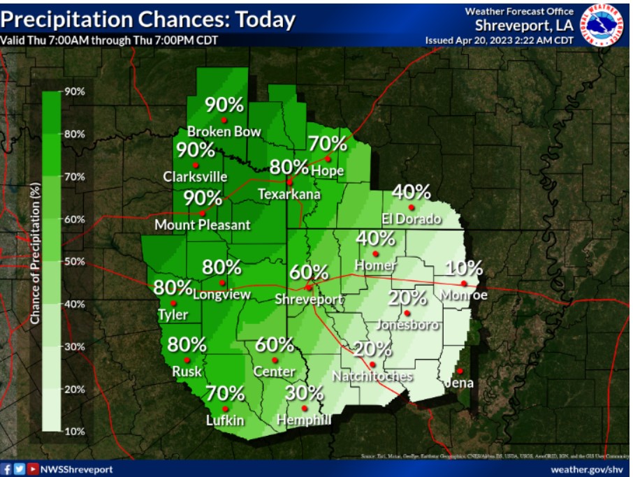
Moderate to heavy rainfall will bring a potential for isolated Flash Flooding across the highlighted areas. These areas indicate at least a five percent or 15 percent chance of flooding within 25 miles of a point.
A cold front will move into the region today, increasing the potential for strong to severe thunderstorms and isolated Flash Flooding.