


North and Central Texas
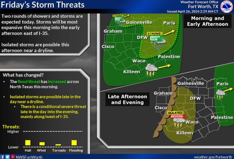 Expect two rounds of storms today. Storms will be most expansive this morning into the early afternoon along and east of I-35. Isolated strong to marginally severe storms and flooding will be possible with the morning activity. Isolated storms are likely late this afternoon near a dry line. There is a conditional severe threat with the late afternoon activity.
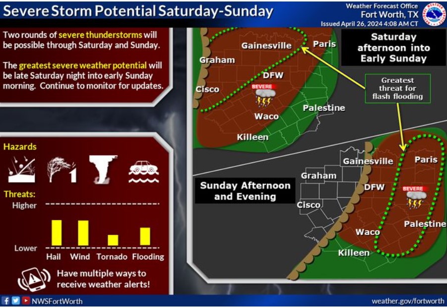
Severe storms are possible on Saturday and Sunday ahead of a dryline. Large hail, damaging winds, and a tornado or two will be possible. Additionally, the risk for flash flooding will increase Saturday night west of I-35 and again through Sunday afternoon across East Texas. Given the potential for night-time flooding and severe weather, ensure you have all the necessary preparations completed before severe weather strikes!
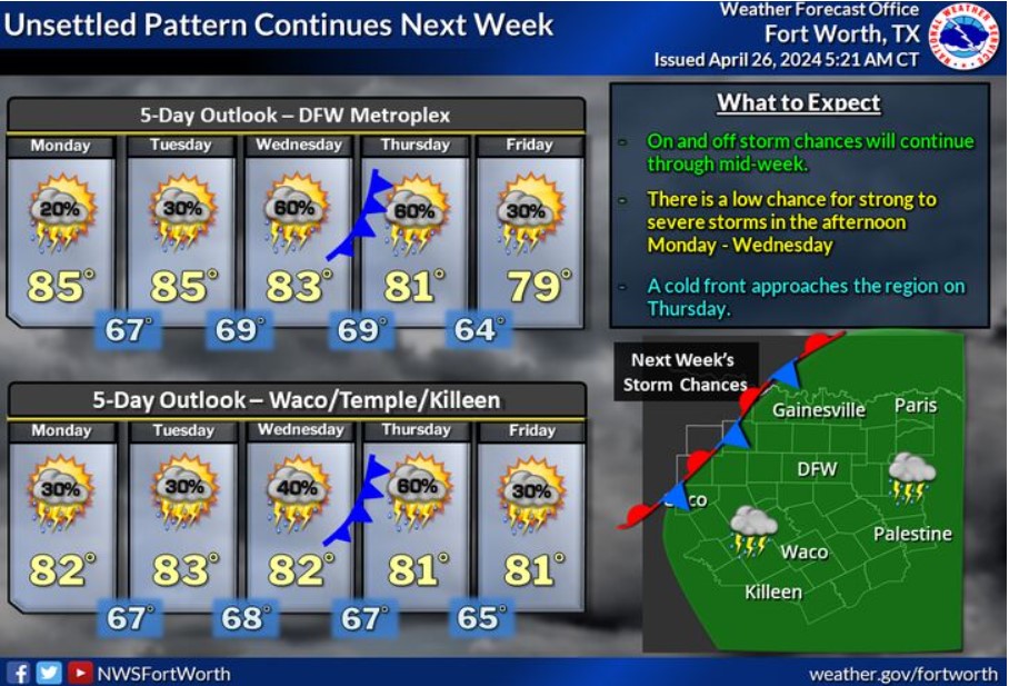
An unsettled weather pattern with humid and warm conditions will persist throughout next week. Storms will be possible each afternoon, with a low threat of strong to severe storms.
Today and Tonight
Thunderstorms are moving into Western North Texas early this morning. Storms will increase in coverage later this morning, mainly along and east of the I-35 corridor. Some of these storms may be severe, with a threat of damaging winds and large hail. There will be a localized flooding threat across eastern North Texas.
Saturday through Thursday
The severe threat will increase again Saturday afternoon through Sunday morning across North Texas, and expect another round of thunderstorms. Large hail, damaging winds, and a few tornadoes will be possible. In addition, locally heavy rainfall may cause flash flooding across parts of North Texas.
There will also be a chance for thunderstorms on Sunday afternoon and evening, mainly east of I-35. A few of these storms could be severe, with damaging winds and large hail.
On-and-off storm chances will continue through the weekend. Lightning and brief heavy rain will be the main threats.
SPOTTER INFORMATION STATEMENT
The National Weather Service will appreciate your timely reports of severe weather and flooding through the weekend.
South Central and Southwest Arkansas, North Central and Northwest Louisiana, Southeast Oklahoma, and East and Northeast Texas
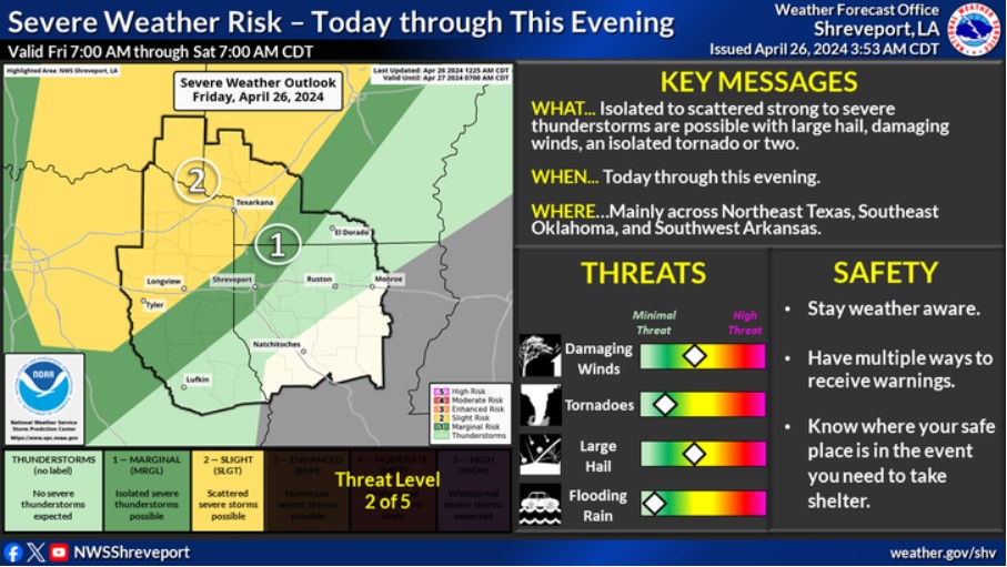
Northeast Texas, Southeast Oklahoma, and Southwest Arkansas are at a slight risk for severe thunderstorms today through this evening. Isolated to scattered strong to severe storms will be possible over these areas, with damaging winds, large hail, and an isolated tornado or two.
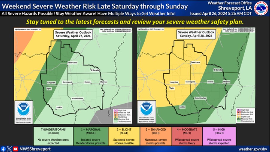
The risk for severe thunderstorms exists again Saturday night for portions of Northeast Texas, Southeast Oklahoma, and Southwest Arkansas, and it expands over much of the region Sunday. Stay tuned to the latest forecasts, and review your severe weather safety plan with the potential severe weather threat increasing later this weekend.
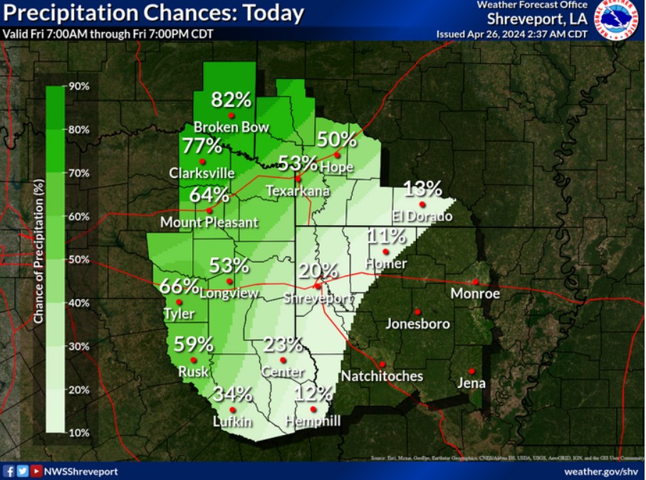
Showers and thunderstorms will increase later this morning and afternoon across Northeast Texas, Southeast Oklahoma, and Southwest Arkansas. Isolated strong to severe storms can’t be ruled out before diminishing this evening.
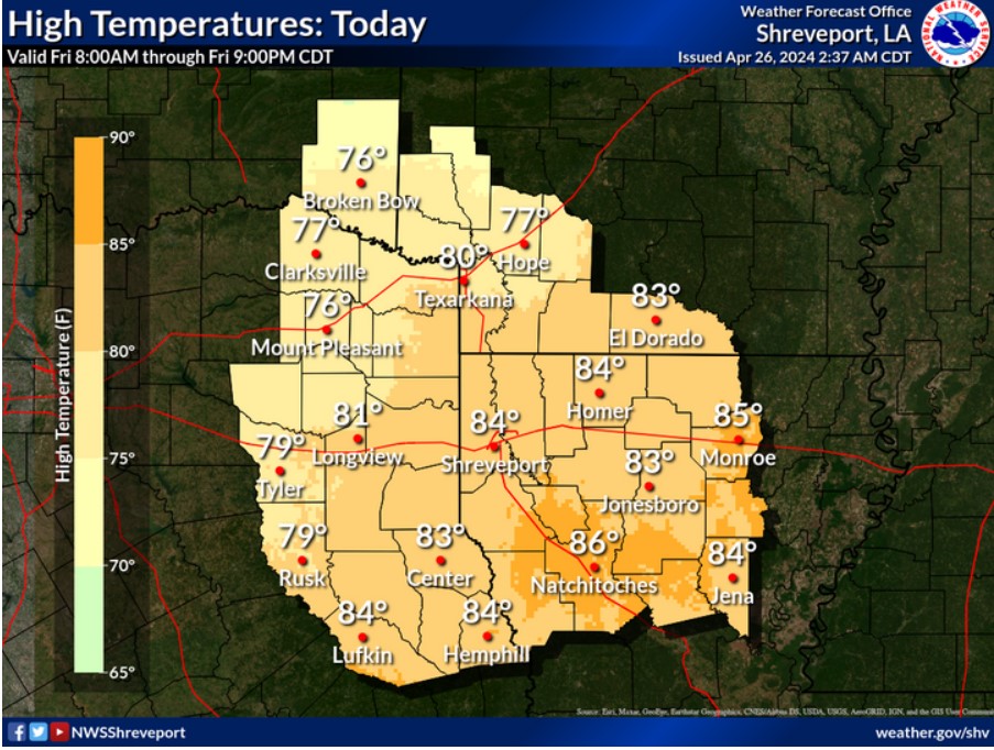
Expect warm and humid conditions today, especially away from the cloudy and rain-cooled areas of Northeast Texas, Southeast Oklahoma, and Southwest Arkansas. Look for temperatures to range from the mid to upper 70s northwest to the mid-80s southeast.
Today and Tonight
Severe weather chances will return to the region today and continue into the weekend. All modes of severe weather will be possible, along with a threat of flash flooding resulting from training heavy rainfall.
Saturday through Thursday
Severe weather chances will linger through the weekend. The greatest chance for widespread severe weather will be Sunday, with all modes of severe weather being possible. Additionally, 3-5 inches of rainfall will be possible through the middle of the new workweek, which could result in additional flooding and flash flooding, given recent rainfall.
SPOTTER INFORMATION STATEMENT
Do not expect spotter activation at this time.