


North and Central Texas
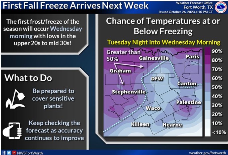
The first frost or freeze of the season will occur Wednesday morning, with lows in the upper 20s to mid-30s! Areas across North Texas and the Big Country have the most excellent chances of seeing below-freezing temperatures. Be prepared to cover sensitive plants, and keep checking the forecast as accuracy improves!
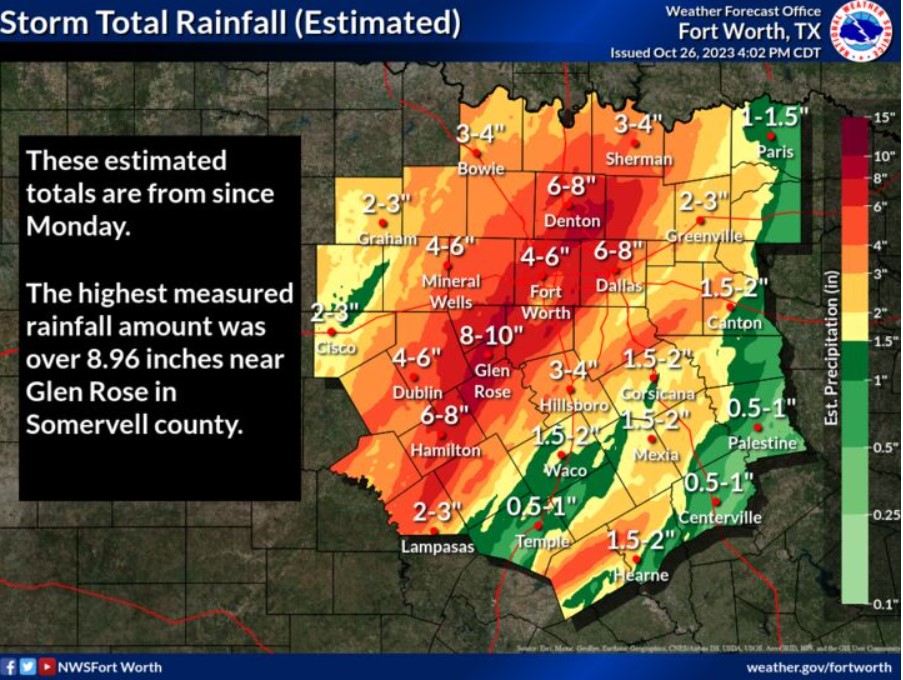
Here is the estimated rainfall from Monday through Thursday afternoon. A swath of 3 to 6 inches of much-needed rain fell across North Texas. The highest measured total was almost 9 inches near Glen Rose.
South Central and Southwest Arkansas, North Central and Northwest Louisiana, Southeast Oklahoma, and East and Northeast Texas
Today and tonight
Scattered to numerous showers, mainly across Northeast Texas, Southeast Oklahoma, Southwest Arkansas, and extreme Northwest Louisiana, will be available today through tonight. Some of this rainfall could sometimes be heavy, especially across portions of Northeast Texas. NWS is not forecasting any severe weather at this time.
Saturday through Thursday
Showers and thunderstorm chances will continue into the weekend ahead of a solid cold front poised to move into the region during the day on Sunday. At this time, instability does not warrant a widespread severe thunderstorm threat. Areas of prolonged heavy rainfall may result in flash flooding, mainly along and north of the I-30 corridor. The rain will likely only end across the Four-State Region sometime during the day on Tuesday.
SPOTTER INFORMATION STATEMENT
Do not expect spotter activation at this time.
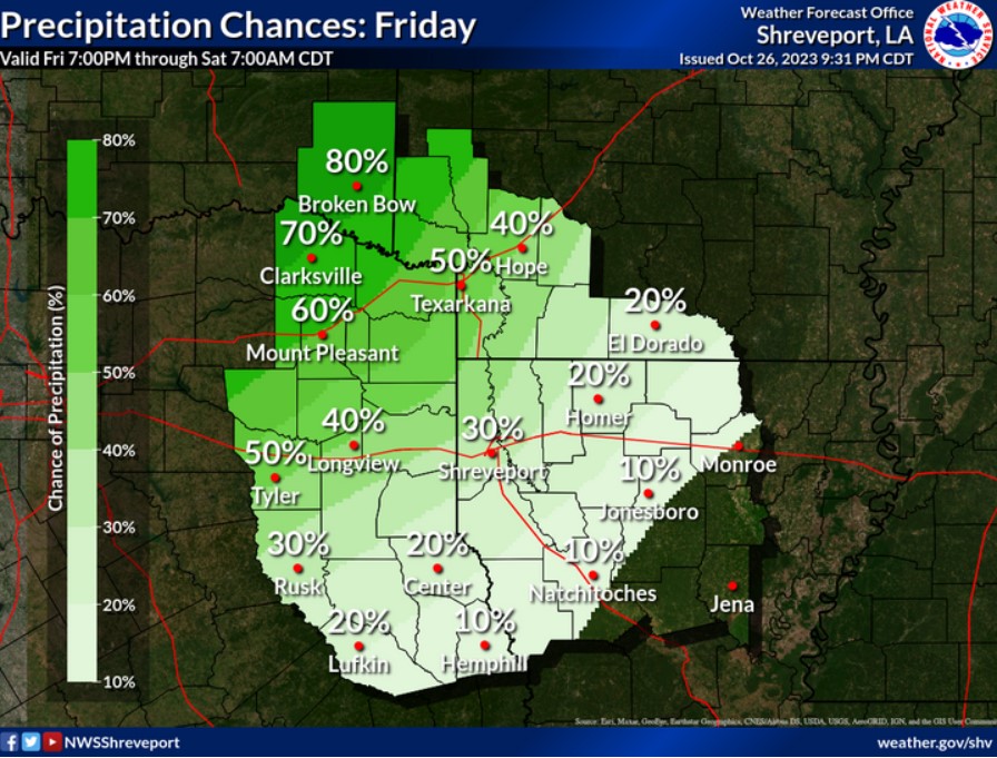
Rain chances today will be highest across the northern half of Northeast Texas, Southeast Oklahoma, and adjacent counties in Southwest Arkansas.