


Tuesday
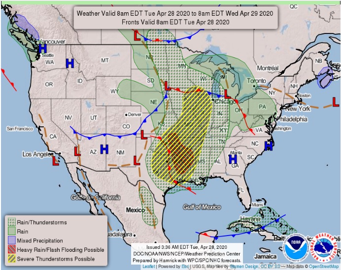
North and Central Texas
Isolated strong to severe thunderstorms are possible north of I-20 and west of I-35 before daybreak. The main threat will be marginally severe hail. Storm chances will increase Tuesday evening and continue through the night as a line of thunderstorms moves across North and Central Texas from north to south. The main threat will be damaging winds, but a few instances of large hail and an isolated tornado are possible.
South Central Arkansas, Southwest Arkansas, North Central Louisiana, Northwest Louisiana, Southeast Oklahoma, East Texas, and Northeast Texas
Scattered showers and thunderstorms will be possible today across the region, as a warm front lifts north across the area and an upper-level disturbance progresses east. An isolated severe weather threat will exist today, with damaging winds and large hail possible.
However, a complex of showers and thunderstorms will develop later this afternoon over Central and Northeast Oklahoma, and quickly shift southeast into Southeast Oklahoma, extreme Northeast Texas, and Southwest Arkansas by mid-evening. Some of these storms will become severe, with damaging winds, large hail, and isolated tornadoes possible. Heavy rainfall which may lead to localized flooding will be possible as well, with the line of strong to severe thunderstorms affecting areas along and south of the I-20 corridor of East Texas and North Louisiana after
midnight. This thunderstorm complex will exit the region before daybreak Wednesday, with the severe threat ending with the departure of these storms.
Wednesday through Monday
Expect no hazardous weather
SPOTTER INFORMATION STATEMENT
Activation of emergency management personnel, amateur radio operators, and storm spotters are needed tonight areawide. Please relay any information about observed severe weather to the NWS while following all local, state, and CDC guidelines.
.
$$