


Hazardous Weather Outlook
Thursday
North and Central Texas
Isolated severe thunderstorms may affect areas northwest of the Metroplex this evening with large hail and damaging winds the
main threats. Overnight tonight into early Friday morning, storms will increase in coverage along a cold front. Some of the stronger thunderstorms could produce damaging winds.
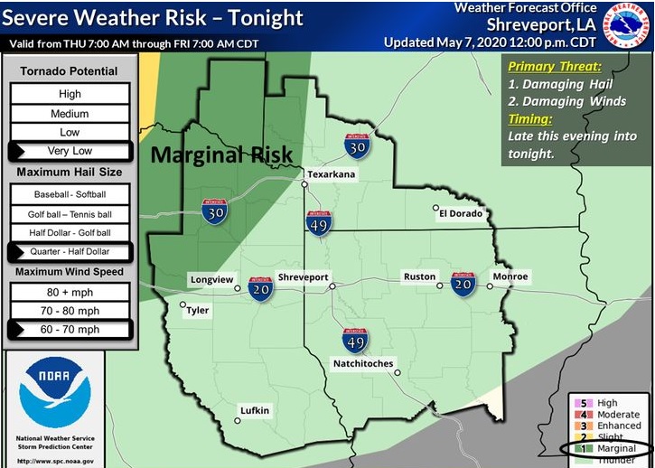
South Central Arkansas, Southwest Arkansas, North Central Louisiana, Northwest Louisiana, Southeast Oklahoma, East Texas, and Northeast Texas.
Isolated strong to severe thunderstorms will be possible a little before midnight for areas along and west of a line from Tyler to Texarkana to Hope. Storms will be capable of producing damaging winds and large hail. Also, high rainfall rates could lead so some isolated flash flooding.
Friday through Wednesday
A line of showers and thunderstorms will progress southeast across the area along a cold front through the day Friday. Strong to severe thunderstorms capable of producing large hail and damaging winds will be possible for areas generally along and south of I-20 on Friday.
SPOTTER INFORMATION STATEMENT
Activation of emergency management personnel, amateur radio operators, and storm spotters may be needed tonight and Friday.