


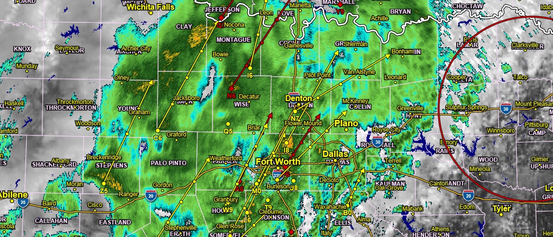
Radar 12:30 pm Tuesday
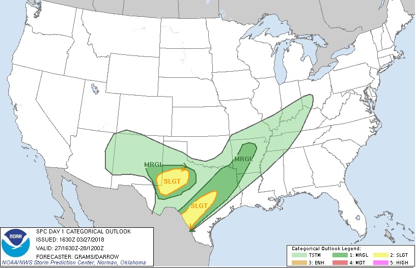
The National Weather Service has cut us a little relief and downgraded Northeast Texas to a marginal chance of severe thunderstorms.
This Hazardous Weather Outlook is for portions of South Central Arkansas, Southwest Arkansas, North Central Louisiana, Northwest Louisiana, Southeast Oklahoma, East Texas and Northeast Texas.
Thunderstorms will move into the region from the Northwest today, bringing heavy rainfall and the potential for a few storms to produce large hail and damaging winds, generally along and Northwest of a line from Tyler to Texarkana. By tonight, heavy rainfall may lead to flash flooding, especially of low-lying and poor drainage areas.
Thunderstorms, along with the threat of flash flooding and isolated severe storms, will continue to spread Southeast across the region into Deep East Texas and North Louisiana Wednesday through Thursday morning. Expect no hazardous weather beyond Thursday at this time.
.SPOTTER INFORMATION STATEMENT…
Activation of emergency management personnel, amateur radio operators, and storm spotters may be needed this afternoon and tonight.