


Today and Tonight
North and Central Texas
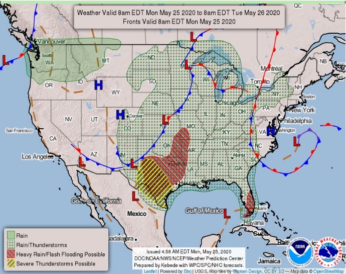
You can expect isolated thunderstorms to redevelop today, roughly near and east of the I-35 corridor. Heavy rainfall and flooding will be the primary hazards, but a few of the stronger storms could produce small hail and gusty winds. Another complex of showers and thunderstorms may arrive from the west tonight. It will be mainly for areas south of I-20 and west of I-35.
Southwest Arkansas, Northwest Louisiana, Southeast Oklahoma, East Texas, and Northeast Texas.
Showers and thunderstorms will increase in coverage today as another upper-level disturbance moves into the region. A marginal risk for isolated strong to severe storms will be possible, but not expecting widespread severe weather. Damaging winds will be the main threat with this activity. Additionally, a Flash Flood Watch is in effect through the remainder of today and tonight as heavy rain could lead to localized flooding in some areas.
Tuesday through Sunday
Thunderstorms will be possible each day through the remainder of the week as an unsettled weather pattern prevails over the region. Although the potential for heavy rainfall will gradually diminish through the week and into the upcoming weekend, the cumulative impact of additional rain on saturated grounds will maintain flooding
concerns.
The Four-State Region will be transitioning into a reasonably wet period through the remainder of the workweek with a nearly stalled upper-level trough west of our region. It will result in periods of scattered to numerous showers and thunderstorms through much of the extended forecast. A Flash Flood Watch is in effect through Tuesday evening, but it could be extended for portions of the Four-State region if heavy rainfall persists.
SPOTTER INFORMATION STATEMENT
Activation of emergency management personnel, amateur radio operators, and storm spotters may be needed today. Please relay any information about observed severe weather to the NWS while following all local, state, and CDC guidelines.