


This Hazardous Weather Outlook is for portions of South Central
Arkansas, Southwest Arkansas, North Central Louisiana, Northwest
Louisiana, Southeast Oklahoma, East Texas and Northeast Texas.
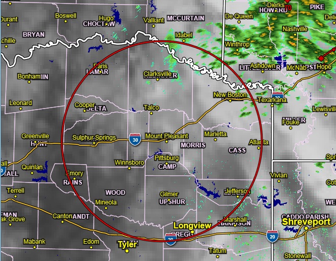
Radar 12:30 pm Friday
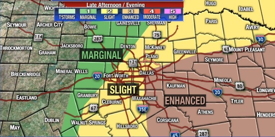
Thunderstorms will gradually become more widespread and increase in intensity across northern areas early this afternoon, with a few producing damaging wind gusts. The threat for severe storms will increase as we move into the mid to late afternoon and evening hours. A cold front brings these storms southward across the entire region. Damaging winds and large hail will be the primary threats, but a few tornadoes and even some localized flooding cannot be ruled out. The danger for severe storms will gradually diminish during the overnight hours, as the cold front moves away from our area.
SPOTTER INFORMATION STATEMENT
Needed late this afternoon and evening are the activation of emergency management personnel, amateur radio operators, and storm spotters.