


North and Central Texas
Today and Tonight
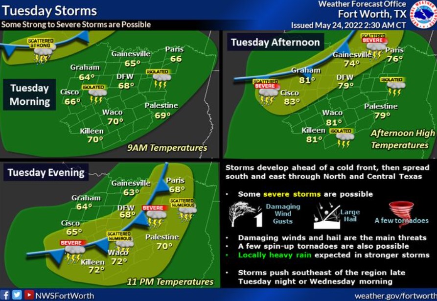
Scattered to numerous thunderstorms are expected later today and this evening ahead of a cold front. Some storms may be severe with large hail and damaging wind gusts. In addition, you can’t rule out a few spin-up tornadoes. Thunderstorms should exit the area overnight Tuesday night or Wednesday morning.
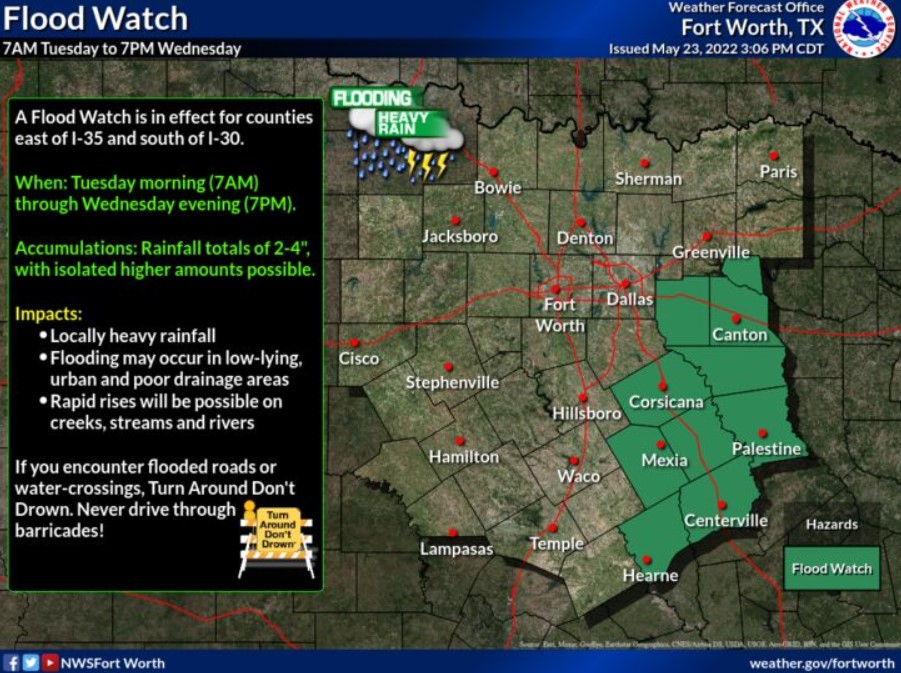
In addition, locally heavy rainfall may result in isolated instances of flooding, particularly in Eastern-Central Texas where previous rainfall occurred this past weekend.
Wednesday through Monday
Expect no hazardous weather.
SPOTTER INFORMATION STATEMENT
Spotter activation may be needed this afternoon and tonight for much of the area.
South Central and Southwest Arkansas, North Central and Northwest Louisiana, Southeast Oklahoma, and East and Northeast Texas
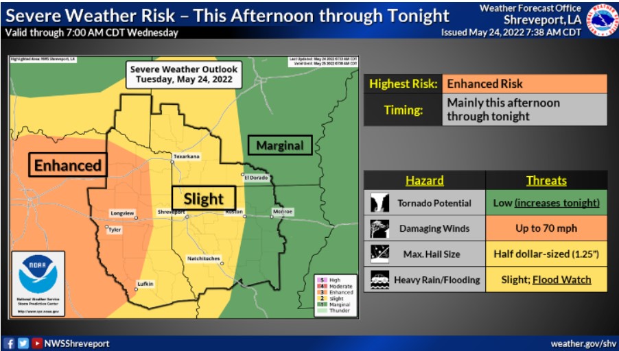
Expect a few rounds of strong to potentially severe thunderstorms Tuesday afternoon and Tuesday night. Any severe storms will have the capability of producing some large hail and damaging winds. You can not rule out a tornado.
Flooding caused by excessive rainfall continues to be possible.
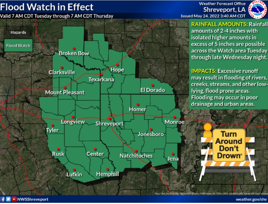
Portions of Arkansas, Louisiana, Southeast Oklahoma, and Texas, including the following counties and parishes, in Arkansas, Columbia, Hempstead, Howard, Lafayette, Little River, Miller, Nevada, Sevier, and Union. In Louisiana, Bienville, Bossier, Caddo, Claiborne, De Soto, Lincoln, Red River, Sabine, Union, and Webster. In Southeast Oklahoma, McCurtain. In Texas, Angelina, Bowie, Camp, Cass, Cherokee, Franklin, Gregg, Harrison, Marion, Morris, Nacogdoches, Panola, Red River, Rusk, Sabine, San Augustine, Shelby, Smith, Titus, Upshur, and Wood.
Flooding is possible from now through Thursday morning. Expect excessive runoff resulting in flooding of rivers, creeks, streams, and other low-lying and flood-prone locations. Creeks and streams may rise out of their banks. Flooding may occur in poor drainage and urban areas.
Rainfall totals of two to four inches will be possible with isolated higher amounts.
PRECAUTIONARY/PREPAREDNESS ACTIONS
You should monitor later forecasts and be alert for possible Flood Warnings. In addition, those living in areas prone to flooding should be prepared to take action should flooding develop.