


North and Central Texas
Today and Tonight.
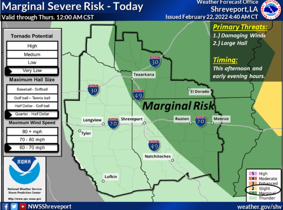
Thunderstorm chances this morning will be mainly east of the I-35 corridor. Isolated severe storms will be possible, with large hail the primary hazard.
Wednesday through Monday
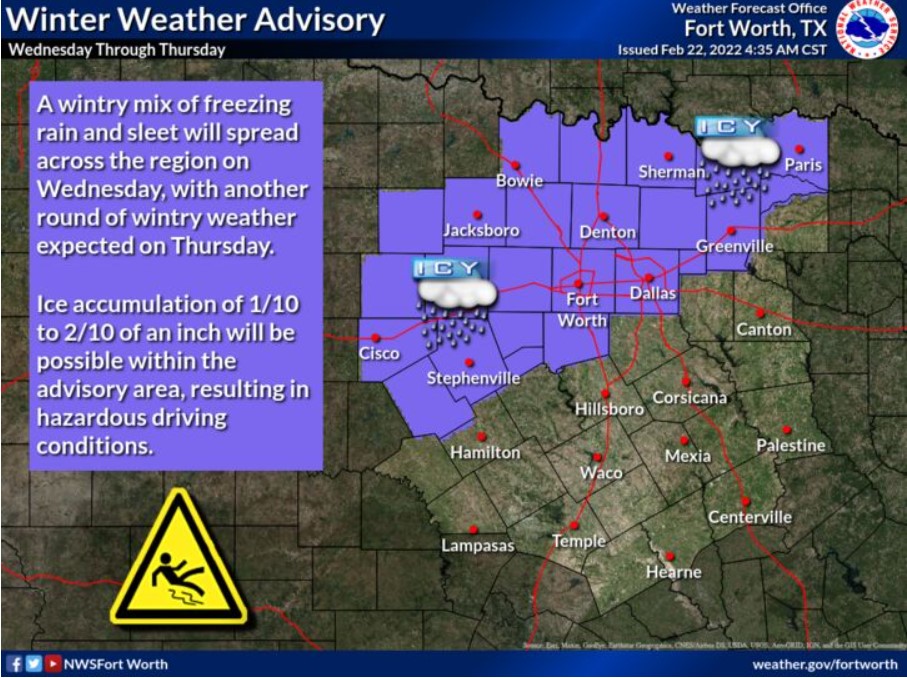
A wintry mix is likely across much of North and Central Texas on Wednesday and Thursday. Ice accumulation would result in impacts to travel, primarily along and northwest of a line from Comanche, Dallas to Paris. Thunderstorms may accompany the wintry weather.
Additional wintry precipitation will be possible on Saturday and Sunday.
SPOTTER INFORMATION STATEMENT
The NWS does not expect spotter activation at this time.
South Central and Southwest Arkansas, North Central and Northwest Louisiana, and East and Northeast Texas
Today and Tonight
Scattered to numerous showers and thunderstorms will be possible today, mainly over portions of extreme Northeast Texas, Southeast Oklahoma, Southwest Arkansas, and possibly Northwest Louisiana, as an upper-level disturbance ejects northeast across the area ahead of a cold front. Isolated strong to severe thunderstorms can not be ruled out over this area today, with damaging winds and hail the main threats.
Wednesday through Monday
Areas of rain will increase Wednesday morning across portions of extreme Northeast Texas, Southeast Oklahoma, and adjacent sections of Southwest Arkansas, with the potential for showers, possibly changing to light freezing rain over Northern and Western McCurtain County Oklahoma. Some light icing accumulations will be possible here, mainly on elevated objects such as bridges, trees, and power lines. As temperatures climb back above freezing, any potential freezing rain should diminish Wednesday night. However, showers and a few embedded thunderstorms will continue to develop Wednesday night and Thursday over Northeast Texas, Southeast Oklahoma, and Southwest Arkansas. It will be before spreading across the remainder of the region Thursday night as colder air begins to spill back southeast with the departure of the cold front.
As the precipitation ends, a brief changeover to light freezing rain can not be ruled out Thursday night over much of East Texas, Southeast Oklahoma, and Southwest Arkansas, with little if any ice accumulations expected. Areas of rain should increase over the region Saturday and could transition over to a light wintry mix Saturday night before diminishing, mainly over Northeast Texas, Southeast Oklahoma, and Southwest Arkansas.
SPOTTER INFORMATION STATEMENT
Activation of emergency management personnel, amateur radio operators and storm spotters may be needed today for portions of Northeast Texas, Southwest Arkansas, and Northwest Louisiana.