


North and Central Texas
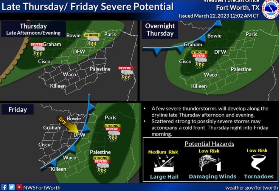
Severe thunderstorms may develop late on Thursday ahead of an advancing dryline, with more strong to severe storms accompanying a cold front moving through the area later Thursday night into Friday. Potential hazards include large hail, damaging winds, and a few tornadoes, mainly north of Interstate 20 and 30. Some uncertainty remains on the timing and actual coverage of severe weather. Continue to monitor future forecasts about this late-week system.
South Central and Southwest Arkansas, North Central and Northwest Louisiana, Southeast Oklahoma, and East and Northeast Texas
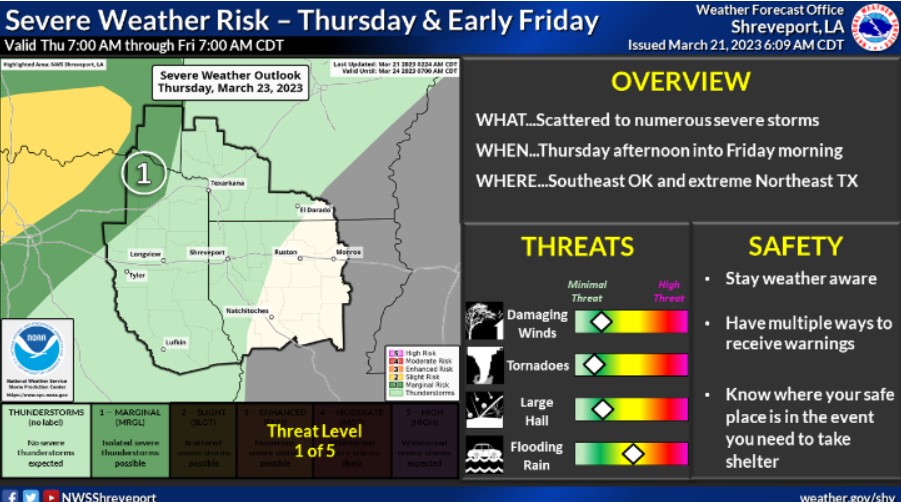
There is a Marginal Risk for severe thunderstorms late Thursday into early Friday, mainly north of the I-30 corridor. Damaging winds and large hail will be the primary threats, and locally heavy rainfall could bring isolated flash flooding.
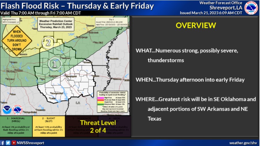
Expect locally heavy rainfall from a line, possibly severe thunderstorms in isolated flash flooding late Thursday into early Friday. There is a Slight Risk north of our I-30 corridor.
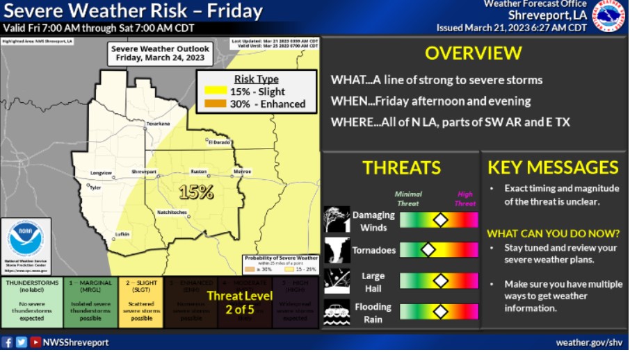
A line of strong to severe storms will continue across the area during early Friday, with afternoon heating firing up a Slight Risk for severe storms in deep East Texas, all of our Parishes, and South Central Arkansas during the afternoon. Damaging winds and large hail will be the primary threats, and locally heavy rainfall could bring isolated flash flooding.
Wednesday through Monday
Scattered showers and thunderstorms will be possible by Thursday evening over Southeast Oklahoma, portions of extreme Northeast Texas, and adjacent sections of Southwest Arkansas before increasing across the remainder of the region Friday ahead of a solid upper-level disturbance and associated dryline. While a severe weather threat will exist Thursday evening and night across Southeast Oklahoma and extreme Northeast Texas, a more significant severe weather threat will exist across much of the region Friday as showers and thunderstorms tap into a more moist, unstable, and strongly sheared environment. Damaging winds, large hail, and isolated tornadoes will all be possible Friday, with locally heavy rainfall accompanying stronger storms. Slightly cooler and drier air will spill into the area after this storm system and the weekend’s dryline.
SPOTTER INFORMATION STATEMENT
Do not expect spotter activation through Wednesday night.