


North and Central Texas
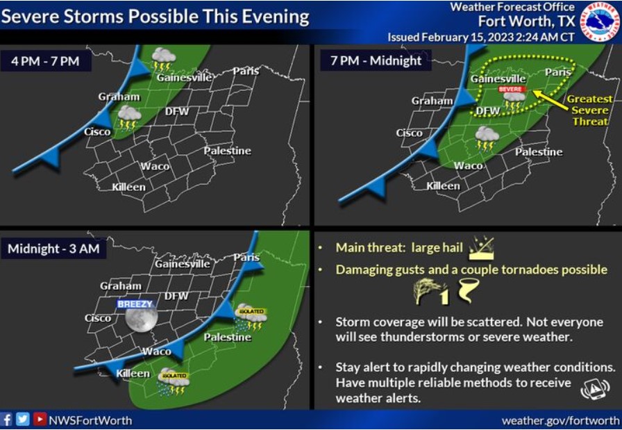
There is a chance for severe thunderstorms to affect North Texas this evening, with the most significant extreme risk north of I-20 and east of I-35. Hail will be the main threat, but a couple of tornadoes and damaging wind gusts are also possible. Coverage will be scattered, and not everyone will see thunderstorms or severe weather. All storms will exit the area to the southeast after midnight.
Today and Tonight
There is a chance of thunderstorms this afternoon into tonight, primarily along and east of the I-35 corridor. A few storms may become severe, with large hail, damaging wind gusts, and possible tornadoes.
Thursday through Tuesday
Expect no hazardous weather at this time.
SPOTTER INFORMATION STATEMENT
Do not expect spotter activation at this time.
South Central and Southwest Arkansas, North Central and Northwest Louisiana, Southeast Oklahoma, and East and Northeast Texas
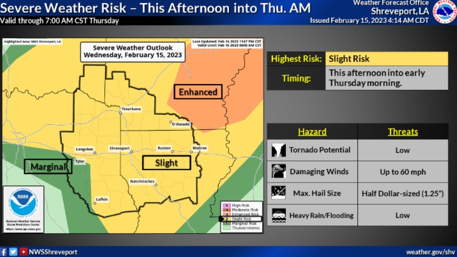
There is a chance for severe storms across the region this afternoon and Thursday morning. Damaging winds, large hail, and tornadoes will be possible. The severe weather threat will likely occur in multiple rounds from late this afternoon into early Thursday morning.
Today and tonight
Thunderstorms are expected late Wednesday and into Thursday. A few storms could be severe. Damaging winds, large hail, and isolated tornadoes will be possible. In addition, locally heavy rainfall may lead to minor flooding of low-lying and poor drainage areas.
Thursday through Tuesday
Expect no hazardous weather at this time. Rain may return to the region late Monday and early Tuesday morning.
SPOTTER INFORMATION STATEMENT
Spotter activation may be needed.