


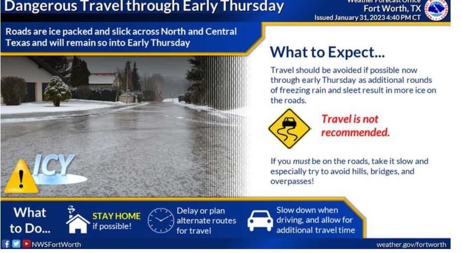
Due to ice-packed and slick roadways, you should avoid travel now through early Thursday. Stay home! If you have to be out on the roads over the next few days, slow down, watch for ice or black ice, and give yourself plenty of time for driving.
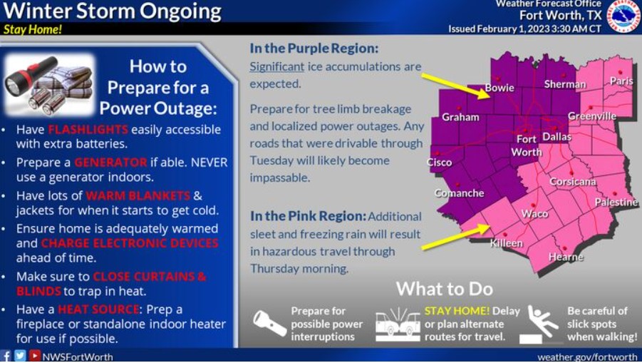
An ice storm warning is in effect for areas along and west of the I- 35 corridor. It is for a half inch of ice accumulation Wednesday afternoon into early Thursday resulting in tree breakage and localized power outages in addition to hazardous or impossible travel conditions. A winter storm warning continues elsewhere in north and central Texas for persisting freezing rain and sleet, leading to dangerous travel. Prepare for power outages by bundling up, ensuring you have flashlights, batteries, and an indoor safe heat source if possible!
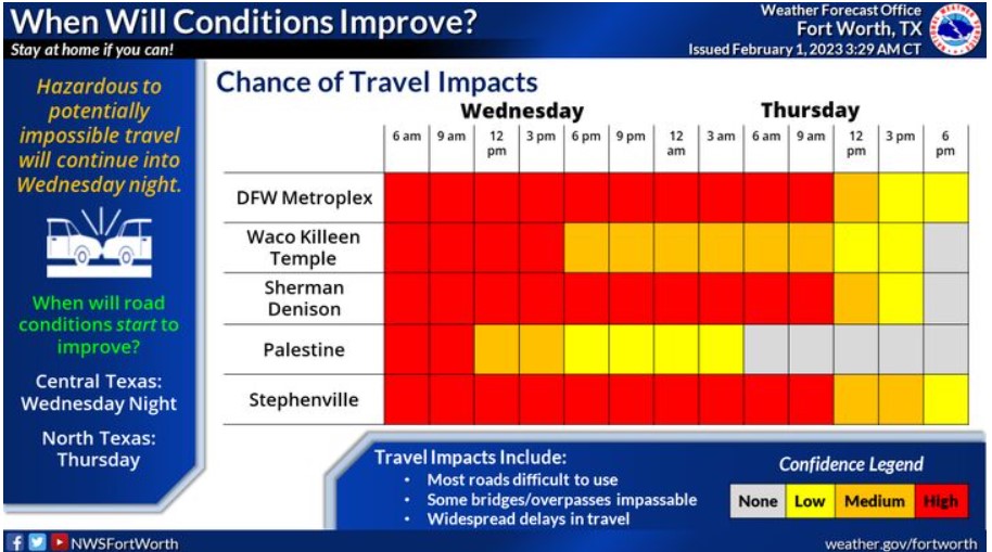
Travel conditions will continue to be hazardous into Wednesday night and Thursday, with more sleet and freezing rain expected. Temperatures will slowly climb above freezing in Central Texas Wednesday night and Thursday morning across most of North Texas, allowing for ice melting. However, slushy roads will persist well after temperatures get above freezing.
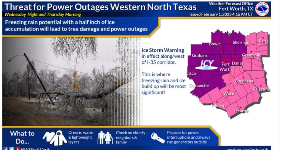
Freezing rain with additional ice amounts from a tenth and up to half an inch will increase the risk of power outages. It is especially true along/west of the I-35 corridor.
A WINTER STORM WARNING IS NOW IN EFFECT UNTIL 9:00 THURSDAY MORNING
WHAT – Additional ice accumulations of a glaze to 0.35″.
WHERE – Eastern North and Central Texas.
WHEN – Until 9:00 Thursday MORNING.
IMPACTS – Dangerous travel conditions will continue into Thursday morning. Roads will become nearly impassible in some areas, and bridges and overpasses will remain icy.
PRECAUTIONARY/PREPAREDNESS ACTIONS
Travel is strongly discouraged. If you must travel, keep an extra flashlight, food, and water in your vehicle in case of an emergency. Prepare for possible power outages.
You can find the latest road conditions for Texas at drivetexas.org.
Today and Tonight
Widespread freezing rain is expected today with significant ice accumulation up to half an inch possible across Western North and
Central Texas. Do not travel unless there is an emergency. Roads will only worsen with additional freezing rain. Localized power outages and tree damage will also be possible.
Thursday through Tuesday
Any remaining ice will impact the Thursday morning commute on area roadways. Snow is possible Thursday afternoon and evening across
North Texas. Conditions will improve Friday.
SPOTTER INFORMATION STATEMENT
Do not expect spotter activation at this time.
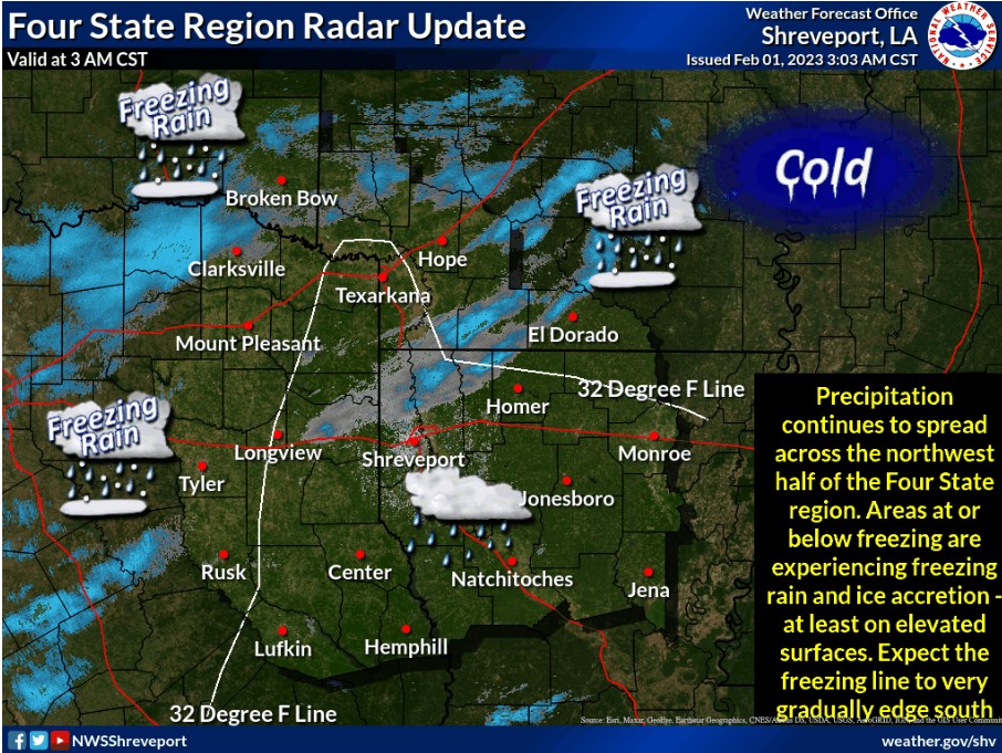
Here is the latest radar update concerning winter weather conditions across the region.
Look for possible significant ice accumulation across portions of Northeast Texas, Southeast Oklahoma, and Southwest Arkansas and lesser amounts across parts of extreme Northeast Texas and Southwest Arkansas through Wednesday Morning.
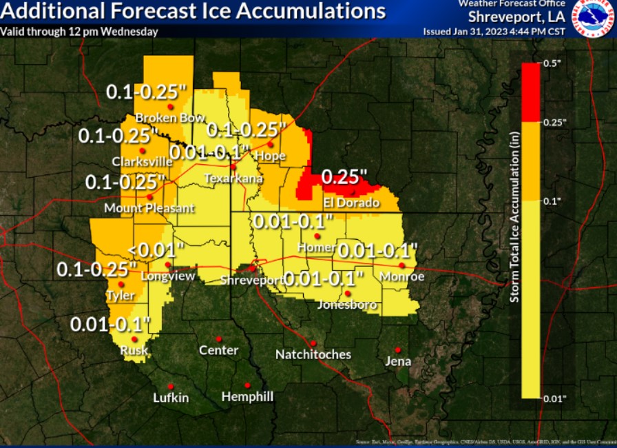
Ice Accumulations of up to a quarter of an inch will be possible across portions of south-central Arkansas, with lesser amounts mainly along and north of the I-20 corridor.

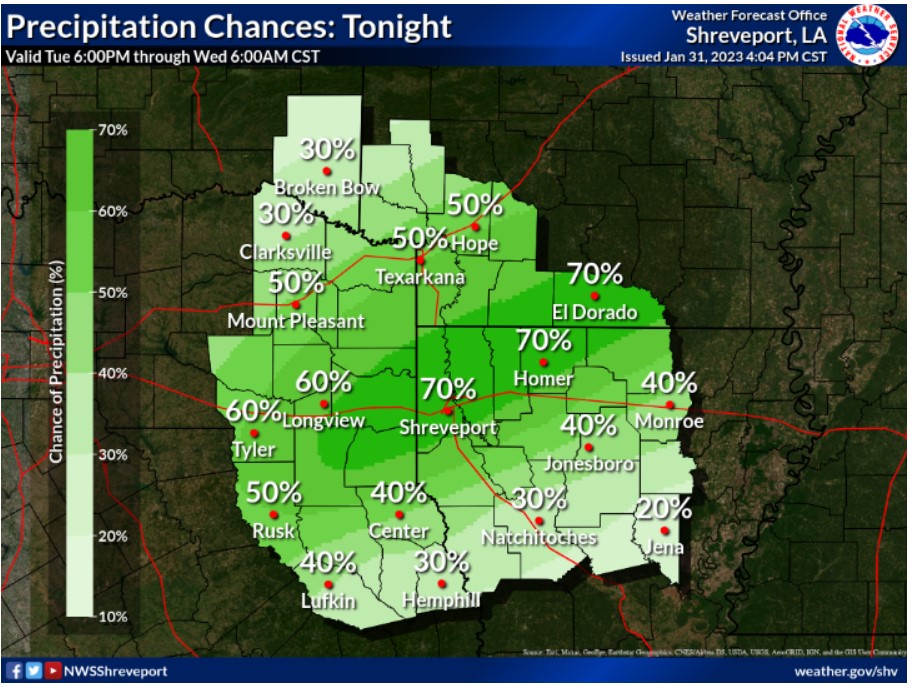
A Flood Watch is in effect for Northwest Louisiana, much of East Texas, and Southwest Arkansas until 6:00 pm Thursday. It is because an additional one to three inches of rainfall can lead to flooding area waterways.
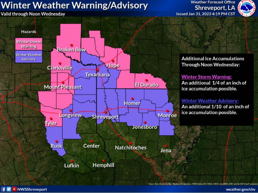
A WINTER STORM WARNING NOW IN EFFECT UNTIL 6:00 WEDNESDAY EVENING
WHAT – Significant icing. Additional ice accumulations of up to one-quarter of an inch will be possible throughout the day.
WHERE – Sevier, Howard, Hempstead, Nevada, Columbia, and Union
Counties in Southwest Arkansas. McCurtain County in Southeast
Oklahoma. Smith, Wood, Upshur, Franklin, Camp, Titus, Upshur
, and Red River Counties in Northeast Texas.
WHEN – Until 6:00 Wednesday evening.
IMPACTS – Bridges and overpasses could become slick resulting in travel impacts this morning. Those impacts will continue through the day and especially into the overnight hours. In addition, power outages and tree damage are likely due to the ice.
PRECAUTIONARY/PREPAREDNESS ACTIONS
If you must travel, keep an extra flashlight, food, and water in your vehicle in case of an emergency. Prepare for possible power outages. The latest road conditions for the state you are calling from can be obtained by calling 5 1 1.
Today and tonight.
The potential for light freezing rain will remain today. As a result, ice accumulations between one-quarter and one-half inch will be possible.
Bridges and overpasses could become slick resulting in travel impacts. Also, power outages and tree damage are likely due to ice accumulation.
Thursday through Tuesday
Light freezing rain will remain possible on Thursday morning, with additional ice accumulations, possibly resulting in travel impacts, especially on bridges and overpasses. By late Thursday morning, areas of rain will increase ahead of a slow-moving upper-level storm system shifting east from Northern Mexico and the Desert Southwest into the Southern Plains and Lower Mississippi Valley. Widespread rainfall amounts of one to three inches are expected, with isolated higher measurements, which could result in the potential for flooding low lying, poor drainage areas, as well as additional rises in the area waterways.
SPOTTER INFORMATION STATEMENT
According to Standard Operating Procedures, weather spotters are encouraged to report significant weather conditions.